
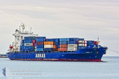
TOMRIZ A
Container Ship
Current Trip
| Time Travelled | 17 h, 20 mins |
|---|---|
| Remaining Time | 3 h, 34 mins |
| Distance Travelled | 173.13 nm |
| Remaining Distance | 36.14 nm |
| AVG Speed | 9.5 Knots |
| MAX Speed | 13.8 Knots |
| AVG Wind | 14.5 knots |
| MAX Wind | 23.3 knots |
| MIN Temp | 7.3°C / 45.14°F |
| MAX Temp | 10.2°C / 50.36°F |
| Draught | 6 m |
| Position Received | 1 m ago |
Current Position
| Longitude | --- |
|---|---|
| Latitude | --- |
| Status | Under way using engine |
| Speed | 7.4 Knots |
| Course | 183.4° |
| Area | Black Sea |
| Station | T-AIS |
| Position Received | 1 m ago |
Info
Information
The current position of TOMRIZ A is in Black Sea with coordinates 41.26182° / 29.13439° as reported on 2025-12-08 20:36 by AIS to our vessel tracker app. The vessel's current speed is 7.4 Knots and is heading at the port of AMBARLI. The estimated time of arrival as calculated by MyShipTracking vessel tracking app is 2025-12-09 03:11 LT
The vessel TOMRIZ A (IMO: 9126754, MMSI: 271001058) is a Container Ship that was built in 1997 ( 28 years old ). It's sailing under the flag of [TR] Turkey.
In this page you can find informations about the vessels current position, last detected port calls, and current voyage information. If the vessels is not in coverage by AIS you will find the latest position.
The current position of TOMRIZ A is detected by our AIS receivers and we are not responsible for the reliability of the data. The last position was recorded while the vessel was in Coverage by the Ais receivers of our vessel tracking app.
The current draught of TOMRIZ A as reported by AIS is 6 meters
Weather
| Temperature | 9°C / 48.2°F |
|---|---|
| Wind Speed | 9 knots |
| Direction | 350° N |
| Pressure | 1023.6 hPa |
| Humidity | 71.1 % |
| Cloud Coverage | 98 % |
Featured Company
Last Port Calls
| Port | Arrival | Departure | Time In Port |
|---|---|---|---|
| 2025-12-04 23:37 | 2025-12-08 05:17 | 3 d | |
| 2025-12-01 20:29 | 2025-12-03 11:06 | 1 d | |
| 2025-11-27 07:04 | 2025-11-28 14:25 | 1 d | |
| 2025-11-20 14:23 | 2025-11-21 12:31 | 22 h | |
| 2025-11-19 17:21 | 2025-11-20 14:11 | 20 h | |
| 2025-11-19 04:10 | 2025-11-19 07:55 | 3 h | |
| 2025-11-18 14:46 | 2025-11-18 22:21 | 7 h | |
| 2025-11-16 07:52 | 2025-11-17 07:02 | 23 h | |
| 2025-11-12 19:00 | 2025-11-15 08:00 | 2 d | |
| 2025-11-09 13:37 | 2025-11-11 18:16 | 2 d |
Last Trips
| Origin | Departure | Destination | Arrival | Distance | |
|---|---|---|---|---|---|
| 2025-12-03 11:06 | 2025-12-04 23:37 | 233.40 nm | |||
| 2025-11-28 14:25 | 2025-12-01 20:29 | 637.75 nm | |||
| 2025-11-21 12:31 | 2025-11-27 07:04 | 629.47 nm | |||
| 2025-11-20 14:11 | 2025-11-20 14:23 | 0.50 nm | |||
| 2025-11-19 07:55 | 2025-11-19 17:21 | 61.70 nm | |||
| 2025-11-18 22:21 | 2025-11-19 04:10 | 62.90 nm | |||
| 2025-11-17 07:02 | 2025-11-18 14:46 | 374.46 nm | |||
| 2025-11-15 08:00 | 2025-11-16 07:52 | 284.83 nm | |||
| 2025-11-11 18:16 | 2025-11-12 19:00 | 285.63 nm | |||
| 2025-11-07 02:36 | 2025-11-09 13:37 | 208.61 nm |
Events
| Time | Event | Details | Position / Dest | Info |
|---|---|---|---|---|
| 2025-12-08 19:36 | START Moving | 9.82 nm, North of RUMELI FENERI |
41.39466 / 29.12890
TRAMR
|
Speed: 3.7 kn Course: 241° |
| 2025-12-08 19:13 | STOP Moving | 10.34 nm, North of RUMELI FENERI |
41.40339 / 29.12863
TRAMR
|
Speed: 0.3 kn Course: 281° |
| 2025-12-08 19:12 | START Moving | 10.37 nm, North of RUMELI FENERI |
41.40383 / 29.12853
TRAMR
|
Speed: 3.1 kn Course: 283° |
| 2025-12-08 18:49 | STOP Moving | 10.85 nm, North of RUMELI FENERI |
41.41197 / 29.12790
TRAMR
|
Speed: 0.1 kn Course: 280° |
| 2025-12-08 18:46 | START Moving | 10.94 nm, North of RUMELI FENERI |
41.41341 / 29.12765
TRAMR
|
Speed: 3.2 kn Course: 280° |
| 2025-12-08 18:37 | STOP Moving | 11.16 nm, North of RUMELI FENERI |
41.41715 / 29.12701
TRAMR
|
Speed: 0.2 kn Course: 271° |
| 2025-12-08 18:26 | START Moving | 11.42 nm, North of RUMELI FENERI |
41.42154 / 29.12616
TRAMR
|
Speed: 4.3 kn Course: 281° |
| 2025-12-08 18:02 | STOP Moving | 12.07 nm, North of RUMELI FENERI |
41.43241 / 29.12522
TRAMR
|
Speed: 0.3 kn Course: 277° |
| 2025-12-08 17:42 | START Moving | 12.59 nm, North of RUMELI FENERI |
41.44114 / 29.12442
TRAMR
|
Speed: 4.6 kn Course: 277° |
| 2025-12-08 17:34 | STOP Moving | 12.8 nm, North of RUMELI FENERI |
41.44464 / 29.12399
TRAMR
|
Speed: 0.1 kn Course: 273° |