
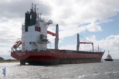
TIMBERLAND
General Cargo
Current Trip
| Trip Time | 15 days |
|---|---|
| Trip Distance | 4535.42 nm |
| AVG Speed | 12.5 Knots |
| MAX Speed | 15.2 Knots |
| Draught | 9.7 m |
| AVG Wind | 11.2 knots |
| MAX Wind | 33 knots |
| MIN Temp | 4.6°C / 40.28°F |
| MAX Temp | 16.4°C / 61.52°F |
| Position Received | 4 d ago |
Current Position
| Longitude | --- |
|---|---|
| Latitude | --- |
| Status | Under way using engine |
| Speed | 11.9 Knots |
| Course | 105.4° |
| Area | Mediterranean Sea - Eastern Basin |
| Station | T-AIS |
| Position Received | 4 d ago |
Info
Information
The current position of TIMBERLAND is in Mediterranean Sea - Eastern Basin with coordinates 34.76745° / 23.93887° as reported on 2026-01-01 09:02 by AIS to our vessel tracker app. The vessel's current speed is 11.9 Knots and is currently inside the port of ALEXANDRIA.
The vessel TIMBERLAND (IMO: 9204790, MMSI: 235090537) is a General Cargo that was built in 2000 ( 26 years old ). It's sailing under the flag of [GB] United Kingdom.
In this page you can find informations about the vessels current position, last detected port calls, and current voyage information. If the vessels is not in coverage by AIS you will find the latest position.
The current position of TIMBERLAND is detected by our AIS receivers and we are not responsible for the reliability of the data. The last position was recorded while the vessel was in Coverage by the Ais receivers of our vessel tracking app.
The current draught of TIMBERLAND as reported by AIS is 9.7 meters
Weather
| Temperature | 17.8°C / 64.04°F |
|---|---|
| Wind Speed | 3 knots |
| Direction | 248° WSW |
| Pressure | 1020 hPa |
| Humidity | 60.7 % |
| Cloud Coverage | 100 % |
Featured Company
Last Port Calls
| Port | Arrival | Departure | Time In Port |
|---|---|---|---|
| 2026-01-03 14:08 | |||
| 2025-12-03 18:53 | 2025-12-18 14:30 | 14 d | |
| 2025-11-24 06:59 | 2025-11-29 12:02 | 5 d | |
| 2025-11-11 13:07 | 2025-11-12 05:30 | 16 h | |
| 2025-11-06 17:03 | 2025-11-09 22:55 | 3 d | |
| 2025-11-05 04:00 |
Most Visited Ports (Last year)
| Port | Arrivals | |
|---|---|---|
| 6 | ||
| 5 | ||
| 2 | ||
| 1 | ||
| 1 | ||
| 1 |
Last Trips
| Origin | Departure | Destination | Arrival | Distance | |
|---|---|---|---|---|---|
| 2025-12-18 14:30 | 2026-01-03 14:08 | 4535.42 nm | |||
| 2025-11-29 12:02 | 2025-12-03 18:53 | 1284.50 nm | |||
| 2025-11-12 05:30 | 2025-11-24 06:59 | 3642.47 nm | |||
| 2025-11-09 22:55 | 2025-11-11 13:07 | 9.61 nm | |||
| 2025-11-05 04:00 | 2025-11-06 17:03 | 300.74 nm |
Events
| Time | Event | Details | Position / Dest | Info |
|---|---|---|---|---|
| 2026-01-03 12:48 | STOP Moving |
31.18999 / 29.87123
[EG] ALEXANDRIA
|
Speed: 0.1 kn Course: 40° |
|
| 2026-01-03 12:08 | PORT ARRIVAL |
|
31.16225 / 29.84678
[EG] ALEXANDRIA
|
Speed: 6.5 kn Course: 81° |
| 2026-01-03 11:02 | START Moving | 4.77 nm, North West of EL DEKHEILA |
31.18223 / 29.72333
EGALY
|
Speed: 3.1 kn Course: 66° |
| 2026-01-02 13:53 | STOP Moving | 4.77 nm, North West of EL DEKHEILA |
31.17992 / 29.72190
EGALY
|
Speed: Course: 303° |
| 2026-01-01 09:07 | Status Changed | Default Under way using engine |
34.76167 / 23.95667
EGALY
|
Speed: 11.9 kn Course: 105.4° |
| 2026-01-01 09:02 | OUT of Coverage |
34.76745 / 23.93887
Mediterranean Sea - Eastern Basin
EGALY
|
Speed: 11.9 kn Course: 105.4° |
|
| 2026-01-01 08:54 | Status Changed | Under way using engine Default |
34.77394 / 23.90926
EGALY
|
Speed: 11.8 kn Course: 98° |
| 2026-01-01 08:35 | Status Changed | Default Under way using engine |
34.78375 / 23.83176
EGALY
|
Speed: 11.6 kn Course: 98.7° |
| 2026-01-01 08:08 | Status Changed | Under way using engine Default |
34.79705 / 23.72825
EGALY
|
Speed: 11.8 kn Course: 101° |
| 2026-01-01 08:08 | IN Coverage |
34.79654 / 23.73158
Mediterranean Sea - Eastern Basin
EGALY
|
Speed: 11.5 kn Course: 99.2° |