
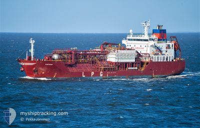
THETAGAS
Tanker
Current Trip
| Time Travelled | 2 days |
|---|---|
| Remaining Time | 1 day |
| Distance Travelled | 810.61 nm |
| Remaining Distance | 503.45 nm |
| AVG Speed | 13.3 Knots |
| MAX Speed | 16 Knots |
| AVG Wind | 12.2 knots |
| MAX Wind | 24.9 knots |
| MIN Temp | 11.6°C / 52.88°F |
| MAX Temp | 19°C / 66.2°F |
| Draught | 5.6 m |
| Position Received | 1 d ago |
Current Position
| Longitude | -9.95795° |
|---|---|
| Latitude | 41.76872° |
| Status | Under way using engine |
| Speed | 12.7 Knots |
| Course | 359° |
| Area | North Atlantic Ocean |
| Station | T-AIS |
| Position Received | 1 d ago |
Info
Information
The current position of THETAGAS is in North Atlantic Ocean with coordinates 41.76872° / -9.95795° as reported on 2024-04-24 23:29 by AIS to our vessel tracker app. The vessel's current speed is 12.7 Knots and is heading at the port of DUNKERQUE. The estimated time of arrival as calculated by MyShipTracking vessel tracking app is 2024-04-27 13:54 LT
The vessel THETAGAS (IMO: 9368792, MMSI: 305178000) is a Tanker It's sailing under the flag of [AG] Antigua Barbuda.
In this page you can find informations about the vessels current position, last detected port calls, and current voyage information. If the vessels is not in coverage by AIS you will find the latest position.
The current position of THETAGAS is detected by our AIS receivers and we are not responsible for the reliability of the data. The last position was recorded while the vessel was in Coverage by the Ais receivers of our vessel tracking app.
The current draught of THETAGAS as reported by AIS is 5.6 meters
Weather
| Temperature | 11.5°C / 52.7°F |
|---|---|
| Wind Speed | 23 knots |
| Direction | 315° NW |
| Pressure | 1005.8 hPa |
| Humidity | 73 % |
| Cloud Coverage | 66 % |
Featured Company
Last Port Calls
| Port | Arrival | Departure | Time In Port |
|---|---|---|---|
| 2024-04-22 22:44 | 2024-04-23 08:24 | 9 h | |
| 2024-04-18 08:58 | 2024-04-20 22:47 | 2 d | |
| 2024-04-13 08:18 | 2024-04-14 10:41 | 1 d | |
| 2024-04-08 15:16 | 2024-04-10 05:07 | 1 d | |
| 2024-04-03 14:49 | 2024-04-04 14:55 | 1 d | |
| 2024-03-03 02:14 | 2024-03-06 03:08 | 3 d | |
| 2024-02-05 20:06 | 2024-02-06 21:20 | 1 d |
Most Visited Ports (Last year)
| Port | Arrivals | |
|---|---|---|
| 13 | ||
| 9 | ||
| 6 | ||
| 3 | ||
| 3 | ||
| 2 |
Last Trips
| Origin | Departure | Destination | Arrival | Distance | |
|---|---|---|---|---|---|
| 2024-04-20 23:47 | 2024-04-23 00:44 | 625.47 nm | |||
| 2024-04-14 12:41 | 2024-04-18 09:58 | 874.94 nm | |||
| 2024-04-10 08:07 | 2024-04-13 10:18 | 683.60 nm | |||
| 2024-04-04 16:55 | 2024-04-08 18:16 | 678.42 nm | |||
| 2024-03-05 21:08 | 2024-04-03 16:49 | 6792.64 nm | |||
| 2024-02-06 22:20 | 2024-03-02 20:14 | 5740.11 nm | |||
| 2024-01-25 10:29 | 2024-02-05 21:06 | 1916.70 nm |
Events
| Time | Event | Details | Position / Dest | Info |
|---|---|---|---|---|
| 2024-04-25 00:12 | Status Changed | Default Under way using engine |
41.98815 / -9.95447
FRDKK
|
Speed: 12.7 kn Course: 359° |
| 2024-04-24 23:29 | Detected in Sea | Spanish part of the North Atlantic Ocean |
41.76872 / -9.95795
North Atlantic Ocean
FRDKK
|
Speed: 12.7 kn Course: 359° |
| 2024-04-24 23:29 | OUT of Coverage |
41.76872 / -9.95795
North Atlantic Ocean
FRDKK
|
Speed: 12.7 kn Course: 359° |
|
| 2024-04-24 17:09 | Status Changed | Under way using engine Default |
40.53383 / -9.93698
FRDKK
|
Speed: 12.5 kn Course: 0° |
| 2024-04-24 16:50 | Status Changed | Default Under way using engine |
40.49388 / -9.93677
FRDKK
|
Speed: 12.3 kn Course: 359° |
| 2024-04-24 15:47 | Status Changed | Under way using engine Default |
40.22183 / -9.93642
FRDKK
|
Speed: 12.5 kn Course: 1° |
| 2024-04-24 15:30 | IN Coverage |
40.22183 / -9.93642
North Atlantic Ocean
FRDKK
|
Speed: 12.3 kn Course: 0° |
|
| 2024-04-24 13:34 | Status Changed | Default Under way using engine |
39.81273 / -9.94718
FRDKK
|
Speed: 12.5 kn Course: 357° |
| 2024-04-24 13:23 | Status Changed | Under way using engine Default |
39.76087 / -9.94643
FRDKK
|
Speed: 12.7 kn Course: 358° |
| 2024-04-24 13:23 | OUT of Coverage |
39.76087 / -9.94643
North Atlantic Ocean
FRDKK
|
Speed: 12.5 kn Course: 357° |