
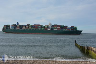
THALASSA NIKI
Container Ship
Current Trip
| Time Travelled | --- |
|---|---|
| Remaining Time | --- |
| Distance Travelled | --- |
| Remaining Distance | --- |
| AVG Speed | --- |
| MAX Speed | --- |
| AVG Wind | --- |
| MAX Wind | --- |
| MIN Temp | --- |
| MAX Temp | --- |
| Draught | 11.8 m |
| Position Received | 7 d ago |
Current Position
| Longitude | 126.36601° |
|---|---|
| Latitude | 35.94798° |
| Status | At anchor |
| Speed | |
| Course | 57° |
| Area | Yellow Sea |
| Station | T-AIS |
| Position Received | 7 d ago |
Info
Information
The current position of THALASSA NIKI is in Yellow Sea with coordinates 35.94798° / 126.36601° as reported on 2024-04-19 21:11 by AIS to our vessel tracker app. The vessel's current speed is 0 Knots and is heading at the port of GUNSAN. The estimated time of arrival as calculated by MyShipTracking vessel tracking app is 2024-04-19 16:00 LT
The vessel THALASSA NIKI (IMO: 9665645, MMSI: 636093018) is a Container Ship that was built in 2014 ( 10 years old ). It's sailing under the flag of [LR] Liberia.
In this page you can find informations about the vessels current position, last detected port calls, and current voyage information. If the vessels is not in coverage by AIS you will find the latest position.
The current position of THALASSA NIKI is detected by our AIS receivers and we are not responsible for the reliability of the data. The last position was recorded while the vessel was in Coverage by the Ais receivers of our vessel tracking app.
The current draught of THALASSA NIKI as reported by AIS is 11.8 meters
Weather
| Temperature | 15°C / 59°F |
|---|---|
| Wind Speed | 11 knots |
| Direction | 169° S |
| Pressure | 1009.7 hPa |
| Humidity | 87.5 % |
| Cloud Coverage | 100 % |
Featured Company
Last Port Calls
| Port | Arrival | Departure | Time In Port |
|---|---|---|---|
| 2024-04-18 03:57 | |||
| 2024-04-11 23:34 | 2024-04-13 05:49 | 1 d | |
| 2024-04-01 17:37 | 2024-04-02 06:08 | 12 h | |
| 2024-02-29 15:15 | 2024-03-02 02:29 | 1 d | |
| 2024-02-26 05:34 | 2024-02-28 12:16 | 2 d | |
| 2024-02-23 15:39 | 2024-02-25 00:14 | 1 d |
Most Visited Ports (Last year)
| Port | Arrivals | |
|---|---|---|
| 8 | ||
| 5 | ||
| 5 | ||
| 4 | ||
| 4 | ||
| 4 |
Last Trips
| Origin | Departure | Destination | Arrival | Distance | |
|---|---|---|---|---|---|
| 2024-04-13 13:49 | 2024-04-18 11:57 | 575.12 nm | |||
| 2024-04-02 14:08 | 2024-04-12 07:34 | 2897.62 nm | |||
| 2024-03-02 03:29 | 2024-04-02 01:37 | 11838.58 nm | |||
| 2024-02-28 13:16 | 2024-02-29 16:15 | 340.71 nm | |||
| 2024-02-25 01:14 | 2024-02-26 06:34 | 414.69 nm | |||
| 2024-01-21 15:06 | 2024-02-23 16:39 | 12023.97 nm |
Events
| Time | Event | Details | Position / Dest | Info |
|---|---|---|---|---|
| 2024-04-25 01:36 | STOP Moving | 12.49 nm, South West of ZHOUSHAN |
29.78323 / 122.08633
KRKUV
|
Speed: 0.2 kn Course: 273° |
| 2024-04-25 00:56 | START Moving | 12.61 nm, South West of ZHOUSHAN |
29.78543 / 122.07724
KRKUV
|
Speed: 3.1 kn Course: 243° |
| 2024-04-24 01:52 | STOP Moving | 12.99 nm, South West of ZHOUSHAN |
29.78057 / 122.07228
KRKUV
|
Speed: 0.1 kn Course: 229° |
| 2024-04-23 20:16 | START Moving | 18.76 nm, South East of ZHOUSHAN |
29.83342 / 122.52548
KRKUV
|
Speed: 6.8 kn Course: 104° |
| 2024-04-23 10:12 | STOP Moving | 18.34 nm, South East of ZHOUSHAN |
29.83462 / 122.51733
KRKUV
|
Speed: 0.2 kn Course: 35° |
| 2024-04-23 04:16 | START Moving | 13.59 nm, South East of NINGBO |
29.77588 / 122.02119
KRKUV
|
Speed: 3.8 kn Course: 135° |
| 2024-04-22 04:16 | STOP Moving | 13.34 nm, South East of NINGBO |
29.77968 / 122.01897
KRKUV
|
Speed: 0.3 kn Course: 232° |
| 2024-04-22 01:12 | START Moving |
29.65793 / 122.48962
KRKUV
|
Speed: 3.4 kn Course: 237° |
|
| 2024-04-21 15:44 | STOP Moving |
29.65850 / 122.49241
KRKUV
|
Speed: 0.3 kn Course: 275° |
|
| 2024-04-21 13:04 | START Moving |
29.79139 / 122.99380
KRKUV
|
Speed: 6.1 kn Course: 199° |