
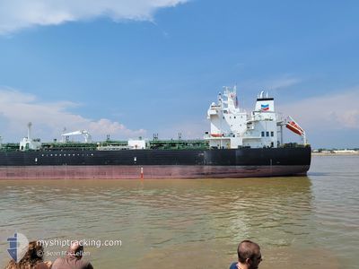
TEXAS VOYAGER
Tanker
Current Trip
| Time Travelled | 19 h, 16 mins |
|---|---|
| Remaining Time | --- |
| Distance Travelled | 248.34 nm |
| Remaining Distance | --- |
| AVG Speed | 11.4 Knots |
| MAX Speed | 14.6 Knots |
| AVG Wind | 8 knots |
| MAX Wind | 13.7 knots |
| MIN Temp | 9.4°C / 48.92°F |
| MAX Temp | 12.4°C / 54.32°F |
| Draught | 11.3 m |
| Position Received | 1 h, 40 m ago |
Current Position
| Longitude | --- |
|---|---|
| Latitude | --- |
| Status | Under way using engine |
| Speed | 14 Knots |
| Course | 152° |
| Area | North Pacific Ocean |
| Station | T-AIS |
| Position Received | 1 h, 40 m ago |
Info
Information
The current position of TEXAS VOYAGER is in North Pacific Ocean with coordinates 34.69212° / -122.00668° as reported on 2025-03-04 22:31 by AIS to our vessel tracker app. The vessel's current speed is 14 Knots and is heading at the port of BALBOA. The estimated time of arrival as calculated by MyShipTracking vessel tracking app is 2025-03-14 11:00 LT
The vessel TEXAS VOYAGER (IMO: 9719886, MMSI: 369142000) is a Tanker It's sailing under the flag of [US] USA.
In this page you can find informations about the vessels current position, last detected port calls, and current voyage information. If the vessels is not in coverage by AIS you will find the latest position.
The current position of TEXAS VOYAGER is detected by our AIS receivers and we are not responsible for the reliability of the data. The last position was recorded while the vessel was in Coverage by the Ais receivers of our vessel tracking app.
The current draught of TEXAS VOYAGER as reported by AIS is 11.3 meters
Weather
| Temperature | 12.4°C / 54.32°F |
|---|---|
| Wind Speed | 7 knots |
| Direction | 306° NW |
| Pressure | 1020.6 hPa |
| Humidity | 77.9 % |
| Cloud Coverage | 76 % |
Featured Company
Last Port Calls
| Port | Arrival | Departure | Time In Port |
|---|---|---|---|
| 2025-03-01 08:18 | 2025-03-03 20:56 | 2 d | |
| 2025-02-20 18:02 | 2025-02-22 11:30 | 1 d | |
| 2025-02-12 08:28 | 2025-02-15 13:13 | 3 d | |
| 2025-02-05 18:05 | 2025-02-06 16:20 | 22 h | |
| 2025-01-30 13:14 | 2025-02-03 18:15 | 4 d | |
| 2025-01-22 18:31 | 2025-01-25 16:27 | 2 d | |
| 2025-01-14 18:36 | 2025-01-17 20:13 | 3 d | |
| 2025-01-04 15:13 | 2025-01-06 20:45 | 2 d | |
| 2024-12-31 23:36 |
Most Visited Ports (Last year)
| Port | Arrivals | |
|---|---|---|
| 27 | ||
| 9 | ||
| 3 | ||
| 1 | ||
| 1 | ||
| 1 |
Last Trips
| Origin | Departure | Destination | Arrival | Distance | |
|---|---|---|---|---|---|
| 2025-02-22 11:30 | 2025-03-01 08:18 | 111.90 nm | |||
| 2025-02-15 13:13 | 2025-02-20 18:02 | 924.55 nm | |||
| 2025-02-06 16:20 | 2025-02-12 08:28 | 863.03 nm | |||
| 2025-02-03 18:15 | 2025-02-05 18:05 | 29.23 nm | |||
| 2025-01-25 16:27 | 2025-01-30 13:14 | 870.88 nm | |||
| 2025-01-17 20:13 | 2025-01-22 18:31 | 885.09 nm | |||
| 2025-01-06 20:45 | 2025-01-14 18:36 | 939.38 nm | |||
| 2024-12-31 23:36 | 2025-01-04 15:13 | 467.43 nm |
Events
| Time | Event | Details | Position / Dest | Info |
|---|---|---|---|---|
| 2025-03-04 22:38 | Status Changed | Default Under way using engine |
34.66999 / -121.99284
BALBOA, PANAMA
|
Speed: 14 kn Course: 152° |
| 2025-03-04 22:31 | Status Changed | Under way using engine Default |
34.69212 / -122.00668
BALBOA, PANAMA
|
Speed: 14.1 kn Course: 152° |
| 2025-03-04 22:31 | OUT of Coverage |
34.69212 / -122.00668
North Pacific Ocean
BALBOA, PANAMA
|
Speed: 14 kn Course: 152° |
|
| 2025-03-04 22:11 | Status Changed | Default Under way using engine |
34.76444 / -122.05451
BALBOA, PANAMA
|
Speed: 13.9 kn Course: 150.4° |
| 2025-03-04 22:01 | Status Changed | Under way using engine Default |
34.79722 / -122.07717
BALBOA, PANAMA
|
Speed: 13.8 kn Course: 150° |
| 2025-03-04 21:51 | Status Changed | Default Under way using engine |
34.83015 / -122.10007
BALBOA, PANAMA
|
Speed: 13.7 kn Course: 148.7° |
| 2025-03-04 21:44 | Status Changed | Under way using engine Default |
34.85162 / -122.11532
BALBOA, PANAMA
|
Speed: 13.7 kn Course: 149° |
| 2025-03-04 21:37 | IN Coverage |
34.85162 / -122.11532
North Pacific Ocean
BALBOA, PANAMA
|
Speed: 13.7 kn Course: 148.7° |
|
| 2025-03-04 20:48 | Status Changed | Default Under way using engine |
35.03822 / -122.25090
BALBOA, PANAMA
|
Speed: 14 kn Course: 148.9° |
| 2025-03-04 20:42 | OUT of Coverage |
35.05597 / -122.26350
North Pacific Ocean
BALBOA, PANAMA
|
Speed: 14 kn Course: 148.9° |