
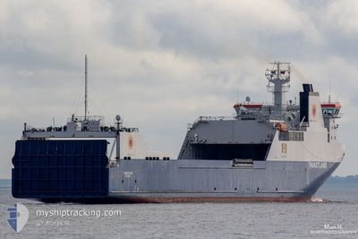
TAVASTLAND
Ro-Ro Cargo
Current Trip
| Trip Time | 3 days |
|---|---|
| Trip Distance | 433.62 nm |
| AVG Speed | 9.1 Knots |
| MAX Speed | 9.1 Knots |
| Draught | 6.6 m |
| AVG Wind | 25.3 knots |
| MAX Wind | 35.5 knots |
| MIN Temp | 3°C / 37.4°F |
| MAX Temp | 6.6°C / 43.88°F |
| Position Received | 1 m ago |
Current Position
| Longitude | --- |
|---|---|
| Latitude | --- |
| Status | Moored |
| Speed | 0.1 Knots |
| Course | 47° |
| Area | North Sea |
| Station | T-AIS |
| Position Received | 1 m ago |
Info
Information
The current position of TAVASTLAND is in North Sea with coordinates 51.35517° / 3.17707° as reported on 2026-01-03 19:57 by AIS to our vessel tracker app. The vessel's current speed is 0.1 Knots and is currently inside the port of ZEEBRUGGE.
The vessel TAVASTLAND (IMO: 9334959, MMSI: 266232000) is a Ro-Ro Cargo that was built in 2006 ( 20 years old ). It's sailing under the flag of [SE] Sweden.
In this page you can find informations about the vessels current position, last detected port calls, and current voyage information. If the vessels is not in coverage by AIS you will find the latest position.
The current position of TAVASTLAND is detected by our AIS receivers and we are not responsible for the reliability of the data. The last position was recorded while the vessel was in Coverage by the Ais receivers of our vessel tracking app.
The current draught of TAVASTLAND as reported by AIS is 6.6 meters
Weather
| Temperature | 3°C / 37.4°F |
|---|---|
| Wind Speed | 14 knots |
| Direction | 307° NW |
| Pressure | 1008.7 hPa |
| Humidity | 70.5 % |
| Cloud Coverage | 18 % |
Featured Company
Last Port Calls
| Port | Arrival | Departure | Time In Port |
|---|---|---|---|
| 2026-01-03 17:45 | |||
| 2025-12-31 17:20 | 2025-12-31 17:35 | 15 m | |
| 2025-12-31 11:20 | 2025-12-31 11:36 | 15 m | |
| 2025-12-30 18:12 | 2025-12-31 10:56 | 16 h | |
| 2025-12-29 10:25 | 2025-12-30 17:20 | 1 d | |
| 2025-12-26 05:48 | 2025-12-26 12:00 | 6 h | |
| 2025-12-23 09:22 | 2025-12-23 09:38 | 15 m | |
| 2025-12-22 14:58 | 2025-12-23 08:54 | 17 h | |
| 2025-12-22 07:03 | 2025-12-22 14:22 | 7 h | |
| 2025-12-19 08:26 | 2025-12-19 18:03 | 9 h |
Last Trips
| Origin | Departure | Destination | Arrival | Distance | |
|---|---|---|---|---|---|
| 2025-12-31 17:35 | 2026-01-03 17:45 | 433.62 nm | |||
| 2025-12-31 11:36 | 2025-12-31 17:20 | 91.60 nm | |||
| 2025-12-31 10:56 | 2025-12-31 11:20 | 3.26 nm | |||
| 2025-12-30 17:20 | 2025-12-30 18:12 | 4.73 nm | |||
| 2025-12-26 12:00 | 2025-12-29 10:25 | 722.37 nm | |||
| 2025-12-23 09:38 | 2025-12-26 05:48 | 724.21 nm | |||
| 2025-12-23 08:54 | 2025-12-23 09:22 | 3.53 nm | |||
| 2025-12-22 14:22 | 2025-12-22 14:58 | 4.47 nm | |||
| 2025-12-19 18:03 | 2025-12-22 07:03 | 848.73 nm | |||
| 2025-12-18 22:46 | 2025-12-19 08:26 | 117.30 nm |
Events
| Time | Event | Details | Position / Dest | Info |
|---|---|---|---|---|
| 2026-01-03 17:34 | Status Changed | Moored Under way using engine |
51.35516 / 3.17708
[BE] ZEEBRUGGE
|
Speed: 0.1 kn Course: 47° |
| 2026-01-03 16:52 | STOP Moving |
51.35708 / 3.19443
[BE] ZEEBRUGGE
|
Speed: 0.3 kn Course: 148° |
|
| 2026-01-03 16:45 | PORT ARRIVAL |
|
51.36424 / 3.18795
[BE] ZEEBRUGGE
|
Speed: 9.7 kn Course: 136.4° |
| 2026-01-03 15:49 | Change Sea Area | Belgian part of the North Sea Dutch part of the North Sea |
51.52936 / 3.09557
North Sea
BEZEE
|
Speed: 17 kn Course: 220.3° |
| 2026-01-03 14:16 | Status Changed | Under way using engine Default |
51.94216 / 3.30809
BEZEE
|
Speed: 16.9 kn Course: 188° |
| 2026-01-03 14:16 | IN Coverage |
51.94216 / 3.30809
North Sea
BEZEE
|
Speed: 17 kn Course: 187.9° |
|
| 2026-01-03 09:54 | Status Changed | Default Under way using engine |
53.06698 / 4.24029
BEZEE
|
Speed: 19.4 kn Course: 230.1° |
| 2026-01-03 09:51 | OUT of Coverage |
53.07811 / 4.25942
North Sea
BEZEE
|
Speed: 19.4 kn Course: 230.1° |
|
| 2026-01-03 05:22 | Status Changed | Under way using engine Default |
53.73733 / 5.32048
BEZEE
|
Speed: 9.7 kn Course: 173° |
| 2026-01-03 05:21 | Status Changed | Default Under way using engine |
53.74213 / 5.31928
BEZEE
|
Speed: 9.7 kn Course: 166.8° |