
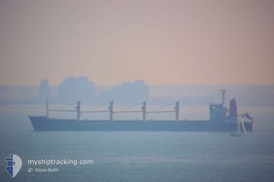
TARSUS M
Bulk Carrier
Current Trip
| Time Travelled | 9 days |
|---|---|
| Remaining Time | 4 days |
| Distance Travelled | 1123.69 nm |
| Remaining Distance | 1098.75 nm |
| AVG Speed | 7.8 Knots |
| MAX Speed | 10.1 Knots |
| AVG Wind | 15.5 knots |
| MAX Wind | 25.3 knots |
| MIN Temp | 20.4°C / 68.72°F |
| MAX Temp | 28°C / 82.4°F |
| Draught | 11.7 m |
| Position Received | 2025-10-04 00:20 |
Current Position
| Longitude | --- |
|---|---|
| Latitude | --- |
| Status | Under way using engine |
| Speed | 10 Knots |
| Course | 51° |
| Area | Indian Ocean |
| Station | T-AIS |
| Position Received | 2025-10-04 00:20 |
Info
Information
The current position of TARSUS M is in Indian Ocean with coordinates -29.63992° / 31.50193° as reported on 2025-10-04 00:20 by AIS to our vessel tracker app. The vessel's current speed is 10 Knots and is heading at the port of DJIBOUTI. The estimated time of arrival as calculated by MyShipTracking vessel tracking app is 2025-12-19 13:24 LT
The vessel TARSUS M (IMO: 9188908, MMSI: 352001472) is a Bulk Carrier that was built in 2006 ( 19 years old ). It's sailing under the flag of [PA] Panama.
In this page you can find informations about the vessels current position, last detected port calls, and current voyage information. If the vessels is not in coverage by AIS you will find the latest position.
The current position of TARSUS M is detected by our AIS receivers and we are not responsible for the reliability of the data. The last position was recorded while the vessel was in Coverage by the Ais receivers of our vessel tracking app.
The current draught of TARSUS M as reported by AIS is 11.7 meters
Weather
| Temperature | 21.8°C / 71.24°F |
|---|---|
| Wind Speed | 20 knots |
| Direction | 356° N |
| Pressure | 1014.9 hPa |
| Humidity | 54.5 % |
| Cloud Coverage | --- |
Featured Company
Events
| Time | Event | Details | Position / Dest | Info |
|---|---|---|---|---|
| 2025-12-13 15:17 | START Moving |
27.53142 / 34.61572
DJJIB
|
Speed: 6.2 kn Course: 73° |
|
| 2025-12-13 14:32 | STOP Moving |
27.53333 / 34.59667
DJJIB
|
Speed: Course: -1° |
|
| 2025-12-12 23:33 | STOP Moving |
27.36167 / 34.60166
DJJIB
|
Speed: Course: -1° |
|
| 2025-12-12 21:30 | STOP Moving |
27.39333 / 34.58833
DJJIB
|
Speed: Course: -1° |
|
| 2025-12-12 08:04 | START Moving |
27.32333 / 35.14667
DJJIB
|
Speed: 4 kn Course: -1° |
|
| 2025-12-12 07:37 | STOP Moving |
27.31333 / 35.14167
DJJIB
|
Speed: Course: -1° |
|
| 2025-12-11 14:32 | START Moving |
27.26413 / 34.79848
DJJIB
|
Speed: 8 kn Course: 321° |
|
| 2025-12-11 05:49 | STOP Moving |
27.28667 / 34.69833
DJJIB
|
Speed: Course: -1° |
|
| 2025-12-06 21:55 | START Moving | 19.12 nm, West of SALIF |
15.40667 / 42.35500
DJJIB
|
Speed: 6 kn Course: 255° |
| 2025-12-05 17:51 | STOP Moving | 17.03 nm, West of SALIF |
15.39603 / 42.38925
DJJIB
|
Speed: 0.3 kn Course: 176° |