
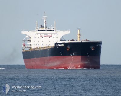
TAI CHANG
Bulk Carrier
Current Trip
TANJUNG KAMPEH
| Time Travelled | 40 days |
|---|---|
| Remaining Time | --- |
| Distance Travelled | 3727.45 nm |
| Remaining Distance | --- |
| AVG Speed | 10.5 Knots |
| MAX Speed | 17.2 Knots |
| AVG Wind | 9.4 knots |
| MAX Wind | 31 knots |
| MIN Temp | 22.6°C / 72.68°F |
| MAX Temp | 29.9°C / 85.82°F |
| Draught | 7.3 m |
| Position Received | 13 h, 49 m ago |
Current Position
| Longitude | --- |
|---|---|
| Latitude | --- |
| Status | Under way using engine |
| Speed | 14.6 Knots |
| Course | 134.7° |
| Area | South China Sea |
| Station | T-AIS |
| Position Received | 13 h, 49 m ago |
Info
Information
The current position of TAI CHANG is in South China Sea with coordinates 1.17791° / 104.81370° as reported on 2025-12-12 17:18 by AIS to our vessel tracker app. The vessel's current speed is 14.6 Knots
The vessel TAI CHANG (IMO: 9498872, MMSI: 477728300) is a Bulk Carrier that was built in 2010 ( 15 years old ). It's sailing under the flag of [HK] Hong Kong.
In this page you can find informations about the vessels current position, last detected port calls, and current voyage information. If the vessels is not in coverage by AIS you will find the latest position.
The current position of TAI CHANG is detected by our AIS receivers and we are not responsible for the reliability of the data. The last position was recorded while the vessel was in Coverage by the Ais receivers of our vessel tracking app.
The current draught of TAI CHANG as reported by AIS is 7.3 meters
Weather
| Temperature | 27.1°C / 80.78°F |
|---|---|
| Wind Speed | 14 knots |
| Direction | 300° WNW |
| Pressure | 1007.8 hPa |
| Humidity | 81.1 % |
| Cloud Coverage | 100 % |
Featured Company
Events
| Time | Event | Details | Position / Dest | Info |
|---|---|---|---|---|
| 2025-12-12 17:25 | Status Changed | Default Under way using engine |
1.15806 / 104.83348
TANJUNG KAMPEH
|
Speed: 14.6 kn Course: 134.7° |
| 2025-12-12 17:18 | OUT of Coverage |
1.17791 / 104.81370
South China Sea
TANJUNG KAMPEH
|
Speed: 14.6 kn Course: 134.7° |
|
| 2025-12-12 17:05 | Status Changed | Under way using engine Default |
1.21584 / 104.77578
TANJUNG KAMPEH
|
Speed: 14.7 kn Course: 130° |
| 2025-12-12 16:57 | Status Changed | Default Under way using engine |
1.23812 / 104.75194
TANJUNG KAMPEH
|
Speed: 14.7 kn Course: 130.6° |
| 2025-12-12 16:57 | Status Changed | Under way using engine Default |
1.23866 / 104.75133
TANJUNG KAMPEH
|
Speed: 14.6 kn Course: 128° |
| 2025-12-12 16:45 | Status Changed | Default Under way using engine |
1.26793 / 104.71433
TANJUNG KAMPEH
|
Speed: 14.6 kn Course: 129.2° |
| 2025-12-12 16:31 | Status Changed | Under way using engine Default |
1.30350 / 104.67020
TANJUNG KAMPEH
|
Speed: 14.4 kn Course: 128° |
| 2025-12-12 16:29 | Status Changed | Default Under way using engine |
1.30857 / 104.66396
TANJUNG KAMPEH
|
Speed: 14.4 kn Course: 129.4° |
| 2025-12-12 16:29 | Status Changed | Under way using engine Default |
1.30958 / 104.66271
TANJUNG KAMPEH
|
Speed: 14.5 kn Course: 128° |
| 2025-12-12 16:29 | Change Sea Area | Indonesian part of the South China Sea Malaysian part of the South China Sea |
1.30958 / 104.66271
South China Sea
TANJUNG KAMPEH
|
Speed: 14.4 kn Course: 129.4° |