
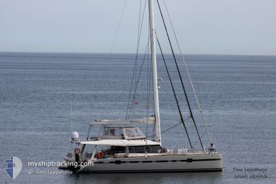
SUNNYACHT
Sailing
Current Trip
SUNNYACHT is out of coverage. Learn how you can join the community and extend the coverage to your area by clicking here!
Unknown
Destination Port
ETA*
---
| Time Travelled | 11 days |
|---|---|
| Remaining Time | --- |
| Distance Travelled | 65.11 nm |
| Remaining Distance | --- |
| AVG Speed | 5.4 Knots |
| MAX Speed | 7.9 Knots |
| AVG Wind | 16.4 knots |
| MAX Wind | 20 knots |
| MIN Temp | 25.4°C / 77.72°F |
| MAX Temp | 26.2°C / 79.16°F |
| Draught | --- |
| Position Received | 2 d ago |
Current Position
| Longitude | --- |
|---|---|
| Latitude | --- |
| Status | Default |
| Speed | 0.1 Knots |
| Course | --- |
| Area | Caribbean Sea |
| Station | T-AIS |
| Position Received | 2 d ago |
Info
info
Information
The current position of SUNNYACHT is in Caribbean Sea with coordinates 18.07258° / -63.08765° as reported on 2025-02-28 13:16 by AIS to our vessel tracker app. The vessel's current speed is 0.1 Knots
The vessel SUNNYACHT (MMSI: 268238901) is a Sailing It's sailing under the flag of [SM] San Marino.
In this page you can find informations about the vessels current position, last detected port calls, and current voyage information. If the vessels is not in coverage by AIS you will find the latest position.
The current position of SUNNYACHT is detected by our AIS receivers and we are not responsible for the reliability of the data. The last position was recorded while the vessel was in Coverage by the Ais receivers of our vessel tracking app.
Weather
| Temperature | 26°C / 78.8°F |
|---|---|
| Wind Speed | 14 knots |
| Direction | 108° ESE |
| Pressure | 1016.7 hPa |
| Humidity | 77.4 % |
| Cloud Coverage | --- |
Featured Company
Limited time offer - Install a base station receiver to your area and list your company on MyShipTracking Free forever!
Last Port Calls
| Port | Arrival | Departure | Time In Port |
|---|---|---|---|
| 2025-02-17 19:35 | 2025-02-19 14:37 | 1 d | |
| 2025-02-17 12:25 | 2025-02-17 12:50 | 25 m | |
| 2025-01-04 13:38 | 2025-01-05 20:51 | 1 d |
Last Trips
| Origin | Departure | Destination | Arrival | Distance | |
|---|---|---|---|---|---|
| 2025-02-17 08:50 | 2025-02-17 15:35 | 10.14 nm | |||
| 2025-01-05 16:51 | 2025-02-17 08:25 | 21.56 nm | |||
| 2024-12-31 10:27 | 2025-01-04 09:38 | 37.32 nm |
Events
| Time | Event | Details | Position / Dest | Info |
|---|---|---|---|---|
| 2025-02-28 13:16 | OUT of Coverage |
18.07258 / -63.08765
Caribbean Sea
|
Speed: 0.1 kn Course: 511° |
|
| 2025-02-26 23:11 | STOP Moving | 0.6 nm, North of MARIGOT |
18.07261 / -63.08739
|
Speed: 0.1 kn Course: 511° |
| 2025-02-26 21:20 | Change Sea Area | Saint-Martin part of the Caribbean Sea Sint-Maarten part of the Caribbean Sea |
18.04981 / -62.95386
Caribbean Sea
|
Speed: 6.7 kn Course: 326.4° |
| 2025-02-26 21:12 | Change Sea Area | Sint-Maarten part of the Caribbean Sea Saint-Martin part of the Caribbean Sea |
18.03724 / -62.94492
Caribbean Sea
|
Speed: 7.3 kn Course: 325.2° |
| 2025-02-26 19:56 | START Moving | 0.81 nm, North West of GUSTAVIA |
17.90817 / -62.86492
|
Speed: 6.7 kn Course: 300.3° |
| 2025-02-26 18:58 | STOP Moving | 0.56 nm, North West of GUSTAVIA |
17.90687 / -62.86044
|
Speed: 0.3 kn Course: 511° |
| 2025-02-26 18:33 | START Moving | 2.01 nm, North West of GUSTAVIA |
17.92220 / -62.87996
|
Speed: 5.9 kn Course: 234° |
| 2025-02-26 17:09 | IN Coverage |
17.92443 / -62.87105
Caribbean Sea
|
Speed: 0.3 kn Course: 511° |
|
| 2025-02-26 15:46 | OUT of Coverage |
17.92443 / -62.87097
Caribbean Sea
|
Speed: 0.1 kn Course: 511° |
|
| 2025-02-26 13:24 | IN Coverage |
17.92432 / -62.87104
Caribbean Sea
|
Speed: 0.1 kn Course: 511° |