
SUN RISE
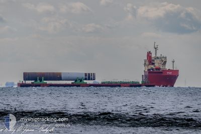
Heavy Lift Vessel
Current Trip
| Time Travelled | 25 days |
|---|---|
| Remaining Time | 3 days |
| Distance Travelled | 4453.97 nm |
| Remaining Distance | 1031.46 nm |
| AVG Speed | 8.2 Knots |
| MAX Speed | 12.6 Knots |
| AVG Wind | 15 knots |
| MAX Wind | 32 knots |
| MIN Temp | 0.7°C / 33.26°F |
| MAX Temp | 23.2°C / 73.76°F |
| Draught | 6.8 m |
| Position Received | 7 d ago |
Current Position
| Longitude | --- |
|---|---|
| Latitude | --- |
| Status | Under way using engine |
| Speed | 8.5 Knots |
| Course | 252.3° |
| Area | North Atlantic Ocean |
| Station | T-AIS |
| Position Received | 7 d ago |
Info
Information
The current position of SUN RISE is in North Atlantic Ocean with coordinates 38.65045° / -32.14864° as reported on 2025-11-30 10:15 by AIS to our vessel tracker app. The vessel's current speed is 8.5 Knots and is heading at the port of NORFOLK. The estimated time of arrival as calculated by MyShipTracking vessel tracking app is 2025-12-12 01:58 LT
The vessel SUN RISE (IMO: 9623219, MMSI: 440032000) is a Heavy Lift Vessel that was built in 2012 ( 13 years old ). It's sailing under the flag of [KR] Korea.
In this page you can find informations about the vessels current position, last detected port calls, and current voyage information. If the vessels is not in coverage by AIS you will find the latest position.
The current position of SUN RISE is detected by our AIS receivers and we are not responsible for the reliability of the data. The last position was recorded while the vessel was in Coverage by the Ais receivers of our vessel tracking app.
The current draught of SUN RISE as reported by AIS is 6.8 meters
Weather
| Temperature | 22°C / 71.6°F |
|---|---|
| Wind Speed | 12 knots |
| Direction | 271° W |
| Pressure | 1014.9 hPa |
| Humidity | 73.6 % |
| Cloud Coverage | 100 % |
Featured Company
Last Port Calls
Most Visited Ports (Last year)
| Port | Arrivals | |
|---|---|---|
| 6 | ||
| 2 | ||
| 1 | ||
| 1 | ||
| 1 |
Last Trips
| Origin | Departure | Destination | Arrival | Distance | |
|---|---|---|---|---|---|
| 2025-11-12 18:28 | 2025-11-12 19:52 | 6.06 nm | |||
| 2025-11-10 15:56 | 2025-11-10 17:23 | 5.24 nm | |||
| 2025-11-10 06:49 | 2025-11-10 14:30 | 59.04 nm | |||
| 2025-10-21 05:03 | 2025-11-06 23:05 | 3639.55 nm | |||
| 2025-08-25 07:37 | 2025-10-17 00:15 | 7260.67 nm |
Events
| Time | Event | Details | Position / Dest | Info |
|---|---|---|---|---|
| 2025-11-30 10:36 | Status Changed | Default Under way using engine |
38.63150 / -32.21717
USPTM
|
Speed: 8.5 kn Course: 252.3° |
| 2025-11-30 10:15 | Status Changed | Under way using engine Default |
38.65045 / -32.14864
USPTM
|
Speed: 8.4 kn Course: 252° |
| 2025-11-30 10:15 | OUT of Coverage |
38.65045 / -32.14864
North Atlantic Ocean
USPTM
|
Speed: 8.5 kn Course: 252.3° |
|
| 2025-11-30 09:58 | Status Changed | Default Under way using engine |
38.66143 / -32.10887
USPTM
|
Speed: 7.7 kn Course: 247.9° |
| 2025-11-30 09:49 | Status Changed | Under way using engine Default |
38.67055 / -32.07684
USPTM
|
Speed: 7.8 kn Course: 246° |
| 2025-11-30 09:06 | Status Changed | Default Under way using engine |
38.70207 / -31.96845
USPTM
|
Speed: 8.2 kn Course: 246.1° |
| 2025-11-30 08:52 | Status Changed | Under way using engine Default |
38.71446 / -31.92921
USPTM
|
Speed: 8.2 kn Course: 248° |
| 2025-11-30 08:52 | IN Coverage |
38.71446 / -31.92921
North Atlantic Ocean
USPTM
|
Speed: 8.2 kn Course: 246.1° |
|
| 2025-11-30 07:53 | Status Changed | Default Under way using engine |
38.75529 / -31.77298
USPTM
|
Speed: 8.1 kn Course: 249.2° |
| 2025-11-30 07:45 | OUT of Coverage |
38.76318 / -31.74314
North Atlantic Ocean
USPTM
|
Speed: 8.1 kn Course: 249.2° |