
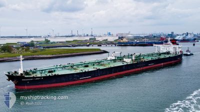
SUEZ ICE SUPREME
Crude Oil Tanker
Current Trip
| Time Travelled | 58 days |
|---|---|
| Remaining Time | --- |
| Distance Travelled | 10863.88 nm |
| Remaining Distance | --- |
| AVG Speed | 11.4 Knots |
| MAX Speed | 11.4 Knots |
| AVG Wind | 13.2 knots |
| MAX Wind | 41.7 knots |
| MIN Temp | 5.3°C / 41.54°F |
| MAX Temp | 32°C / 89.6°F |
| Draught | 9.5 m |
| Position Received | 2 m ago |
Current Position
| Longitude | --- |
|---|---|
| Latitude | --- |
| Status | Under way using engine |
| Speed | 4.4 Knots |
| Course | 245° |
| Area | Gulf of Finland |
| Station | T-AIS |
| Position Received | 2 m ago |
Info
Information
The current position of SUEZ ICE SUPREME is in Gulf of Finland with coordinates 59.84512° / 25.88370° as reported on 2025-12-11 15:06 by AIS to our vessel tracker app. The vessel's current speed is 4.4 Knots and is heading at the port of HUNDIPEA. The estimated time of arrival as calculated by MyShipTracking vessel tracking app is 2025-12-12 01:00 LT
The vessel SUEZ ICE SUPREME (IMO: 9296418, MMSI: 636022121) is a Crude Oil Tanker that was built in 2007 ( 18 years old ). It's sailing under the flag of [LR] Liberia.
In this page you can find informations about the vessels current position, last detected port calls, and current voyage information. If the vessels is not in coverage by AIS you will find the latest position.
The current position of SUEZ ICE SUPREME is detected by our AIS receivers and we are not responsible for the reliability of the data. The last position was recorded while the vessel was in Coverage by the Ais receivers of our vessel tracking app.
The current draught of SUEZ ICE SUPREME as reported by AIS is 9.5 meters
Weather
| Temperature | 5.3°C / 41.54°F |
|---|---|
| Wind Speed | 10 knots |
| Direction | 289° WNW |
| Pressure | 1002.5 hPa |
| Humidity | 93.6 % |
| Cloud Coverage | 100 % |
Featured Company
Last Port Calls
| Port | Arrival | Departure | Time In Port |
|---|---|---|---|
| 2025-11-23 11:39 | 2025-11-23 21:03 | 9 h | |
| 2025-11-01 09:04 | 2025-11-01 20:09 | 11 h | |
| 2025-10-12 18:21 | 2025-10-13 23:31 | 1 d |
Most Visited Ports (Last year)
| Port | Arrivals | |
|---|---|---|
| 8 | ||
| 2 | ||
| 2 | ||
| 1 | ||
| 1 |
Last Trips
| Origin | Departure | Destination | Arrival | Distance | |
|---|---|---|---|---|---|
| 2025-10-13 23:31 | 2025-11-23 11:39 | 10870.28 nm | |||
| 2025-10-13 23:31 | 2025-11-01 09:04 | 4820.03 nm | |||
| 2025-08-08 00:49 | 2025-10-12 18:21 | 9413.79 nm |
Events
| Time | Event | Details | Position / Dest | Info |
|---|---|---|---|---|
| 2025-12-11 10:38 | Detected in Sea | Estonian part of the Gulf of Finland |
59.67513 / 24.14682
Gulf of Finland
TALLINN FOR ORDERS
|
Speed: 12.9 kn Course: 69° |
| 2025-12-11 08:37 | Detected in Sea | Finnish part of the Gulf of Finland |
59.52888 / 23.27847
Gulf of Finland
TALLINN FOR ORDERS
|
Speed: 12.8 kn Course: 70° |
| 2025-12-11 08:24 | Change Sea Area | Estonian part of the Gulf of Finland Estonian part of the Baltic Sea |
59.51330 / 23.18990
Gulf of Finland
TALLINN FOR ORDERS
|
Speed: 12.7 kn Course: 71° |
| 2025-12-11 07:54 | Detected in Sea | Estonian part of the Baltic Sea |
59.47612 / 22.97263
Baltic Sea
TALLINN FOR ORDERS
|
Speed: 12.8 kn Course: 71° |
| 2025-12-11 07:01 | Change Sea Area | Finnish part of the Baltic Sea Estonian part of the Baltic Sea |
59.40642 / 22.60005
Baltic Sea
TALLINN FOR ORDERS
|
Speed: 13.1 kn Course: 54° |
| 2025-12-11 06:48 | Status Changed | Under way using engine Default |
59.37650 / 22.52598
TALLINN FOR ORDERS
|
Speed: 12.7 kn Course: 53° |
| 2025-12-11 06:33 | IN Coverage |
59.37650 / 22.52598
Baltic Sea
TALLINN FOR ORDERS
|
Speed: 12.8 kn Course: 51° |
|
| 2025-12-11 05:45 | Status Changed | Default Under way using engine |
59.23195 / 22.15035
TALLINN FOR ORDERS
|
Speed: 12.5 kn Course: 52° |
| 2025-12-11 05:39 | OUT of Coverage |
59.21913 / 22.11718
Baltic Sea
TALLINN FOR ORDERS
|
Speed: 12.5 kn Course: 52° |
|
| 2025-12-11 05:29 | Change Sea Area | Estonian part of the Baltic Sea Swedish part of the Baltic Sea |
59.19675 / 22.05785
Baltic Sea
TALLINN FOR ORDERS
|
Speed: 12.7 kn Course: 54° |