
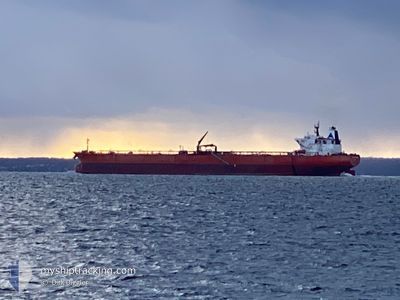
SUEZ ENCHANTED
Crude Oil Tanker
Current Trip
| Time Travelled | 49 days |
|---|---|
| Remaining Time | 1 day |
| Distance Travelled | 12092.64 nm |
| Remaining Distance | 498.13 nm |
| AVG Speed | 11.4 Knots |
| MAX Speed | 15.8 Knots |
| AVG Wind | 13.2 knots |
| MAX Wind | 31 knots |
| MIN Temp | 7.3°C / 45.14°F |
| MAX Temp | 29.4°C / 84.92°F |
| Draught | 8.5 m |
| Position Received | 1 m ago |
Current Position
| Longitude | --- |
|---|---|
| Latitude | --- |
| Status | Under way using engine |
| Speed | 11 Knots |
| Course | 80.7° |
| Area | Sea of Marmara |
| Station | T-AIS |
| Position Received | 1 m ago |
Info
Information
The current position of SUEZ ENCHANTED is in Sea of Marmara with coordinates 40.78272° / 28.34536° as reported on 2025-12-20 18:49 by AIS to our vessel tracker app. The vessel's current speed is 11 Knots and is heading at the port of NOVOROSSIYSK. The estimated time of arrival as calculated by MyShipTracking vessel tracking app is 2025-12-22 20:20 LT
The vessel SUEZ ENCHANTED (IMO: 9318084, MMSI: 636021924) is a Crude Oil Tanker that was built in 2007 ( 18 years old ). It's sailing under the flag of [LR] Liberia.
In this page you can find informations about the vessels current position, last detected port calls, and current voyage information. If the vessels is not in coverage by AIS you will find the latest position.
The current position of SUEZ ENCHANTED is detected by our AIS receivers and we are not responsible for the reliability of the data. The last position was recorded while the vessel was in Coverage by the Ais receivers of our vessel tracking app.
The current draught of SUEZ ENCHANTED as reported by AIS is 8.5 meters
Weather
| Temperature | 12.1°C / 53.78°F |
|---|---|
| Wind Speed | 14 knots |
| Direction | 56° NE |
| Pressure | 1016.9 hPa |
| Humidity | 78.2 % |
| Cloud Coverage | 99 % |
Featured Company
Last Port Calls
| Port | Arrival | Departure | Time In Port |
|---|---|---|---|
| 2025-12-13 13:54 | 2025-12-13 23:13 | 9 h | |
| 2025-11-19 07:24 | 2025-11-19 16:49 | 9 h | |
| 2025-10-30 16:32 | 2025-11-01 05:05 | 1 d |
Most Visited Ports (Last year)
| Port | Arrivals | |
|---|---|---|
| 8 | ||
| 3 | ||
| 2 |
Last Trips
| Origin | Departure | Destination | Arrival | Distance | |
|---|---|---|---|---|---|
| 2025-11-01 05:05 | 2025-12-13 13:54 | 11205.09 nm | |||
| 2025-11-01 05:05 | 2025-11-19 07:24 | 4825.94 nm | |||
| 2025-08-05 18:16 | 2025-10-30 16:32 | 12228.31 nm |
Events
| Time | Event | Details | Position / Dest | Info |
|---|---|---|---|---|
| 2025-12-20 15:57 | Status Changed | Under way using engine Default |
40.72132 / 27.68966
RUNVS
|
Speed: 10.6 kn Course: 85° |
| 2025-12-20 15:50 | Status Changed | Default Under way using engine |
40.71943 / 27.65889
RUNVS
|
Speed: 10.7 kn Course: 77.2° |
| 2025-12-20 15:44 | Status Changed | Under way using engine Default |
40.71786 / 27.63750
RUNVS
|
Speed: 10.9 kn Course: 69° |
| 2025-12-20 15:25 | IN Coverage |
40.71832 / 27.64005
Sea of Marmara
RUNVS
|
Speed: 10.7 kn Course: 77.2° |
|
| 2025-12-20 14:26 | Status Changed | Default Under way using engine |
40.61943 / 27.34377
RUNVS
|
Speed: 11 kn Course: 68.5° |
| 2025-12-20 14:18 | Status Changed | Under way using engine Default |
40.61042 / 27.31362
RUNVS
|
Speed: 11 kn Course: 68° |
| 2025-12-20 14:18 | IN Coverage |
40.61042 / 27.31362
Sea of Marmara
RUNVS
|
Speed: 11 kn Course: 68.5° |
|
| 2025-12-20 14:18 | OUT of Coverage |
40.61042 / 27.31362
Sea of Marmara
RUNVS
|
Speed: 11 kn Course: 68.5° |
|
| 2025-12-20 11:14 | Status Changed | Default Under way using engine |
40.36944 / 26.67058
RUNVS
|
Speed: 10.6 kn Course: 39.4° |
| 2025-12-20 11:12 | OUT of Coverage |
40.36486 / 26.66577
Sea of Marmara
RUNVS
|
Speed: 10.6 kn Course: 39.4° |