
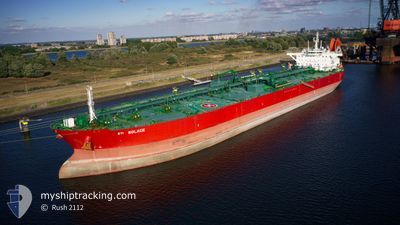
STI SOLACE
Tanker
Current Trip
| Time Travelled | 38 days |
|---|---|
| Remaining Time | --- |
| Distance Travelled | 8627.04 nm |
| Remaining Distance | --- |
| AVG Speed | 12.8 Knots |
| MAX Speed | 15.3 Knots |
| AVG Wind | 11 knots |
| MAX Wind | 29 knots |
| MIN Temp | 14.1°C / 57.38°F |
| MAX Temp | 28.3°C / 82.94°F |
| Draught | 14.7 m |
| Position Received | 7 d ago |
Current Position
| Longitude | --- |
|---|---|
| Latitude | --- |
| Status | Under way using engine |
| Speed | 13.5 Knots |
| Course | 126.7° |
| Area | Gulf of Oman |
| Station | T-AIS |
| Position Received | 7 d ago |
Info
Information
The current position of STI SOLACE is in Gulf of Oman with coordinates 24.68320° / 57.06239° as reported on 2025-02-26 02:01 by AIS to our vessel tracker app. The vessel's current speed is 13.5 Knots and is heading at the port of ROTTERDAM. The estimated time of arrival as calculated by MyShipTracking vessel tracking app is 2025-04-03 09:00 LT
The vessel STI SOLACE (IMO: 9708588, MMSI: 538006077) is a Tanker It's sailing under the flag of [MH] Marshall Is.
In this page you can find informations about the vessels current position, last detected port calls, and current voyage information. If the vessels is not in coverage by AIS you will find the latest position.
The current position of STI SOLACE is detected by our AIS receivers and we are not responsible for the reliability of the data. The last position was recorded while the vessel was in Coverage by the Ais receivers of our vessel tracking app.
The current draught of STI SOLACE as reported by AIS is 14.7 meters
Weather
| Temperature | 27.8°C / 82.04°F |
|---|---|
| Wind Speed | 6 knots |
| Direction | 329° NNW |
| Pressure | 1012.3 hPa |
| Humidity | 72.6 % |
| Cloud Coverage | 84 % |
Featured Company
Last Port Calls
| Port | Arrival | Departure | Time In Port |
|---|---|---|---|
| 2025-01-24 11:55 | 2025-01-26 02:27 | 1 d | |
| 2025-01-12 06:42 | 2025-01-14 13:24 | 2 d |
Last Trips
| Origin | Departure | Destination | Arrival | Distance | |
|---|---|---|---|---|---|
| 2025-01-14 13:24 | 2025-01-24 11:55 | 1597.48 nm | |||
| 2024-12-12 19:39 | 2025-01-12 06:42 | 8131.59 nm |
Events
| Time | Event | Details | Position / Dest | Info |
|---|---|---|---|---|
| 2025-02-26 02:10 | Status Changed | Default Under way using engine |
24.66405 / 57.08966
NLRTM
|
Speed: 13.5 kn Course: 126.7° |
| 2025-02-26 02:01 | OUT of Coverage |
24.68320 / 57.06239
Gulf of Oman
|
Speed: 13.5 kn Course: 126.7° |
|
| 2025-02-26 00:14 | Status Changed | Under way using engine Default |
24.99594 / 56.79444
NLRTM
|
Speed: 13.8 kn Course: 169° |
| 2025-02-26 00:10 | Status Changed | Default Under way using engine |
25.01243 / 56.79105
NLRTM
|
Speed: 13.8 kn Course: 169.5° |
| 2025-02-26 00:01 | Change Sea Area | Omani part of the Gulf of Oman United Arab Emirates part of the Gulf of Oman |
25.04415 / 56.78480
Gulf of Oman
|
Speed: 13.8 kn Course: 169.9° |
| 2025-02-25 20:59 | Change Sea Area | United Arab Emirates part of the Gulf of Oman Omani part of the Gulf of Oman |
25.67286 / 56.74638
Gulf of Oman
|
Speed: 10.5 kn Course: 180.6° |
| 2025-02-25 19:47 | Detected in Sea | Omani part of the Gulf of Oman |
25.91372 / 56.72347
Gulf of Oman
|
Speed: 13.3 kn Course: 176.7° |
| 2025-02-25 19:45 | Status Changed | Under way using engine Default |
25.91976 / 56.72308
NLRTM
|
Speed: 13.1 kn Course: 177° |
| 2025-02-25 19:31 | IN Coverage |
25.91372 / 56.72347
Gulf of Oman
|
Speed: 13.3 kn Course: 176.7° |
|
| 2025-02-25 13:39 | OUT of Coverage |
26.19999 / 55.95466
Persian Gulf
|
Speed: 14.5 kn Course: 52.2° |