
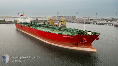
ADVANTAGE LOVE
Tanker
Current Trip
| Time Travelled | 26 days |
|---|---|
| Remaining Time | --- |
| Distance Travelled | 7698.55 nm |
| Remaining Distance | --- |
| AVG Speed | 12.3 Knots |
| MAX Speed | 15.7 Knots |
| AVG Wind | 11.9 knots |
| MAX Wind | 29 knots |
| MIN Temp | 15.6°C / 60.08°F |
| MAX Temp | 28.6°C / 83.48°F |
| Draught | 12.8 m |
| Position Received | 4 d ago |
Current Position
| Longitude | --- |
|---|---|
| Latitude | --- |
| Status | Under way using engine |
| Speed | 10.4 Knots |
| Course | 47.3° |
| Area | South China Sea |
| Station | T-AIS |
| Position Received | 4 d ago |
Info
Information
The current position of ADVANTAGE LOVE is in South China Sea with coordinates 1.33798° / 104.39216° as reported on 2025-12-30 14:56 by AIS to our vessel tracker app. The vessel's current speed is 10.4 Knots and is heading at the port of YEOSU. The estimated time of arrival as calculated by MyShipTracking vessel tracking app is 2026-01-07 12:00 LT
The vessel ADVANTAGE LOVE (IMO: 9708552, MMSI: 538006074) is a Tanker It's sailing under the flag of [MH] Marshall Is.
In this page you can find informations about the vessels current position, last detected port calls, and current voyage information. If the vessels is not in coverage by AIS you will find the latest position.
The current position of ADVANTAGE LOVE is detected by our AIS receivers and we are not responsible for the reliability of the data. The last position was recorded while the vessel was in Coverage by the Ais receivers of our vessel tracking app.
The current draught of ADVANTAGE LOVE as reported by AIS is 12.8 meters
Weather
| Temperature | 24.3°C / 75.74°F |
|---|---|
| Wind Speed | 24 knots |
| Direction | 49° NE |
| Pressure | 1017 hPa |
| Humidity | 73.1 % |
| Cloud Coverage | 100 % |
Featured Company
Last Port Calls
| Port | Arrival | Departure | Time In Port |
|---|---|---|---|
| 2025-12-13 12:56 | 2025-12-13 21:49 | 8 h | |
| 2025-12-06 16:10 | 2025-12-08 07:35 | 1 d | |
| 2025-11-23 08:57 | 2025-11-25 17:40 | 2 d | |
| 2025-11-14 08:47 | 2025-11-14 18:16 | 9 h | |
| 2025-11-11 04:44 | 2025-11-12 05:16 | 1 d | |
| 2025-11-08 06:18 | 2025-11-08 15:30 | 9 h |
Most Visited Ports (Last year)
| Port | Arrivals | |
|---|---|---|
| 4 | ||
| 2 | ||
| 1 | ||
| 1 | ||
| 1 | ||
| 1 |
Last Trips
| Origin | Departure | Destination | Arrival | Distance | |
|---|---|---|---|---|---|
| 2025-12-08 07:35 | 2025-12-13 12:56 | 1372.44 nm | |||
| 2025-11-25 17:40 | 2025-12-06 16:10 | 1106.25 nm | |||
| 2025-11-12 05:16 | 2025-11-23 08:57 | 2041.98 nm | |||
| 2025-11-12 05:16 | 2025-11-14 08:47 | 510.57 nm | |||
| 2025-10-07 14:00 | 2025-11-11 04:44 | 6419.47 nm | |||
| 2025-10-07 14:00 | 2025-11-08 06:18 | 5759.38 nm |
Events
| Time | Event | Details | Position / Dest | Info |
|---|---|---|---|---|
| 2025-12-30 14:57 | Status Changed | Default Under way using engine |
1.33997 / 104.39428
SG SIN>> KR YOS
|
Speed: 10.4 kn Course: 47.3° |
| 2025-12-30 14:56 | OUT of Coverage |
1.33798 / 104.39216
South China Sea
SG SIN>> KR YOS
|
Speed: 10.4 kn Course: 47.3° |
|
| 2025-12-30 14:46 | Detected in Sea | Malaysian part of the South China Sea |
1.32026 / 104.37321
South China Sea
SG SIN>> KR YOS
|
Speed: 9.2 kn Course: 47.6° |
| 2025-12-30 14:46 | Status Changed | Under way using engine Default |
1.32026 / 104.37321
SG SIN>> KR YOS
|
Speed: 8.7 kn Course: 48° |
| 2025-12-30 14:40 | Status Changed | Default Under way using engine |
1.30950 / 104.36174
SG SIN>> KR YOS
|
Speed: 6 kn Course: 46.4° |
| 2025-12-30 14:19 | Status Changed | Under way using engine Default |
1.28493 / 104.33724
SG SIN>> KR YOS
|
Speed: 6.1 kn Course: 52° |
| 2025-12-30 14:16 | Status Changed | Default Under way using engine |
1.28277 / 104.33452
SG SIN>> KR YOS
|
Speed: 8 kn Course: 85° |
| 2025-12-30 13:40 | Change Sea Area | Malaysian part of the Singapore Strait Indonesian part of the Singapore Strait |
1.25787 / 104.23568
Singapore Strait
SG SIN>> KR YOS
|
Speed: 11.4 kn Course: 82.9° |
| 2025-12-30 11:53 | Change Sea Area | Indonesian part of the Singapore Strait Singaporean part of the Singapore Strait |
1.24148 / 103.97331
Singapore Strait
SG SIN>> KR YOS
|
Speed: 8 kn Course: 86.6° |
| 2025-12-30 11:29 | START Moving | 4.95 nm, South West of TANAH MERAH |
1.26625 / 103.94929
SG SIN>> KR YOS
|
Speed: 3.1 kn Course: 145° |