
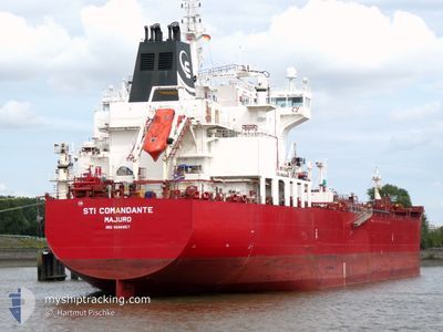
STI COMANDANTE
Oil/Chemical Tanker
Current Trip
| Time Travelled | 1 day |
|---|---|
| Remaining Time | 2 h, 21 mins |
| Distance Travelled | 375.17 nm |
| Remaining Distance | 33.57 nm |
| AVG Speed | 11 Knots |
| MAX Speed | 13.4 Knots |
| AVG Wind | 19.9 knots |
| MAX Wind | 28.7 knots |
| MIN Temp | 6.9°C / 44.42°F |
| MAX Temp | 10.1°C / 50.18°F |
| Draught | 11.5 m |
| Position Received | 3 m ago |
Current Position
| Longitude | --- |
|---|---|
| Latitude | --- |
| Status | Under way using engine |
| Speed | 12.5 Knots |
| Course | 18.2° |
| Area | North Sea |
| Station | T-AIS |
| Position Received | 3 m ago |
Info
Information
The current position of STI COMANDANTE is in North Sea with coordinates 60.55840° / 4.43357° as reported on 2025-12-15 13:08 by AIS to our vessel tracker app. The vessel's current speed is 12.5 Knots and is heading at the port of MONGSTAD . The estimated time of arrival as calculated by MyShipTracking vessel tracking app is 2025-12-15 16:32 LT
The vessel STI COMANDANTE (IMO: 9686857, MMSI: 538005397) is a Oil/Chemical Tanker that was built in 2014 ( 11 years old ). It's sailing under the flag of [MH] Marshall Is.
In this page you can find informations about the vessels current position, last detected port calls, and current voyage information. If the vessels is not in coverage by AIS you will find the latest position.
The current position of STI COMANDANTE is detected by our AIS receivers and we are not responsible for the reliability of the data. The last position was recorded while the vessel was in Coverage by the Ais receivers of our vessel tracking app.
The current draught of STI COMANDANTE as reported by AIS is 11.5 meters
Weather
| Temperature | 9.6°C / 49.28°F |
|---|---|
| Wind Speed | 8 knots |
| Direction | 229° SW |
| Pressure | 1000.4 hPa |
| Humidity | 82.5 % |
| Cloud Coverage | 100 % |
Featured Company
Last Port Calls
| Port | Arrival | Departure | Time In Port |
|---|---|---|---|
| 2025-12-12 17:26 | 2025-12-14 05:16 | 1 d | |
| 2025-12-08 22:57 | 2025-12-11 07:29 | 2 d | |
| 2025-12-06 03:28 | 2025-12-07 14:31 | 1 d | |
| 2025-12-01 06:24 | 2025-12-04 09:48 | 3 d | |
| 2025-11-25 16:17 | 2025-11-28 12:07 | 2 d | |
| 2025-11-20 00:33 | 2025-11-22 02:39 | 2 d | |
| 2025-11-11 22:12 | 2025-11-18 03:20 | 6 d | |
| 2025-10-31 23:20 | 2025-11-02 13:10 | 1 d | |
| 2025-10-21 16:39 | 2025-10-23 13:06 | 1 d | |
| 2025-10-12 13:30 | 2025-10-13 13:22 | 23 h |
Last Trips
| Origin | Departure | Destination | Arrival | Distance | |
|---|---|---|---|---|---|
| 2025-12-11 07:29 | 2025-12-12 17:26 | 420.24 nm | |||
| 2025-12-07 14:31 | 2025-12-08 22:57 | 409.08 nm | |||
| 2025-12-04 09:48 | 2025-12-06 03:28 | 550.51 nm | |||
| 2025-11-28 12:07 | 2025-12-01 06:24 | 147.52 nm | |||
| 2025-11-22 02:39 | 2025-11-25 16:17 | 77.17 nm | |||
| 2025-11-18 03:20 | 2025-11-20 00:33 | 250.46 nm | |||
| 2025-11-02 13:10 | 2025-11-11 22:12 | 283.55 nm | |||
| 2025-10-23 13:06 | 2025-10-31 23:20 | 877.37 nm | |||
| 2025-10-13 13:22 | 2025-10-21 16:39 | 1825.36 nm | |||
| 2025-10-10 04:35 | 2025-10-12 13:30 | 6.73 nm |
Events
| Time | Event | Details | Position / Dest | Info |
|---|---|---|---|---|
| 2025-12-14 18:29 | Change Sea Area | Norwegian part of the North Sea Norwegian part of the Skaggerak |
57.77980 / 7.39231
North Sea
SEGOT=>NOMON
|
Speed: 11.1 kn Course: 269.8° |
| 2025-12-14 13:20 | Change Sea Area | Norwegian part of the Skaggerak Danish part of the Skaggerak |
57.82066 / 9.08222
Skaggerak
SEGOT=>NOMON
|
Speed: 9.8 kn Course: 280.4° |
| 2025-12-14 12:19 | Status Changed | Under way using engine Default |
57.82347 / 9.38676
SEGOT=>NOMON
|
Speed: 9.3 kn Course: 266° |
| 2025-12-14 12:17 | Status Changed | Default Under way using engine |
57.82375 / 9.39411
SEGOT=>NOMON
|
Speed: 9.1 kn Course: 266.6° |
| 2025-12-14 11:28 | Status Changed | Under way using engine Default |
57.83568 / 9.63645
SEGOT=>NOMON
|
Speed: 9.6 kn Course: 263° |
| 2025-12-14 11:21 | Status Changed | Default Under way using engine |
57.83791 / 9.67164
SEGOT=>NOMON
|
Speed: 9.8 kn Course: 263.3° |
| 2025-12-14 11:20 | Status Changed | Under way using engine Default |
57.83833 / 9.67833
SEGOT=>NOMON
|
Speed: 9.7 kn Course: 262° |
| 2025-12-14 11:17 | Status Changed | Default Under way using engine |
57.83923 / 9.69185
SEGOT=>NOMON
|
Speed: 9.8 kn Course: 262.5° |
| 2025-12-14 11:07 | Status Changed | Under way using engine Default |
57.84219 / 9.74200
SEGOT=>NOMON
|
Speed: 9.9 kn Course: 266° |
| 2025-12-14 11:05 | Status Changed | Default Under way using engine |
57.84263 / 9.75242
SEGOT=>NOMON
|
Speed: 9.9 kn Course: 265.2° |