
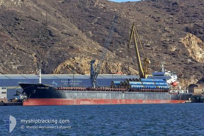
STAR II
Bulk Carrier
Current Trip
| Time Travelled | 3 days |
|---|---|
| Remaining Time | --- |
| Distance Travelled | 647.41 nm |
| Remaining Distance | --- |
| AVG Speed | 9.8 Knots |
| MAX Speed | 10.9 Knots |
| AVG Wind | 14.3 knots |
| MAX Wind | 25 knots |
| MIN Temp | 8.1°C / 46.58°F |
| MAX Temp | 14.3°C / 57.74°F |
| Draught | 5.2 m |
| Position Received | 10 h, 51 m ago |
Current Position
| Longitude | --- |
|---|---|
| Latitude | --- |
| Status | Under way using engine |
| Speed | 10.6 Knots |
| Course | 134.8° |
| Area | Ionian Sea |
| Station | T-AIS |
| Position Received | 10 h, 51 m ago |
Info
Information
The current position of STAR II is in Ionian Sea with coordinates 37.19754° / 20.81023° as reported on 2025-03-04 17:04 by AIS to our vessel tracker app. The vessel's current speed is 10.6 Knots and is heading at the port of CONSTANTA. The estimated time of arrival as calculated by MyShipTracking vessel tracking app is 2025-03-07 15:00 LT
The vessel STAR II (IMO: 9476068, MMSI: 636021503) is a Bulk Carrier that was built in 2007 ( 18 years old ). It's sailing under the flag of [LR] Liberia.
In this page you can find informations about the vessels current position, last detected port calls, and current voyage information. If the vessels is not in coverage by AIS you will find the latest position.
The current position of STAR II is detected by our AIS receivers and we are not responsible for the reliability of the data. The last position was recorded while the vessel was in Coverage by the Ais receivers of our vessel tracking app.
The current draught of STAR II as reported by AIS is 5.2 meters
Weather
| Temperature | 11.7°C / 53.06°F |
|---|---|
| Wind Speed | 2 knots |
| Direction | 38° NE |
| Pressure | 1022.2 hPa |
| Humidity | 40.5 % |
| Cloud Coverage | --- |
Featured Company
Last Port Calls
| Port | Arrival | Departure | Time In Port |
|---|---|---|---|
| 2025-02-28 17:31 | 2025-03-02 00:22 | 1 d | |
| 2025-02-13 07:38 | 2025-02-15 19:52 | 2 d | |
| 2025-01-15 21:55 | 2025-01-19 12:01 | 3 d |
Most Visited Ports (Last year)
| Port | Arrivals | |
|---|---|---|
| 13 | ||
| 5 | ||
| 4 | ||
| 3 | ||
| 3 | ||
| 2 |
Last Trips
| Origin | Departure | Destination | Arrival | Distance | |
|---|---|---|---|---|---|
| 2025-01-19 12:01 | 2025-02-13 07:38 | 1105.21 nm | |||
| 2024-12-27 19:16 | 2025-01-15 21:55 | 919.70 nm |
Events
| Time | Event | Details | Position / Dest | Info |
|---|---|---|---|---|
| 2025-03-04 17:34 | Status Changed | Default Under way using engine |
37.13734 / 20.88974
RO CND
|
Speed: 10.6 kn Course: 134.8° |
| 2025-03-04 17:04 | OUT of Coverage |
37.19754 / 20.81023
Ionian Sea
RO CND
|
Speed: 10.6 kn Course: 134.8° |
|
| 2025-03-04 08:23 | Detected in Sea | Greek part of the Ionian Sea |
38.47591 / 19.95276
Ionian Sea
RO CND
|
Speed: 9.3 kn Course: 154.3° |
| 2025-03-04 08:23 | Status Changed | Under way using engine Default |
38.47591 / 19.95276
RO CND
|
Speed: 9.2 kn Course: 155° |
| 2025-03-04 08:14 | IN Coverage |
38.47591 / 19.95276
Ionian Sea
RO CND
|
Speed: 9.3 kn Course: 154.3° |
|
| 2025-03-03 20:09 | Status Changed | Default Under way using engine |
40.18813 / 18.84607
RO CND
|
Speed: 10.1 kn Course: 140.4° |
| 2025-03-03 20:01 | OUT of Coverage |
40.20607 / 18.82760
Adriatic Sea
RO CND
|
Speed: 10.1 kn Course: 140.4° |
|
| 2025-03-03 19:44 | Status Changed | Under way using engine Default |
40.24669 / 18.79004
RO CND
|
Speed: 10.4 kn Course: 147° |
| 2025-03-03 19:37 | Status Changed | Default Under way using engine |
40.26217 / 18.77749
RO CND
|
Speed: 10.1 kn Course: 148.4° |
| 2025-03-03 18:49 | Status Changed | Under way using engine Default |
40.37885 / 18.68420
RO CND
|
Speed: 10.1 kn Course: 145° |