
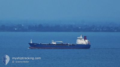
SRIWANGI
Oil/Chemical Tanker
Current Trip
| Time Travelled | 18 h, 20 mins |
|---|---|
| Remaining Time | 23 h, 48 mins |
| Distance Travelled | 174.16 nm |
| Remaining Distance | 234.86 nm |
| AVG Speed | 9.2 Knots |
| MAX Speed | 11.4 Knots |
| AVG Wind | 13 knots |
| MAX Wind | 15.3 knots |
| MIN Temp | 28.3°C / 82.94°F |
| MAX Temp | 31.2°C / 88.16°F |
| Draught | 7.7 m |
| Position Received | 16 h, 19 m ago |
Current Position
| Longitude | 103.48699° |
|---|---|
| Latitude | 1.22465° |
| Status | Under way using engine |
| Speed | 9.1 Knots |
| Course | 286.8° |
| Area | Singapore Strait |
| Station | T-AIS |
| Position Received | 16 h, 19 m ago |
Info
Information
The current position of SRIWANGI is in Singapore Strait with coordinates 1.22465° / 103.48699° as reported on 2024-07-26 17:58 by AIS to our vessel tracker app. The vessel's current speed is 9.1 Knots and is heading at the port of PENANG. The estimated time of arrival as calculated by MyShipTracking vessel tracking app is 2024-07-28 18:05 LT
The vessel SRIWANGI (IMO: 9313101, MMSI: 563167200) is a Oil/Chemical Tanker that was built in 2006 ( 18 years old ). It's sailing under the flag of [SG] Singapore.
In this page you can find informations about the vessels current position, last detected port calls, and current voyage information. If the vessels is not in coverage by AIS you will find the latest position.
The current position of SRIWANGI is detected by our AIS receivers and we are not responsible for the reliability of the data. The last position was recorded while the vessel was in Coverage by the Ais receivers of our vessel tracking app.
The current draught of SRIWANGI as reported by AIS is 7.7 meters
Weather
| Temperature | 30°C / 86°F |
|---|---|
| Wind Speed | 13 knots |
| Direction | 109° ESE |
| Pressure | 1005.7 hPa |
| Humidity | 76.7 % |
| Cloud Coverage | 100 % |
Featured Company
Last Port Calls
| Port | Arrival | Departure | Time In Port |
|---|---|---|---|
| 2024-07-24 15:24 | 2024-07-26 23:57 | 2 d | |
| 2024-07-17 23:38 | 2024-07-19 16:14 | 1 d | |
| 2024-07-14 23:07 | 2024-07-16 03:03 | 1 d | |
| 2024-07-09 23:50 | 2024-07-12 19:02 | 2 d | |
| 2024-07-07 10:58 | 2024-07-08 02:31 | 15 h | |
| 2024-07-06 07:37 | 2024-07-07 10:09 | 1 d | |
| 2024-07-02 11:09 | 2024-07-04 06:10 | 1 d | |
| 2024-06-28 04:35 | 2024-06-29 21:05 | 1 d | |
| 2024-06-21 01:49 | 2024-06-26 02:37 | 5 d | |
| 2024-06-17 04:44 | 2024-06-19 21:49 | 2 d |
Most Visited Ports (Last year)
| Port | Arrivals | |
|---|---|---|
| 23 | ||
| 17 | ||
| 4 | ||
| 4 | ||
| 3 | ||
| 3 |
Last Trips
| Origin | Departure | Destination | Arrival | Distance | |
|---|---|---|---|---|---|
| 2024-07-19 16:14 | 2024-07-24 15:24 | 418.14 nm | |||
| 2024-07-16 03:03 | 2024-07-17 23:38 | 396.32 nm | |||
| 2024-07-12 19:02 | 2024-07-14 23:07 | 410.89 nm | |||
| 2024-07-08 02:31 | 2024-07-09 23:50 | 395.58 nm | |||
| 2024-07-07 10:09 | 2024-07-07 10:58 | 3.14 nm | |||
| 2024-07-04 06:10 | 2024-07-06 07:37 | 405.55 nm | |||
| 2024-06-29 21:05 | 2024-07-02 11:09 | 409.32 nm | |||
| 2024-06-26 02:37 | 2024-06-28 04:35 | 406.28 nm | |||
| 2024-06-19 21:49 | 2024-06-21 01:49 | 254.42 nm | |||
| 2024-06-14 06:13 | 2024-06-17 04:44 | 271.69 nm |
Events
| Time | Event | Details | Position / Dest | Info |
|---|---|---|---|---|
| 2024-07-26 18:03 | Status Changed | Default Under way using engine |
1.22836 / 103.47447
MY_PEN
|
Speed: 9.1 kn Course: 286.8° |
| 2024-07-26 17:58 | OUT of Coverage |
1.22465 / 103.48699
Singapore Strait
MY_PEN
|
Speed: 9.1 kn Course: 286.8° |
|
| 2024-07-26 17:49 | Status Changed | Under way using engine Default |
1.21840 / 103.50925
MY_PEN
|
Speed: 9.3 kn Course: 286° |
| 2024-07-26 17:43 | Status Changed | Default Under way using engine |
1.21441 / 103.52372
MY_PEN
|
Speed: 9.4 kn Course: 281.9° |
| 2024-07-26 17:20 | Change Sea Area | Malaysian part of the Singapore Strait Indonesian part of the Singapore Strait |
1.20036 / 103.58433
Singapore Strait
MY_PEN
|
Speed: 9.9 kn Course: 279.1° |
| 2024-07-26 16:59 | Change Sea Area | Indonesian part of the Singapore Strait Singaporean part of the Singapore Strait |
1.19933 / 103.64208
Singapore Strait
MY_PEN
|
Speed: 9.5 kn Course: 233.8° |
| 2024-07-26 16:01 | START Moving | 2.69 nm, North of BUKOM ISLAND |
1.27996 / 103.74097
MY_PEN
|
Speed: 3.2 kn Course: 135° |
| 2024-07-26 15:57 | PORT DEPARTURE |
|
1.28120 / 103.73887
MY_PEN
|
Speed: 1.9 kn Course: 105° |
| 2024-07-26 15:50 | Draught Changed | 7.7 6.5 |
1.27894 / 103.73815
[SG] JURONG ISLAND
|
Speed: 0.4 kn Course: 319° |
| 2024-07-26 15:43 | Status Changed | Under way using engine Default |
1.27895 / 103.73810
[SG] JURONG ISLAND
|
Speed: Course: 312° |