
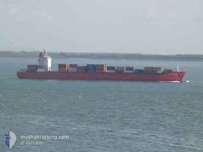
SPIRIT OF SYDNEY
Container Ship
Current Trip
| Trip Time | 18 h, 19 mins |
|---|---|
| Trip Distance | 296.05 nm |
| AVG Speed | 15.6 Knots |
| MAX Speed | 17.8 Knots |
| Draught | 11.3 m |
| AVG Wind | 7.7 knots |
| MAX Wind | 11 knots |
| MIN Temp | 25.8°C / 78.44°F |
| MAX Temp | 27.5°C / 81.5°F |
| Position Received | 15 d ago |
Current Position
| Longitude | --- |
|---|---|
| Latitude | --- |
| Status | Under way using engine |
| Speed | 17.2 Knots |
| Course | 263.6° |
| Area | North Atlantic Ocean |
| Station | T-AIS |
| Position Received | 15 d ago |
Info
Information
The current position of SPIRIT OF SYDNEY is in North Atlantic Ocean with coordinates 35.83838° / -6.04299° as reported on 2025-02-16 23:51 by AIS to our vessel tracker app. The vessel's current speed is 17.2 Knots and is currently inside the port of LUANDA.
The vessel SPIRIT OF SYDNEY (IMO: 9391672, MMSI: 232013525) is a Container Ship that was built in 2007 ( 18 years old ). It's sailing under the flag of [GB] United Kingdom.
In this page you can find informations about the vessels current position, last detected port calls, and current voyage information. If the vessels is not in coverage by AIS you will find the latest position.
The current position of SPIRIT OF SYDNEY is detected by our AIS receivers and we are not responsible for the reliability of the data. The last position was recorded while the vessel was in Coverage by the Ais receivers of our vessel tracking app.
The current draught of SPIRIT OF SYDNEY as reported by AIS is 11.3 meters
Weather
| Temperature | 26.5°C / 79.7°F |
|---|---|
| Wind Speed | 5 knots |
| Direction | 253° WSW |
| Pressure | 1007.7 hPa |
| Humidity | 79.1 % |
| Cloud Coverage | 94 % |
Featured Company
Last Port Calls
| Port | Arrival | Departure | Time In Port |
|---|---|---|---|
| 2025-03-04 08:32 | |||
| 2025-03-02 05:52 | 2025-03-03 14:13 | 1 d | |
| 2025-02-10 21:46 | 2025-02-11 20:26 | 22 h | |
| 2025-02-07 08:13 | 2025-02-08 08:19 | 1 d | |
| 2025-02-05 03:13 | 2025-02-06 09:32 | 1 d | |
| 2025-02-02 16:00 | 2025-02-02 22:48 | 6 h | |
| 2025-01-16 05:08 | 2025-01-17 19:47 | 1 d | |
| 2025-01-13 03:48 | 2025-01-14 13:28 | 1 d |
Last Trips
| Origin | Departure | Destination | Arrival | Distance | |
|---|---|---|---|---|---|
| 2025-03-03 15:13 | 2025-03-04 09:32 | 296.05 nm | |||
| 2025-02-11 20:26 | 2025-03-02 06:52 | 4479.99 nm | |||
| 2025-02-08 09:19 | 2025-02-10 21:46 | 977.21 nm | |||
| 2025-02-06 10:32 | 2025-02-07 09:13 | 302.42 nm | |||
| 2025-02-02 23:48 | 2025-02-05 04:13 | 136.80 nm | |||
| 2025-01-17 20:47 | 2025-02-02 17:00 | 5500.07 nm | |||
| 2025-01-14 14:28 | 2025-01-16 06:08 | 314.09 nm | |||
| 2024-12-23 13:43 | 2025-01-13 04:48 | 5370.07 nm |
Events
| Time | Event | Details | Position / Dest | Info |
|---|---|---|---|---|
| 2025-03-04 09:23 | STOP Moving |
-8.78626 / 13.27186
[AO] LUANDA
|
Speed: Course: 45° |
|
| 2025-03-04 08:32 | PORT ARRIVAL |
|
-8.76892 / 13.26983
[AO] LUANDA
|
Speed: 5.6 kn Course: 220° |
| 2025-03-03 14:13 | PORT DEPARTURE |
|
-4.77105 / 11.83153
MAPTM
|
Speed: 4.1 kn Course: 340° |
| 2025-03-03 14:09 | START Moving |
-4.77547 / 11.83372
[CG] POINTE NOIRE
|
Speed: 4.1 kn Course: 340° |
|
| 2025-03-02 06:21 | STOP Moving |
-4.77857 / 11.82757
[CG] POINTE NOIRE
|
Speed: Course: 269° |
|
| 2025-03-02 05:52 | PORT ARRIVAL |
|
-4.77533 / 11.83321
[CG] POINTE NOIRE
|
Speed: 5 kn Course: 140° |
| 2025-02-27 13:25 | START Moving | 1.06 nm, South West of TEMA |
5.61485 / .00439
MAPTM
|
Speed: 7.8 kn Course: 84° |
| 2025-02-26 11:09 | STOP Moving | 1.78 nm, South West of TEMA |
5.61376 / -.01101
MAPTM
|
Speed: Course: 244° |
| 2025-02-26 09:26 | START Moving | 6.35 nm, South East of TEMA |
5.54215 / .07461
MAPTM
|
Speed: 5.2 kn Course: 5° |
| 2025-02-25 12:10 | STOP Moving | 6.39 nm, South East of TEMA |
5.54314 / .07717
MAPTM
|
Speed: 0.2 kn Course: 217° |