
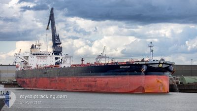
SPEEDWAY
Tanker
Current Trip
| Time Travelled | 2 days |
|---|---|
| Remaining Time | 22 h, 55 mins |
| Distance Travelled | 679.90 nm |
| Remaining Distance | 220.37 nm |
| AVG Speed | 10.7 Knots |
| MAX Speed | 12.8 Knots |
| AVG Wind | 7.6 knots |
| MAX Wind | 17.8 knots |
| MIN Temp | 9.5°C / 49.1°F |
| MAX Temp | 15.2°C / 59.36°F |
| Draught | 9.3 m |
| Position Received | 1 h, 0 m ago |
Current Position
| Longitude | --- |
|---|---|
| Latitude | --- |
| Status | Under way using engine |
| Speed | 9.2 Knots |
| Course | 123.7° |
| Area | Ionian Sea |
| Station | T-AIS |
| Position Received | 1 h, 0 m ago |
Info
Information
The current position of SPEEDWAY is in Ionian Sea with coordinates 36.81886° / 20.78521° as reported on 2025-03-03 02:13 by AIS to our vessel tracker app. The vessel's current speed is 9.2 Knots and is heading at the port of PIRAEUS. The estimated time of arrival as calculated by MyShipTracking vessel tracking app is 2025-03-04 04:09 LT
The vessel SPEEDWAY (IMO: 9749506, MMSI: 241497000) is a Tanker It's sailing under the flag of [GR] Greece.
In this page you can find informations about the vessels current position, last detected port calls, and current voyage information. If the vessels is not in coverage by AIS you will find the latest position.
The current position of SPEEDWAY is detected by our AIS receivers and we are not responsible for the reliability of the data. The last position was recorded while the vessel was in Coverage by the Ais receivers of our vessel tracking app.
The current draught of SPEEDWAY as reported by AIS is 9.3 meters
Weather
| Temperature | 14.8°C / 58.64°F |
|---|---|
| Wind Speed | 5 knots |
| Direction | 63° ENE |
| Pressure | 1018.3 hPa |
| Humidity | 75.4 % |
| Cloud Coverage | 98 % |
Featured Company
Most Visited Ports (Last year)
| Port | Arrivals | |
|---|---|---|
| 2 | ||
| 1 | ||
| 1 | ||
| 1 | ||
| 1 | ||
| 1 |
Events
| Time | Event | Details | Position / Dest | Info |
|---|---|---|---|---|
| 2025-03-03 02:18 | Status Changed | Default Under way using engine |
36.81266 / 20.79660
GRPIR
|
Speed: 9.2 kn Course: 123.7° |
| 2025-03-03 01:38 | Status Changed | Under way using engine Default |
36.87067 / 20.68957
GRPIR
|
Speed: 9.2 kn Course: 122° |
| 2025-03-03 00:52 | Status Changed | Default Under way using engine |
36.93659 / 20.56632
GRPIR
|
Speed: 9.3 kn Course: 126° |
| 2025-03-03 00:26 | Status Changed | Under way using engine Default |
36.97505 / 20.49732
GRPIR
|
Speed: 9.3 kn Course: 125° |
| 2025-03-03 00:08 | Status Changed | Default Under way using engine |
37.00135 / 20.44954
GRPIR
|
Speed: 9.2 kn Course: 124.9° |
| 2025-03-02 12:52 | Status Changed | Under way using engine Default |
38.51365 / 19.56681
GRPIR
|
Speed: 8.7 kn Course: 159° |
| 2025-03-02 12:47 | Status Changed | Default Under way using engine |
38.52523 / 19.56110
GRPIR
|
Speed: 8.7 kn Course: 158.7° |
| 2025-03-02 12:15 | Change Sea Area | Greek part of the Ionian Sea Italian part of the Adriatic Sea |
38.59714 / 19.52475
Ionian Sea
GRPIR
|
Speed: 8.4 kn Course: 156.4° |
| 2025-03-02 12:15 | Status Changed | Under way using engine Default |
38.59714 / 19.52475
GRPIR
|
Speed: 8.4 kn Course: 157° |
| 2025-03-02 11:58 | IN Coverage |
38.59714 / 19.52475
Ionian Sea
GRPIR
|
Speed: 8.4 kn Course: 156.4° |