
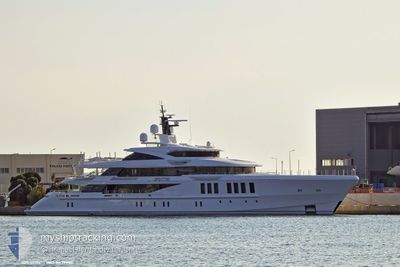
SPECTRE
Pleasure Craft
Current Trip
| Trip Time | --- |
|---|---|
| Trip Distance | --- |
| AVG Speed | --- |
| MAX Speed | --- |
| Draught | --- |
| AVG Wind | --- |
| MAX Wind | --- |
| MIN Temp | --- |
| MAX Temp | --- |
| Position Received | 19 h, 18 m ago |
Current Position
| Longitude | --- |
|---|---|
| Latitude | --- |
| Status | Moored |
| Speed | |
| Course | 251° |
| Area | Caribbean Sea |
| Station | T-AIS |
| Position Received | 19 h, 18 m ago |
Info
Information
The current position of SPECTRE is in Caribbean Sea with coordinates 18.39762° / -68.90209° as reported on 2025-12-09 16:33 by AIS to our vessel tracker app. The vessel's current speed is 0 Knots and is currently inside the port of CASA DE CAMPO.
The vessel SPECTRE (IMO: 9837999, MMSI: 339794000) is a Pleasure Craft It's sailing under the flag of [JM] Jamaica.
In this page you can find informations about the vessels current position, last detected port calls, and current voyage information. If the vessels is not in coverage by AIS you will find the latest position.
The current position of SPECTRE is detected by our AIS receivers and we are not responsible for the reliability of the data. The last position was recorded while the vessel was in Coverage by the Ais receivers of our vessel tracking app.
The current draught of SPECTRE as reported by AIS is 3.6 meters
Weather
| Temperature | 27.9°C / 82.22°F |
|---|---|
| Wind Speed | 5 knots |
| Direction | 104° ESE |
| Pressure | 1015.3 hPa |
| Humidity | 65.2 % |
| Cloud Coverage | 5 % |
Featured Company
Last Port Calls
| Port | Arrival | Departure | Time In Port |
|---|---|---|---|
| 2025-11-13 10:38 | 2025-11-15 19:44 | 2 d | |
| 2025-11-10 11:39 | 2025-11-13 08:11 | 2 d | |
| 2025-10-09 20:37 | 2025-11-10 08:22 | ||
| 2025-10-08 10:01 |
Most Visited Ports (Last year)
| Port | Arrivals | |
|---|---|---|
| 5 | ||
| 2 | ||
| 2 | ||
| 2 | ||
| 1 | ||
| 1 |
Events
| Time | Event | Details | Position / Dest | Info |
|---|---|---|---|---|
| 2025-12-09 16:33 | OUT of Coverage |
18.39762 / -68.90209
Caribbean Sea
[DO] CASA DE CAMPO
|
Speed: Course: 53.6° |
|
| 2025-12-09 13:24 | IN Coverage |
18.39761 / -68.90208
Caribbean Sea
[DO] CASA DE CAMPO
|
Speed: Course: 53.6° |
|
| 2025-12-08 15:09 | OUT of Coverage |
18.39763 / -68.90206
Caribbean Sea
[DO] CASA DE CAMPO
|
Speed: Course: 53.6° |
|
| 2025-12-08 13:06 | Destination Changed | ST.KITTS LA ROMANA |
18.39762 / -68.90208
[DO] CASA DE CAMPO
|
Speed: Course: 251° |
| 2025-12-08 12:33 | IN Coverage |
18.39761 / -68.90207
Caribbean Sea
[DO] CASA DE CAMPO
|
Speed: Course: 53.6° |
|
| 2025-12-08 06:06 | OUT of Coverage |
18.39760 / -68.90209
Caribbean Sea
[DO] CASA DE CAMPO
|
Speed: Course: 53° |
|
| 2025-12-08 04:30 | IN Coverage |
18.39762 / -68.90210
Caribbean Sea
[DO] CASA DE CAMPO
|
Speed: Course: 53° |
|
| 2025-12-06 09:24 | OUT of Coverage |
18.30143 / -67.88985
Caribbean Sea
LA ROMANA
|
Speed: 15.6 kn Course: 250.2° |
|
| 2025-12-06 07:58 | Change Sea Area | Puerto Rican part of the Caribbean Sea Puerto Rican part of the North Atlantic Ocean |
18.41929 / -67.51179
Caribbean Sea
LA ROMANA
|
Speed: 16 kn Course: 251.4° |
| 2025-12-06 06:33 | Destination Changed | LA ROMANA PR SJU |
18.53401 / -67.14498
LA ROMANA
|
Speed: 15.8 kn Course: 254.7° |