
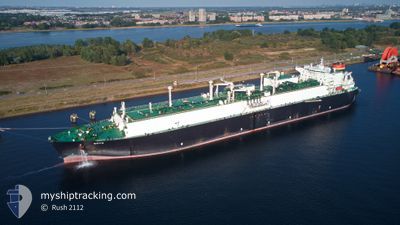
SOYO
Lng Tanker
Current Trip
A0 SZA
| Time Travelled | 13 days |
|---|---|
| Remaining Time | --- |
| Distance Travelled | 6292.75 nm |
| Remaining Distance | --- |
| AVG Speed | 18.8 Knots |
| MAX Speed | 21 Knots |
| AVG Wind | 13.2 knots |
| MAX Wind | 25.5 knots |
| MIN Temp | 16.9°C / 62.42°F |
| MAX Temp | 28.4°C / 83.12°F |
| Draught | 9.4 m |
| Position Received | 9 d ago |
Current Position
| Longitude | --- |
|---|---|
| Latitude | --- |
| Status | Under way using engine |
| Speed | 17.5 Knots |
| Course | 141.3° |
| Area | South Atlantic Ocean |
| Station | T-AIS |
| Position Received | 9 d ago |
Info
Information
The current position of SOYO is in South Atlantic Ocean with coordinates -34.53954° / 18.05984° as reported on 2025-12-26 15:28 by AIS to our vessel tracker app. The vessel's current speed is 17.5 Knots
The vessel SOYO (IMO: 9475208, MMSI: 311038500) is a Lng Tanker that was built in 2011 ( 15 years old ). It's sailing under the flag of [BS] Bahamas.
In this page you can find informations about the vessels current position, last detected port calls, and current voyage information. If the vessels is not in coverage by AIS you will find the latest position.
The current position of SOYO is detected by our AIS receivers and we are not responsible for the reliability of the data. The last position was recorded while the vessel was in Coverage by the Ais receivers of our vessel tracking app.
The current draught of SOYO as reported by AIS is 9.4 meters
Weather
| Temperature | 26°C / 78.8°F |
|---|---|
| Wind Speed | 14 knots |
| Direction | 27° NNE |
| Pressure | 1013.6 hPa |
| Humidity | 66.7 % |
| Cloud Coverage | 2 % |
Featured Company
Last Port Calls
| Port | Arrival | Departure | Time In Port |
|---|---|---|---|
| 2025-12-21 09:33 | 2025-12-22 14:41 | 1 d | |
| 2025-11-29 07:38 | 2025-11-30 12:40 | 1 d | |
| 2025-11-16 09:31 | 2025-11-17 16:48 | 1 d |
Most Visited Ports (Last year)
| Port | Arrivals | |
|---|---|---|
| 9 | ||
| 2 | ||
| 1 | ||
| 1 | ||
| 1 | ||
| 1 |
Last Trips
| Origin | Departure | Destination | Arrival | Distance | |
|---|---|---|---|---|---|
| 2025-11-30 12:40 | 2025-12-21 09:33 | 6911.20 nm | |||
| 2025-11-17 16:48 | 2025-11-29 07:38 | 4473.52 nm | |||
| 2025-10-30 02:28 | 2025-11-16 09:31 | 6834.02 nm |
Events
| Time | Event | Details | Position / Dest | Info |
|---|---|---|---|---|
| 2025-12-26 15:34 | Status Changed | Default Under way using engine |
-34.56039 / 18.08009
A0 SZA
|
Speed: 17.5 kn Course: 141.3° |
| 2025-12-26 15:28 | Change Sea Area | South African part of the South Atlantic Ocean Senegalese part of the North Atlantic Ocean |
-34.53954 / 18.05984
South Atlantic Ocean
|
Speed: 17.5 kn Course: 141.3° |
| 2025-12-26 15:28 | Status Changed | Under way using engine Default |
-34.53954 / 18.05984
A0 SZA
|
Speed: 17.4 kn Course: 141° |
| 2025-12-26 15:28 | OUT of Coverage |
-34.53954 / 18.05984
South Atlantic Ocean
|
Speed: 17.5 kn Course: 141.3° |
|
| 2025-12-26 15:11 | IN Coverage |
-34.53954 / 18.05984
South Atlantic Ocean
|
Speed: 17.5 kn Course: 141.3° |