
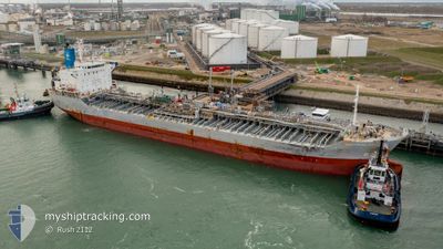
SOUTHERN OWL
Tanker C
Current Trip
| Trip Time | 3 days |
|---|---|
| Trip Distance | 952.16 nm |
| AVG Speed | 11.3 Knots |
| MAX Speed | 13.8 Knots |
| Draught | 9.4 m |
| AVG Wind | 15.8 knots |
| MAX Wind | 28 knots |
| MIN Temp | 19.6°C / 67.28°F |
| MAX Temp | 26.1°C / 78.98°F |
| Position Received | 9 h, 31 m ago |
Current Position
| Longitude | --- |
|---|---|
| Latitude | --- |
| Status | Under way using engine |
| Speed | 13.1 Knots |
| Course | 306.2° |
| Area | South Atlantic Ocean |
| Station | T-AIS |
| Position Received | 9 h, 31 m ago |
Info
Information
The current position of SOUTHERN OWL is in South Atlantic Ocean with coordinates -25.51676° / -48.38576° as reported on 2024-12-15 23:50 by AIS to our vessel tracker app. The vessel's current speed is 13.1 Knots and is currently inside the port of PARANAGUA.
The vessel SOUTHERN OWL (IMO: 9773143, MMSI: 563127200) is a Tanker C It's sailing under the flag of [SG] Singapore.
In this page you can find informations about the vessels current position, last detected port calls, and current voyage information. If the vessels is not in coverage by AIS you will find the latest position.
The current position of SOUTHERN OWL is detected by our AIS receivers and we are not responsible for the reliability of the data. The last position was recorded while the vessel was in Coverage by the Ais receivers of our vessel tracking app.
The current draught of SOUTHERN OWL as reported by AIS is 9.4 meters
Weather
| Temperature | 18.1°C / 64.58°F |
|---|---|
| Wind Speed | 5 knots |
| Direction | 289° WNW |
| Pressure | 1006.6 hPa |
| Humidity | 79.6 % |
| Cloud Coverage | --- |
Featured Company
Last Port Calls
| Port | Arrival | Departure | Time In Port |
|---|---|---|---|
| 2024-12-15 21:36 | |||
| 2024-12-10 17:21 | 2024-12-11 22:30 | 1 d | |
| 2024-12-05 00:32 | 2024-12-10 02:21 | 5 d | |
| 2024-12-02 02:32 | 2024-12-04 21:56 | 2 d | |
| 2024-11-10 04:45 | 2024-11-10 05:21 | 35 m | |
| 2024-11-05 12:08 | 2024-11-07 03:05 | 1 d | |
| 2024-10-25 09:31 | 2024-10-26 10:55 | 1 d | |
| 2024-10-16 11:56 | 2024-10-17 09:57 | 22 h | |
| 2024-10-02 11:52 | 2024-10-07 17:27 | 5 d |
Most Visited Ports (Last year)
| Port | Arrivals | |
|---|---|---|
| 6 | ||
| 5 | ||
| 5 | ||
| 5 | ||
| 4 | ||
| 3 |
Last Trips
| Origin | Departure | Destination | Arrival | Distance | |
|---|---|---|---|---|---|
| 2024-12-11 22:30 | 2024-12-15 21:36 | 952.16 nm | |||
| 2024-12-10 02:21 | 2024-12-10 17:21 | 149.88 nm | |||
| 2024-12-04 21:56 | 2024-12-05 00:32 | 14.01 nm | |||
| 2024-11-10 05:21 | 2024-12-02 02:32 | 1219.60 nm | |||
| 2024-11-07 03:05 | 2024-11-10 04:45 | 986.67 nm | |||
| 2024-10-26 10:55 | 2024-11-05 12:08 | 3213.98 nm | |||
| 2024-10-17 09:57 | 2024-10-25 09:31 | 350.71 nm | |||
| 2024-10-07 17:27 | 2024-10-16 11:56 | 1647.95 nm | |||
| 2024-09-26 22:08 | 2024-10-02 11:52 | 1666.11 nm |
Events
| Time | Event | Details | Position / Dest | Info |
|---|---|---|---|---|
| 2024-12-16 01:05 | STOP Moving |
-25.50056 / -48.53809
[BR] PARANAGUA
|
Speed: Course: 106° |
|
| 2024-12-16 00:36 | PORT ARRIVAL |
|
-25.49888 / -48.53056
[BR] PARANAGUA
|
Speed: 7.3 kn Course: 266° |
| 2024-12-15 23:57 | Status Changed | Default Under way using engine |
-25.50179 / -48.40987
BR PNG
|
Speed: 13.1 kn Course: 306.2° |
| 2024-12-15 23:50 | OUT of Coverage |
-25.51676 / -48.38576
South Atlantic Ocean
[BR] PARANAGUA
|
Speed: 13.1 kn Course: 306.2° |
|
| 2024-12-15 23:43 | Status Changed | Under way using engine Default |
-25.53304 / -48.36715
BR PNG
|
Speed: 12.9 kn Course: 317° |
| 2024-12-15 23:43 | IN Coverage |
-25.53304 / -48.36715
South Atlantic Ocean
|
Speed: 13.2 kn Course: 314.8° |
|
| 2024-12-15 22:34 | START Moving | 10.07 nm, South East of ILHA DO MEL |
-25.68559 / -48.20690
BR PNG
|
Speed: 8.3 kn Course: 359° |
| 2024-12-15 12:55 | STOP Moving | 10.66 nm, South East of ILHA DO MEL |
-25.69507 / -48.20324
BR PNG
|
Speed: 0.3 kn Course: 177° |
| 2024-12-15 10:13 | Status Changed | Default Under way using engine |
-26.17653 / -48.09661
BR PNG
|
Speed: 13.3 kn Course: 0.6° |
| 2024-12-15 10:12 | OUT of Coverage |
-26.18274 / -48.09663
South Atlantic Ocean
BR PNG
|
Speed: 13.3 kn Course: 0.6° |