
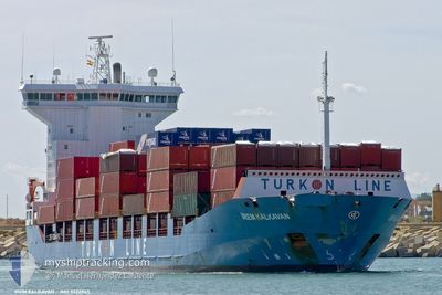
SOL PROGRESS
Container Ship
Current Trip
COLOMBO
| Time Travelled | 6 days |
|---|---|
| Remaining Time | --- |
| Distance Travelled | 1247.95 nm |
| Remaining Distance | --- |
| AVG Speed | 11.7 Knots |
| MAX Speed | 18.1 Knots |
| AVG Wind | 10.6 knots |
| MAX Wind | 21 knots |
| MIN Temp | 20.7°C / 69.26°F |
| MAX Temp | 29.9°C / 85.82°F |
| Draught | 6.3 m |
| Position Received | 8 d ago |
Current Position
| Longitude | --- |
|---|---|
| Latitude | --- |
| Status | Under way using engine |
| Speed | 10 Knots |
| Course | 347° |
| Area | Laccadive Sea |
| Station | T-AIS |
| Position Received | 8 d ago |
Info
Information
The current position of SOL PROGRESS is in Laccadive Sea with coordinates 6.53586° / 79.85261° as reported on 2025-12-15 06:16 by AIS to our vessel tracker app. The vessel's current speed is 10 Knots
The vessel SOL PROGRESS (IMO: 9322865, MMSI: 351018000) is a Container Ship that was built in 2006 ( 19 years old ). It's sailing under the flag of [PA] Panama.
In this page you can find informations about the vessels current position, last detected port calls, and current voyage information. If the vessels is not in coverage by AIS you will find the latest position.
The current position of SOL PROGRESS is detected by our AIS receivers and we are not responsible for the reliability of the data. The last position was recorded while the vessel was in Coverage by the Ais receivers of our vessel tracking app.
The current draught of SOL PROGRESS as reported by AIS is 6.3 meters
Weather
| Temperature | 27.1°C / 80.78°F |
|---|---|
| Wind Speed | 5 knots |
| Direction | 321° NW |
| Pressure | 1010.8 hPa |
| Humidity | 23.2 % |
| Cloud Coverage | 2 % |
Featured Company
Most Visited Ports (Last year)
| Port | Arrivals | |
|---|---|---|
| 23 | ||
| 2 | ||
| 1 |
Last Trips
Events
| Time | Event | Details | Position / Dest | Info |
|---|---|---|---|---|
| 2025-12-21 03:37 | STOP Moving |
20.93675 / 88.15592
COLOMBO
|
Speed: 0.1 kn Course: 80° |
|
| 2025-12-17 03:14 | PORT DEPARTURE |
|
6.96874 / 79.84718
COLOMBO
|
Speed: 6.6 kn Course: 334° |
| 2025-12-17 03:06 | START Moving |
6.95677 / 79.85232
[LK] COLOMBO
|
Speed: 5.4 kn Course: 357° |
|
| 2025-12-15 22:06 | STOP Moving |
6.95200 / 79.85338
[LK] COLOMBO
|
Speed: Course: 12° |
|
| 2025-12-15 21:38 | PORT ARRIVAL |
|
6.96299 / 79.84265
[LK] COLOMBO
|
Speed: 8.1 kn Course: 121° |
| 2025-12-15 20:38 | START Moving | 6.05 nm, North West of COLOMBO |
7.00992 / 79.75091
COLOMBO
|
Speed: 7.7 kn Course: 79° |
| 2025-12-15 20:26 | STOP Moving | 6.53 nm, North West of COLOMBO |
7.00917 / 79.74107
COLOMBO
|
Speed: 0.3 kn Course: 27° |
| 2025-12-15 10:06 | START Moving | 9.81 nm, South West of COLOMBO |
6.86056 / 79.70349
COLOMBO
|
Speed: 6.2 kn Course: 343° |
| 2025-12-15 09:02 | STOP Moving | 9.66 nm, South West of COLOMBO |
6.88251 / 79.69295
COLOMBO
|
Speed: 0.2 kn Course: 2° |
| 2025-12-15 06:16 | OUT of Coverage |
6.53586 / 79.85261
Laccadive Sea
|
Speed: 10 kn Course: 347° |