
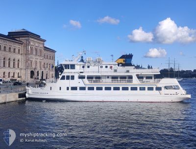
SODERARM
Passengers Ship
Current Trip
| Time Travelled | 17 h, 33 mins |
|---|---|
| Remaining Time | 28 mins |
| Distance Travelled | 28.06 nm |
| Remaining Distance | --- |
| AVG Speed | 9.5 Knots |
| MAX Speed | 11.6 Knots |
| AVG Wind | 14.5 knots |
| MAX Wind | 19.3 knots |
| MIN Temp | 4.3°C / 39.74°F |
| MAX Temp | 6.3°C / 43.34°F |
| Draught | 3 m |
| Position Received | 4 m ago |
Current Position
| Longitude | --- |
|---|---|
| Latitude | --- |
| Status | Default |
| Speed | 8.4 Knots |
| Course | 0.5° |
| Area | Baltic Sea |
| Station | T-AIS |
| Position Received | 4 m ago |
Info
Information
The current position of SODERARM is in Baltic Sea with coordinates 59.34419° / 18.89968° as reported on 2025-12-21 11:11 by AIS to our vessel tracker app. The vessel's current speed is 8.4 Knots and is heading at the port of STAVSNAS. The estimated time of arrival as calculated by MyShipTracking vessel tracking app is 2025-12-21 12:44 LT
The vessel SODERARM (IMO: 9284312, MMSI: 265538450) is a Passengers Ship that was built in 2004 ( 21 years old ). It's sailing under the flag of [SE] Sweden.
In this page you can find informations about the vessels current position, last detected port calls, and current voyage information. If the vessels is not in coverage by AIS you will find the latest position.
The current position of SODERARM is detected by our AIS receivers and we are not responsible for the reliability of the data. The last position was recorded while the vessel was in Coverage by the Ais receivers of our vessel tracking app.
The current draught of SODERARM as reported by AIS is 3 meters
Weather
| Temperature | 4.6°C / 40.28°F |
|---|---|
| Wind Speed | 17 knots |
| Direction | 304° NW |
| Pressure | 1017.9 hPa |
| Humidity | 81.1 % |
| Cloud Coverage | 2 % |
Featured Company
Last Port Calls
| Port | Arrival | Departure | Time In Port |
|---|---|---|---|
| 2025-12-20 18:41 | 2025-12-20 18:43 | 2 m | |
| 2025-12-20 13:24 | 2025-12-20 15:18 | 1 h | |
| 2025-12-20 08:25 | 2025-12-20 09:42 | 1 h | |
| 2025-12-19 17:57 | 2025-12-19 18:26 | 28 m | |
| 2025-12-19 14:26 | 2025-12-19 14:46 | 20 m | |
| 2025-12-19 08:12 | 2025-12-19 09:46 | 1 h | |
| 2025-12-19 07:43 | 2025-12-19 08:02 | 19 m | |
| 2025-12-18 17:49 | 2025-12-18 18:27 | 38 m | |
| 2025-12-18 08:20 | 2025-12-18 09:41 | 1 h | |
| 2025-12-18 08:01 | 2025-12-18 08:02 | 0 m |
Last Trips
| Origin | Departure | Destination | Arrival | Distance | |
|---|---|---|---|---|---|
| 2025-12-20 15:18 | 2025-12-20 18:41 | 22.14 nm | |||
| 2025-12-20 09:42 | 2025-12-20 13:24 | 23.94 nm | |||
| 2025-12-19 18:26 | 2025-12-20 08:25 | 15.13 nm | |||
| 2025-12-19 14:46 | 2025-12-19 17:57 | 20.97 nm | |||
| 2025-12-19 09:46 | 2025-12-19 14:26 | 22.25 nm | |||
| 2025-12-19 08:02 | 2025-12-19 08:12 | 1.52 nm | |||
| 2025-12-18 18:27 | 2025-12-19 07:43 | 22.41 nm | |||
| 2025-12-18 09:41 | 2025-12-18 17:49 | 43.53 nm | |||
| 2025-12-18 09:41 | 2025-12-18 08:20 | 43.53 nm | |||
| 2025-12-17 18:29 | 2025-12-18 08:01 | 15.04 nm |
Events
| Time | Event | Details | Position / Dest | Info |
|---|---|---|---|---|
| 2025-12-21 09:51 | START Moving | 0.83 nm, East of STAVSNAS |
59.28237 / 18.73181
|
Speed: 9.7 kn Course: 19.1° |
| 2025-12-21 09:47 | STOP Moving | 0.84 nm, East of STAVSNAS |
59.28028 / 18.73112
|
Speed: 0.2 kn Course: 118° |
| 2025-12-21 09:21 | START Moving | 0.7 nm, East of STAVSNAS |
59.28104 / 18.72667
|
Speed: 10.8 kn Course: 286.1° |
| 2025-12-21 09:16 | STOP Moving | 0.84 nm, East of STAVSNAS |
59.28028 / 18.73112
|
Speed: 0.3 kn Course: 118° |
| 2025-12-21 08:21 | START Moving | 0.73 nm, East of STAVSNAS |
59.28060 / 18.72752
|
Speed: 9.4 kn Course: 282.9° |
| 2025-12-21 08:18 | STOP Moving | 0.84 nm, East of STAVSNAS |
59.28030 / 18.73117
|
Speed: 0.2 kn Course: 124° |
| 2025-12-21 08:06 | START Moving | 2.08 nm, East of STAVSNAS |
59.29748 / 18.76820
|
Speed: 10.2 kn Course: 289.3° |
| 2025-12-21 08:05 | STOP Moving | 2.17 nm, East of STAVSNAS |
59.29650 / 18.77187
|
Speed: Course: 185° |
| 2025-12-21 07:53 | START Moving | 1.47 nm, South West of NOTTNAS |
59.30943 / 18.82853
|
Speed: 11.1 kn Course: 294.6° |
| 2025-12-21 07:46 | IN Coverage |
59.30503 / 18.85032
Baltic Sea
|
Speed: 6.7 kn Course: 248° |