
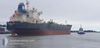
SEAWAYS STAR
Oil/Chemical Tanker
Current Trip
| Time Travelled | 33 days |
|---|---|
| Remaining Time | --- |
| Distance Travelled | 3658.88 nm |
| Remaining Distance | --- |
| AVG Speed | 12.9 Knots |
| MAX Speed | 16.4 Knots |
| AVG Wind | 8.3 knots |
| MAX Wind | 17.3 knots |
| MIN Temp | 13.9°C / 57.02°F |
| MAX Temp | 31.9°C / 89.42°F |
| Draught | 10.9 m |
| Position Received | 25 d ago |
Current Position
| Longitude | -79.49416° |
|---|---|
| Latitude | 8.85500° |
| Status | Under way using engine |
| Speed | 13.4 Knots |
| Course | 142.6° |
| Area | North Pacific Ocean |
| Station | T-AIS |
| Position Received | 25 d ago |
Info
Information
The current position of SEAWAYS STAR is in North Pacific Ocean with coordinates 8.85500° / -79.49416° as reported on 2024-04-26 00:35 by AIS to our vessel tracker app. The vessel's current speed is 13.4 Knots and is heading at the port of CRISTOBAL.
The vessel SEAWAYS STAR (IMO: 9337523, MMSI: 477047800) is a Oil/Chemical Tanker that was built in 2008 ( 16 years old ). It's sailing under the flag of [HK] Hong Kong.
In this page you can find informations about the vessels current position, last detected port calls, and current voyage information. If the vessels is not in coverage by AIS you will find the latest position.
The current position of SEAWAYS STAR is detected by our AIS receivers and we are not responsible for the reliability of the data. The last position was recorded while the vessel was in Coverage by the Ais receivers of our vessel tracking app.
The current draught of SEAWAYS STAR as reported by AIS is 10.9 meters
Weather
| Temperature | 18.1°C / 64.58°F |
|---|---|
| Wind Speed | 6 knots |
| Direction | 252° WSW |
| Pressure | 1011.5 hPa |
| Humidity | 72.2 % |
| Cloud Coverage | --- |
Featured Company
Last Port Calls
| Port | Arrival | Departure | Time In Port |
|---|---|---|---|
| 2024-04-18 05:14 | 2024-04-18 08:41 | 3 h | |
| 2024-04-13 03:00 | 2024-04-15 01:04 | 1 d | |
| 2024-03-30 22:39 | 2024-04-02 05:19 | 2 d | |
| 2024-03-24 19:35 | 2024-03-24 19:57 | 22 m | |
| 2024-03-15 07:34 | 2024-03-17 13:40 | 2 d | |
| 2024-03-08 00:33 | 2024-03-10 03:54 | 2 d |
Most Visited Ports (Last year)
| Port | Arrivals | |
|---|---|---|
| 3 | ||
| 3 | ||
| 3 | ||
| 3 | ||
| 3 | ||
| 2 |
Last Trips
| Origin | Departure | Destination | Arrival | Distance | |
|---|---|---|---|---|---|
| 2024-04-14 20:04 | 2024-04-18 00:14 | 797.19 nm | |||
| 2024-04-01 23:19 | 2024-04-12 22:00 | 30.56 nm | |||
| 2024-03-24 14:57 | 2024-03-30 16:39 | 636.74 nm | |||
| 2024-03-17 08:40 | 2024-03-24 14:35 | 1621.02 nm | |||
| 2024-03-09 21:54 | 2024-03-15 02:34 | 1379.98 nm | |||
| 2024-02-26 04:52 | 2024-03-07 18:33 | 2822.87 nm |
Events
| Time | Event | Details | Position / Dest | Info |
|---|---|---|---|---|
| 2024-05-18 20:45 | STOP Moving | 2.7 nm, North West of ARICA |
-18.44333 / -70.36334
PACTB
|
Speed: Course: -1° |
| 2024-05-18 20:03 | START Moving | 0.48 nm, North West of ARICA |
-18.46326 / -70.32916
PACTB
|
Speed: 3.4 kn Course: 259° |
| 2024-05-17 17:49 | STOP Moving | 0.46 nm, North of ARICA |
-18.46296 / -70.32392
PACTB
|
Speed: 0.1 kn Course: 178° |
| 2024-05-17 17:00 | START Moving | 1.84 nm, West of ARICA |
-18.47115 / -70.35793
PACTB
|
Speed: 3.4 kn Course: 71° |
| 2024-05-13 02:05 | STOP Moving | 2.75 nm, North West of ARICA |
-18.44164 / -70.36307
PACTB
|
Speed: 0.3 kn Course: 224° |
| 2024-05-13 01:04 | START Moving | 0.49 nm, North West of ARICA |
-18.46289 / -70.32906
PACTB
|
Speed: 3.1 kn Course: 263° |