
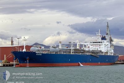
SEASHINE
Tanker D
Current Trip
| Time Travelled | 8 days |
|---|---|
| Remaining Time | 3 days |
| Distance Travelled | 2205.22 nm |
| Remaining Distance | 1272.74 nm |
| AVG Speed | 12.1 Knots |
| MAX Speed | 15.1 Knots |
| AVG Wind | 12.1 knots |
| MAX Wind | 29 knots |
| MIN Temp | 18.1°C / 64.58°F |
| MAX Temp | 32°C / 89.6°F |
| Draught | 10.2 m |
| Position Received | 3 m ago |
Current Position
| Longitude | -8.13345° |
|---|---|
| Latitude | 36.35117° |
| Status | Under way using engine |
| Speed | 14.2 Knots |
| Course | 288.1° |
| Area | North Atlantic Ocean |
| Station | T-AIS |
| Position Received | 3 m ago |
Info
Information
The current position of SEASHINE is in North Atlantic Ocean with coordinates 36.35117° / -8.13345° as reported on 2024-06-01 10:14 by AIS to our vessel tracker app. The vessel's current speed is 14.2 Knots and is heading at the port of ROTTERDAM. The estimated time of arrival as calculated by MyShipTracking vessel tracking app is 2024-06-05 06:50 LT
The vessel SEASHINE (IMO: 9787352, MMSI: 248616000) is a Tanker D It's sailing under the flag of [MT] Malta.
In this page you can find informations about the vessels current position, last detected port calls, and current voyage information. If the vessels is not in coverage by AIS you will find the latest position.
The current position of SEASHINE is detected by our AIS receivers and we are not responsible for the reliability of the data. The last position was recorded while the vessel was in Coverage by the Ais receivers of our vessel tracking app.
The current draught of SEASHINE as reported by AIS is 10.2 meters
Weather
| Temperature | 19.6°C / 67.28°F |
|---|---|
| Wind Speed | 15 knots |
| Direction | 96° E |
| Pressure | 1011.8 hPa |
| Humidity | 90.5 % |
| Cloud Coverage | 1 % |
Featured Company
Last Port Calls
| Port | Arrival | Departure | Time In Port |
|---|---|---|---|
| 2024-05-25 06:03 | 2024-05-25 15:16 | 9 h | |
| 2024-05-22 17:59 | 2024-05-23 21:30 | 1 d | |
| 2024-05-21 03:36 | 2024-05-21 12:39 | 9 h | |
| 2024-05-08 23:12 | 2024-05-12 03:00 | 3 d | |
| 2024-04-28 16:55 | 2024-04-30 15:32 | 1 d | |
| 2024-04-03 08:01 |
Last Trips
| Origin | Departure | Destination | Arrival | Distance | |
|---|---|---|---|---|---|
| 2024-05-23 21:30 | 2024-05-25 06:03 | 27.36 nm | |||
| 2024-05-12 03:00 | 2024-05-22 17:59 | 1275.30 nm | |||
| 2024-05-12 03:00 | 2024-05-21 03:36 | 1148.70 nm | |||
| 2024-04-30 15:32 | 2024-05-08 23:12 | 1852.70 nm | |||
| 2024-04-03 08:01 | 2024-04-28 16:55 | 1944.58 nm |
Events
| Time | Event | Details | Position / Dest | Info |
|---|---|---|---|---|
| 2024-06-01 10:14 | Status Changed | Under way using engine Default |
36.35117 / -8.13345
NLRTM
|
Speed: 14.2 kn Course: 288° |
| 2024-06-01 09:44 | Status Changed | Default Under way using engine |
36.31966 / -7.99242
NLRTM
|
Speed: 13.9 kn Course: 287.1° |
| 2024-06-01 09:30 | Status Changed | Under way using engine Default |
36.30465 / -7.92691
NLRTM
|
Speed: 13.9 kn Course: 285° |
| 2024-06-01 09:24 | Status Changed | Default Under way using engine |
36.29882 / -7.90156
NLRTM
|
Speed: 13.8 kn Course: 285.8° |
| 2024-06-01 09:13 | Status Changed | Under way using engine Default |
36.28715 / -7.85022
NLRTM
|
Speed: 13.8 kn Course: 285° |
| 2024-06-01 09:00 | Status Changed | Default Under way using engine |
36.27285 / -7.78990
NLRTM
|
Speed: 14.1 kn Course: 289.1° |
| 2024-06-01 08:25 | Change Sea Area | Portuguese part of the North Atlantic Ocean Spanish part of the North Atlantic Ocean |
36.24086 / -7.62703
North Atlantic Ocean
NLRTM
|
Speed: 14.2 kn Course: 280° |
| 2024-06-01 08:23 | Status Changed | Under way using engine Default |
36.23978 / -7.61642
NLRTM
|
Speed: 13.9 kn Course: 276° |
| 2024-06-01 08:23 | IN Coverage |
36.24086 / -7.62703
North Atlantic Ocean
NLRTM
|
Speed: 14.2 kn Course: 280° |
|
| 2024-06-01 07:18 | OUT of Coverage |
36.17212 / -7.31954
North Atlantic Ocean
NLRTM
|
Speed: 14.2 kn Course: 287.3° |