
SEADREAM 1
Passengers Ship
Current Trip
| Time Travelled | 3 days |
|---|---|
| Remaining Time | 5 h, 48 mins |
| Distance Travelled | 377.90 nm |
| Remaining Distance | 70.96 nm |
| AVG Speed | 8.4 Knots |
| MAX Speed | 14.6 Knots |
| AVG Wind | 10.8 knots |
| MAX Wind | 18 knots |
| MIN Temp | 24.3°C / 75.74°F |
| MAX Temp | 28.4°C / 83.12°F |
| Draught | 4.3 m |
| Position Received | 3 h, 15 m ago |
Current Position
| Longitude | --- |
|---|---|
| Latitude | --- |
| Status | Under way using engine |
| Speed | 9.9 Knots |
| Course | 191.1° |
| Area | Caribbean Sea |
| Station | T-AIS |
| Position Received | 3 h, 15 m ago |
Info
Information
The current position of SEADREAM 1 is in Caribbean Sea with coordinates 15.46294° / -61.51478° as reported on 2025-03-05 02:46 by AIS to our vessel tracker app. The vessel's current speed is 9.9 Knots and is heading at the port of RODNEY BAY. The estimated time of arrival as calculated by MyShipTracking vessel tracking app is 2025-03-05 07:50 LT
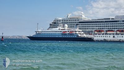
The vessel SEADREAM 1 (IMO: 8203438, MMSI: 308908000) is a Passengers Ship that was built in 1984 ( 41 years old ). It's sailing under the flag of [BS] Bahamas.
In this page you can find informations about the vessels current position, last detected port calls, and current voyage information. If the vessels is not in coverage by AIS you will find the latest position.
The current position of SEADREAM 1 is detected by our AIS receivers and we are not responsible for the reliability of the data. The last position was recorded while the vessel was in Coverage by the Ais receivers of our vessel tracking app.
The current draught of SEADREAM 1 as reported by AIS is 4.3 meters
Weather
| Temperature | 25.5°C / 77.9°F |
|---|---|
| Wind Speed | 13 knots |
| Direction | 105° ESE |
| Pressure | 1012.8 hPa |
| Humidity | 81.1 % |
| Cloud Coverage | 53 % |
Featured Company
Last Port Calls
| Port | Arrival | Departure | Time In Port |
|---|---|---|---|
| 2025-03-01 05:08 | 2025-03-01 18:52 | 13 h | |
| 2025-02-22 07:26 | 2025-02-22 18:10 | 10 h | |
| 2025-02-20 06:38 | 2025-02-20 15:54 | 9 h | |
| 2025-02-18 11:45 | 2025-02-18 18:46 | 7 h | |
| 2025-02-17 07:31 | 2025-02-17 18:23 | 10 h | |
| 2025-02-15 07:07 | 2025-02-16 19:46 | 1 d | |
| 2025-02-13 07:29 | 2025-02-13 14:55 | 7 h | |
| 2025-02-08 06:40 | 2025-02-08 18:08 | 11 h | |
| 2025-02-07 07:51 | 2025-02-07 18:03 | 10 h | |
| 2025-02-01 09:01 | 2025-02-01 18:03 | 9 h |
Most Visited Ports (Last year)
| Port | Arrivals | |
|---|---|---|
| 13 | ||
| 10 | ||
| 6 | ||
| 6 | ||
| 6 | ||
| 6 |
Last Trips
| Origin | Departure | Destination | Arrival | Distance | |
|---|---|---|---|---|---|
| 2025-02-22 18:10 | 2025-03-01 05:08 | 679.22 nm | |||
| 2025-02-20 15:54 | 2025-02-22 07:26 | 92.01 nm | |||
| 2025-02-18 18:46 | 2025-02-20 06:38 | 133.84 nm | |||
| 2025-02-17 18:23 | 2025-02-18 11:45 | 202.06 nm | |||
| 2025-02-16 19:46 | 2025-02-17 07:31 | 119.54 nm | |||
| 2025-02-13 14:55 | 2025-02-15 07:07 | 211.55 nm | |||
| 2025-02-08 18:08 | 2025-02-13 07:29 | 367.14 nm | |||
| 2025-02-07 18:03 | 2025-02-08 06:40 | 90.18 nm | |||
| 2025-02-01 18:03 | 2025-02-07 07:51 | 532.51 nm | |||
| 2025-02-01 08:51 | 2025-02-01 09:01 | 1.30 nm |
Events
| Time | Event | Details | Position / Dest | Info |
|---|---|---|---|---|
| 2025-03-05 02:57 | Status Changed | Default Under way using engine |
15.43213 / -61.51815
RODNEY BAY
|
Speed: 9.9 kn Course: 191.1° |
| 2025-03-05 02:46 | OUT of Coverage |
15.46294 / -61.51478
Caribbean Sea
RODNEY BAY
|
Speed: 9.9 kn Course: 191.1° |
|
| 2025-03-05 02:00 | START Moving | 10.79 nm, West of MARIGOT |
15.57628 / -61.47027
RODNEY BAY
|
Speed: 8.1 kn Course: 218.3° |
| 2025-03-05 01:45 | Status Changed | Under way using engine At anchor |
15.57926 / -61.46854
RODNEY BAY
|
Speed: 0.1 kn Course: 144° |
| 2025-03-05 01:34 | Status Changed | At anchor Default |
15.57944 / -61.46863
RODNEY BAY
|
Speed: Course: 154° |
| 2025-03-05 01:25 | Status Changed | Default At anchor |
15.57945 / -61.46862
RODNEY BAY
|
Speed: Course: 173° |
| 2025-03-05 01:22 | Status Changed | At anchor Default |
15.57945 / -61.46865
RODNEY BAY
|
Speed: Course: 162° |
| 2025-03-05 01:16 | Status Changed | Default At anchor |
15.57954 / -61.46849
RODNEY BAY
|
Speed: Course: 153° |
| 2025-03-04 23:46 | Draught Changed | 4.3 4 |
15.57943 / -61.46876
RODNEY BAY
|
Speed: Course: 84° |
| 2025-03-04 23:46 | Destination Changed | RODNEY BAY GP LSS |
15.57943 / -61.46876
RODNEY BAY
|
Speed: Course: 84° |