
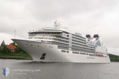
SEABOURN OVATION
Passenger
Current Trip
| Time Travelled | 11 h, 30 mins |
|---|---|
| Remaining Time | --- |
| Distance Travelled | 63.16 nm |
| Remaining Distance | --- |
| AVG Speed | 5.9 Knots |
| MAX Speed | 9.9 Knots |
| AVG Wind | 9.4 knots |
| MAX Wind | 12 knots |
| MIN Temp | 25°C / 77°F |
| MAX Temp | 25.6°C / 78.08°F |
| Draught | 6 m |
| Position Received | 1 m ago |
Current Position
| Longitude | --- |
|---|---|
| Latitude | --- |
| Status | Under way using engine |
| Speed | 6.6 Knots |
| Course | 316.3° |
| Area | Caribbean Sea |
| Station | T-AIS |
| Position Received | 1 m ago |
Info
Information
The current position of SEABOURN OVATION is in Caribbean Sea with coordinates 17.24849° / -62.91786° as reported on 2025-03-05 12:44 by AIS to our vessel tracker app. The vessel's current speed is 6.6 Knots
The vessel SEABOURN OVATION (MMSI: 311000585) is a Passenger It's sailing under the flag of [BS] Bahamas.
In this page you can find informations about the vessels current position, last detected port calls, and current voyage information. If the vessels is not in coverage by AIS you will find the latest position.
The current position of SEABOURN OVATION is detected by our AIS receivers and we are not responsible for the reliability of the data. The last position was recorded while the vessel was in Coverage by the Ais receivers of our vessel tracking app.
The current draught of SEABOURN OVATION as reported by AIS is 6 meters
Weather
| Temperature | 25.2°C / 77.36°F |
|---|---|
| Wind Speed | 12 knots |
| Direction | 107° ESE |
| Pressure | 1014 hPa |
| Humidity | 79.4 % |
| Cloud Coverage | 1 % |
Featured Company
Last Port Calls
| Port | Arrival | Departure | Time In Port |
|---|---|---|---|
| 2025-03-04 07:19 | 2025-03-04 21:15 | 13 h | |
| 2025-03-03 07:00 | 2025-03-03 17:11 | 10 h | |
| 2025-03-02 06:44 | 2025-03-02 18:07 | 11 h | |
| 2025-03-01 05:41 | 2025-03-01 22:58 | 17 h | |
| 2025-02-28 06:27 | 2025-02-28 17:46 | 11 h | |
| 2025-02-26 07:11 | 2025-02-26 20:35 | 13 h | |
| 2025-02-22 06:11 | 2025-02-22 20:57 | 14 h | |
| 2025-02-18 06:50 | 2025-02-18 21:22 | 14 h | |
| 2025-02-16 06:43 | 2025-02-16 18:22 | 11 h | |
| 2025-02-15 05:39 | 2025-02-15 20:40 | 15 h |
Most Visited Ports (Last year)
| Port | Arrivals | |
|---|---|---|
| 13 | ||
| 9 | ||
| 7 | ||
| 7 | ||
| 6 | ||
| 6 |
Last Trips
| Origin | Departure | Destination | Arrival | Distance | |
|---|---|---|---|---|---|
| 2025-03-03 17:11 | 2025-03-04 07:19 | 132.56 nm | |||
| 2025-03-02 18:07 | 2025-03-03 07:00 | 150.59 nm | |||
| 2025-03-01 22:58 | 2025-03-02 06:44 | 117.61 nm | |||
| 2025-02-28 17:46 | 2025-03-01 05:41 | 150.55 nm | |||
| 2025-02-26 20:35 | 2025-02-28 06:27 | 195.47 nm | |||
| 2025-02-22 20:57 | 2025-02-26 07:11 | 478.81 nm | |||
| 2025-02-18 21:22 | 2025-02-22 06:11 | 503.95 nm | |||
| 2025-02-16 18:22 | 2025-02-18 06:50 | 248.51 nm | |||
| 2025-02-15 20:40 | 2025-02-16 06:43 | 119.16 nm | |||
| 2025-02-13 17:58 | 2025-02-15 05:39 | 320.16 nm |
Events
| Time | Event | Details | Position / Dest | Info |
|---|---|---|---|---|
| 2025-03-05 12:44 | Status Changed | Under way using engine Default |
17.24849 / -62.91786
AG SJO
|
Speed: 6.5 kn Course: 318° |
| 2025-03-05 11:59 | Status Changed | Default Under way using engine |
17.19099 / -62.86341
AG SJO
|
Speed: 5.9 kn Course: 315.6° |
| 2025-03-05 11:40 | Status Changed | Under way using engine Default |
17.16867 / -62.84103
AG SJO
|
Speed: 5.8 kn Course: 316° |
| 2025-03-05 11:30 | Status Changed | Default Under way using engine |
17.15740 / -62.82960
AG SJO
|
Speed: 5.8 kn Course: 315.4° |
| 2025-03-05 08:26 | Detected in Sea | Saint Kitts and Nevis part of the Caribbean Sea |
16.98407 / -62.60376
Caribbean Sea
|
Speed: 5.8 kn Course: 257.9° |
| 2025-03-05 08:26 | Status Changed | Under way using engine Default |
16.98407 / -62.60376
AG SJO
|
Speed: 5.8 kn Course: 259° |
| 2025-03-05 08:10 | IN Coverage |
16.98407 / -62.60376
Caribbean Sea
|
Speed: 5.8 kn Course: 257.9° |
|
| 2025-03-05 06:59 | Status Changed | Default Under way using engine |
17.01378 / -62.45433
AG SJO
|
Speed: 6 kn Course: 256° |
| 2025-03-05 06:51 | OUT of Coverage |
17.01664 / -62.44163
Caribbean Sea
|
Speed: 6 kn Course: 256° |
|
| 2025-03-05 06:29 | Status Changed | Under way using engine Default |
17.02649 / -62.40330
AG SJO
|
Speed: 6 kn Course: 259° |