
SEA FALCON II
Bulk Carrier
Current Trip
| Time Travelled | 37 days |
|---|---|
| Remaining Time | 18 h, 22 mins |
| Distance Travelled | 9164.23 nm |
| Remaining Distance | 225.05 nm |
| AVG Speed | 10.8 Knots |
| MAX Speed | 15.3 Knots |
| AVG Wind | 13.2 knots |
| MAX Wind | 31.9 knots |
| MIN Temp | -4.7°C / 23.54°F |
| MAX Temp | 29.5°C / 85.1°F |
| Draught | 10.7 m |
| Position Received | 1 d ago |
Current Position
| Longitude | -86.67794° |
|---|---|
| Latitude | 22.44792° |
| Status | Under way using engine |
| Speed | 11 Knots |
| Course | 255° |
| Area | Gulf of Mexico |
| Station | T-AIS |
| Position Received | 1 d ago |
Info
Information
The current position of SEA FALCON II is in Gulf of Mexico with coordinates 22.44792° / -86.67794° as reported on 2024-05-16 00:33 by AIS to our vessel tracker app. The vessel's current speed is 11 Knots and is heading at the port of VERACRUZ. The estimated time of arrival as calculated by MyShipTracking vessel tracking app is 2024-05-17 20:00 LT
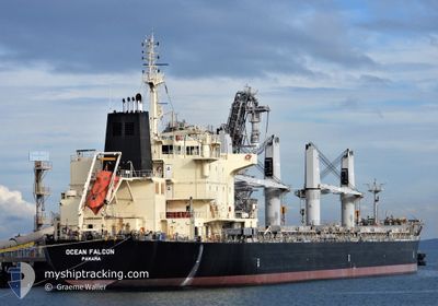
The vessel SEA FALCON II (IMO: 9595163, MMSI: 357656000) is a Bulk Carrier that was built in 2011 ( 13 years old ). It's sailing under the flag of [PA] Panama.
In this page you can find informations about the vessels current position, last detected port calls, and current voyage information. If the vessels is not in coverage by AIS you will find the latest position.
The current position of SEA FALCON II is detected by our AIS receivers and we are not responsible for the reliability of the data. The last position was recorded while the vessel was in Coverage by the Ais receivers of our vessel tracking app.
The current draught of SEA FALCON II as reported by AIS is 10.7 meters
Weather
| Temperature | 29.4°C / 84.92°F |
|---|---|
| Wind Speed | 16 knots |
| Direction | 89° E |
| Pressure | 1004.2 hPa |
| Humidity | 81.3 % |
| Cloud Coverage | --- |
Featured Company
Last Port Calls
| Port | Arrival | Departure | Time In Port |
|---|---|---|---|
| 2024-03-30 07:56 | 2024-04-09 07:46 | 9 d | |
| 2024-03-06 20:11 | 2024-03-09 03:45 | 2 d | |
| 2024-03-04 02:13 | 2024-03-04 09:39 | 7 h | |
| 2024-03-03 13:16 |
Most Visited Ports (Last year)
| Port | Arrivals | |
|---|---|---|
| 2 | ||
| 1 | ||
| 1 | ||
| 1 | ||
| 1 | ||
| 1 |
Last Trips
| Origin | Departure | Destination | Arrival | Distance | |
|---|---|---|---|---|---|
| 2024-03-09 03:45 | 2024-03-30 07:56 | 1787.03 nm | |||
| 2024-03-03 13:16 | 2024-03-06 20:11 | 519.12 nm | |||
| 2024-03-03 13:16 | 2024-03-04 02:13 | 77.76 nm |
Events
| Time | Event | Details | Position / Dest | Info |
|---|---|---|---|---|
| 2024-05-16 00:36 | Status Changed | Default Under way using engine |
22.44500 / -86.68667
MX VER
|
Speed: 11 kn Course: 255° |
| 2024-05-16 00:33 | OUT of Coverage |
22.44792 / -86.67794
Gulf of Mexico
MX VER
|
Speed: 11 kn Course: 255° |
|
| 2024-05-16 00:27 | Change Sea Area | Mexican part of the Gulf of Mexico Bahamas part of the North Atlantic Ocean |
22.45252 / -86.65781
Gulf of Mexico
MX VER
|
Speed: 11 kn Course: 256° |
| 2024-05-16 00:27 | Status Changed | Under way using engine Default |
22.45252 / -86.65781
MX VER
|
Speed: 11 kn Course: 257° |
| 2024-05-16 00:27 | IN Coverage |
22.45252 / -86.65781
Gulf of Mexico
MX VER
|
Speed: 11 kn Course: 256° |
|
| 2024-05-14 15:54 | Status Changed | Default Under way using engine |
24.10751 / -80.68632
MX VER
|
Speed: 9.5 kn Course: 236.2° |
| 2024-05-14 15:47 | OUT of Coverage |
24.11877 / -80.66765
North Atlantic Ocean
MX VER
|
Speed: 9.5 kn Course: 236.2° |
|
| 2024-05-14 15:05 | Status Changed | Under way using engine Default |
24.18022 / -80.56877
MX VER
|
Speed: 9.4 kn Course: 238° |
| 2024-05-14 14:55 | Status Changed | Default Under way using engine |
24.19432 / -80.54456
MX VER
|
Speed: 9.4 kn Course: 237.2° |
| 2024-05-14 11:50 | Status Changed | Under way using engine Default |
24.46528 / -80.08823
MX VER
|
Speed: 10 kn Course: 237° |