
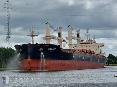
SEA EAGLE
Cargo
Current Trip
USILG
| Time Travelled | 13 days |
|---|---|
| Remaining Time | --- |
| Distance Travelled | 2905.97 nm |
| Remaining Distance | --- |
| AVG Speed | 10.7 Knots |
| MAX Speed | 14.2 Knots |
| AVG Wind | 9.8 knots |
| MAX Wind | 23 knots |
| MIN Temp | 12.7°C / 54.86°F |
| MAX Temp | 22.4°C / 72.32°F |
| Draught | 10.3 m |
| Position Received | 4 m ago |
Current Position
| Longitude | -17.31522° |
|---|---|
| Latitude | 38.49851° |
| Status | Under way using engine |
| Speed | 11.4 Knots |
| Course | 284.8° |
| Area | North Atlantic Ocean |
| Station | T-AIS |
| Position Received | 4 m ago |
Info
Information
The current position of SEA EAGLE is in North Atlantic Ocean with coordinates 38.49851° / -17.31522° as reported on 2024-05-31 00:38 by AIS to our vessel tracker app. The vessel's current speed is 11.4 Knots
The vessel SEA EAGLE (IMO: 9830135, MMSI: 636092874) is a Cargo It's sailing under the flag of [LR] Liberia.
In this page you can find informations about the vessels current position, last detected port calls, and current voyage information. If the vessels is not in coverage by AIS you will find the latest position.
The current position of SEA EAGLE is detected by our AIS receivers and we are not responsible for the reliability of the data. The last position was recorded while the vessel was in Coverage by the Ais receivers of our vessel tracking app.
The current draught of SEA EAGLE as reported by AIS is 10.3 meters
Weather
| Temperature | 18.3°C / 64.94°F |
|---|---|
| Wind Speed | 12 knots |
| Direction | 51° NE |
| Pressure | 1019.5 hPa |
| Humidity | 82.1 % |
| Cloud Coverage | 70 % |
Featured Company
Last Port Calls
| Port | Arrival | Departure | Time In Port |
|---|---|---|---|
| 2024-05-05 07:00 | 2024-05-17 17:12 | 12 d | |
| 2024-04-29 02:59 | |||
| 2024-03-12 09:38 | 2024-03-29 10:41 | 17 d | |
| 2024-03-06 05:27 | 2024-03-11 00:47 | 4 d |
Most Visited Ports (Last year)
| Port | Arrivals | |
|---|---|---|
| 2 | ||
| 1 | ||
| 1 | ||
| 1 | ||
| 1 | ||
| 1 |
Events
| Time | Event | Details | Position / Dest | Info |
|---|---|---|---|---|
| 2024-05-31 00:25 | Status Changed | Under way using engine Default |
38.48749 / -17.26532
USILG
|
Speed: 11 kn Course: 285° |
| 2024-05-31 00:14 | Status Changed | Default Under way using engine |
38.47666 / -17.22167
USILG
|
Speed: 11.7 kn Course: 286° |
| 2024-05-31 00:03 | Status Changed | Under way using engine Default |
38.46820 / -17.17790
USILG
|
Speed: 11 kn Course: 286° |
| 2024-05-30 23:59 | Status Changed | Default Under way using engine |
38.46333 / -17.16167
USILG
|
Speed: 11.7 kn Course: 286.9° |
| 2024-05-30 23:51 | Status Changed | Under way using engine Default |
38.45684 / -17.12933
USILG
|
Speed: 11 kn Course: 285° |
| 2024-05-30 23:47 | Status Changed | Default Under way using engine |
38.45334 / -17.11500
USILG
|
Speed: 11.8 kn Course: 285.7° |
| 2024-05-30 22:53 | Status Changed | Under way using engine Default |
38.40605 / -16.90073
USILG
|
Speed: 11.6 kn Course: 286° |
| 2024-05-30 22:49 | Status Changed | Default Under way using engine |
38.40202 / -16.88382
USILG
|
Speed: 11.6 kn Course: 286.7° |
| 2024-05-30 22:39 | Status Changed | Under way using engine Default |
38.39328 / -16.84654
USILG
|
Speed: 11 kn Course: 286° |
| 2024-05-30 22:35 | Status Changed | Default Under way using engine |
38.38833 / -16.83167
USILG
|
Speed: 11.6 kn Course: 285.8° |