
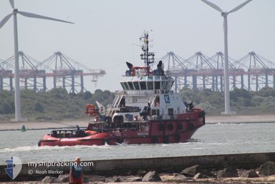
SD HONOUR
Tug
Current Trip
| Trip Time | 9 days |
|---|---|
| Trip Distance | 305.90 nm |
| AVG Speed | 4.5 Knots |
| MAX Speed | 11 Knots |
| Draught | 5.8 m |
| AVG Wind | 11.6 knots |
| MAX Wind | 18 knots |
| MIN Temp | 24.5°C / 76.1°F |
| MAX Temp | 28.2°C / 82.76°F |
| Position Received | 5 d ago |
Current Position
| Longitude | --- |
|---|---|
| Latitude | --- |
| Status | Restricted manoeuverability |
| Speed | 4.4 Knots |
| Course | 220° |
| Area | North Atlantic Ocean |
| Station | T-AIS |
| Position Received | 5 d ago |
Info
Information
The current position of SD HONOUR is in North Atlantic Ocean with coordinates 7.92056° / -57.07147° as reported on 2025-12-07 01:50 by AIS to our vessel tracker app. The vessel's current speed is 4.4 Knots and is currently inside the port of GEORGETOWN.
The vessel SD HONOUR (IMO: 9704910, MMSI: 376641000) is a Tug It's sailing under the flag of [VC] St Vincent Grenadines.
In this page you can find informations about the vessels current position, last detected port calls, and current voyage information. If the vessels is not in coverage by AIS you will find the latest position.
The current position of SD HONOUR is detected by our AIS receivers and we are not responsible for the reliability of the data. The last position was recorded while the vessel was in Coverage by the Ais receivers of our vessel tracking app.
The current draught of SD HONOUR as reported by AIS is 5.8 meters
Weather
| Temperature | 25.5°C / 77.9°F |
|---|---|
| Wind Speed | 5 knots |
| Direction | 71° ENE |
| Pressure | 1009.2 hPa |
| Humidity | 92.7 % |
| Cloud Coverage | 61 % |
Featured Company
Last Port Calls
| Port | Arrival | Departure | Time In Port |
|---|---|---|---|
| 2025-12-07 17:28 | |||
| 2025-11-27 21:34 | 2025-11-28 09:37 | 12 h | |
| 2025-11-15 13:58 | 2025-11-16 01:46 | 11 h | |
| 2025-11-08 06:09 | 2025-11-09 06:30 | 1 d | |
| 2025-11-04 14:38 | 2025-11-04 15:01 | 22 m | |
| 2025-10-15 12:30 | 2025-10-16 12:15 | 23 h |
Most Visited Ports (Last year)
| Port | Arrivals | |
|---|---|---|
| 26 |
Last Trips
| Origin | Departure | Destination | Arrival | Distance | |
|---|---|---|---|---|---|
| 2025-11-28 09:37 | 2025-12-07 17:28 | 305.90 nm | |||
| 2025-11-16 01:46 | 2025-11-27 21:34 | 347.26 nm | |||
| 2025-11-09 06:30 | 2025-11-15 13:58 | 286.64 nm | |||
| 2025-11-04 15:01 | 2025-11-08 06:09 | 250.71 nm | |||
| 2025-10-16 12:15 | 2025-11-04 14:38 | 526.14 nm | |||
| 2025-09-26 06:06 | 2025-10-15 12:30 | 518.01 nm |
Events
| Time | Event | Details | Position / Dest | Info |
|---|---|---|---|---|
| 2025-12-11 12:33 | STOP Moving |
6.81826 / -58.16755
[GY] GEORGETOWN
|
Speed: 0.1 kn Course: 4° |
|
| 2025-12-11 12:10 | START Moving |
6.79619 / -58.17347
[GY] GEORGETOWN
|
Speed: 3.2 kn Course: 5° |
|
| 2025-12-07 21:29 | STOP Moving |
6.78596 / -58.17397
[GY] GEORGETOWN
|
Speed: Course: 10° |
|
| 2025-12-07 21:28 | PORT ARRIVAL |
|
6.78596 / -58.17397
[GY] GEORGETOWN
|
Speed: 1.2 kn Course: 47° |
| 2025-12-07 01:55 | Status Changed | Default Restricted manoeuverability |
7.91608 / -57.07542
FPSO LIZA DESTINY
|
Speed: 4.4 kn Course: 220° |
| 2025-12-07 01:50 | OUT of Coverage |
7.92056 / -57.07147
North Atlantic Ocean
|
Speed: 4.4 kn Course: 222° |
|
| 2025-12-07 00:01 | START Moving |
8.00913 / -56.99431
FPSO LIZA DESTINY
|
Speed: 3.4 kn Course: 210° |
|
| 2025-12-06 23:54 | STOP Moving |
8.01060 / -56.99276
FPSO LIZA DESTINY
|
Speed: 0.3 kn Course: 251° |
|
| 2025-12-06 23:42 | START Moving |
8.00860 / -57.00242
FPSO LIZA DESTINY
|
Speed: 4.8 kn Course: 103° |
|
| 2025-12-06 19:03 | Status Changed | Restricted manoeuverability Default |
8.01430 / -56.99679
FPSO LIZA DESTINY
|
Speed: 0.9 kn Course: 270° |