
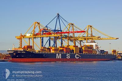
SC MARA
Container Ship
Current Trip
OM SOH
| Time Travelled | 1 day |
|---|---|
| Remaining Time | --- |
| Distance Travelled | 747.60 nm |
| Remaining Distance | --- |
| AVG Speed | 17.2 Knots |
| MAX Speed | 18.5 Knots |
| AVG Wind | 8.8 knots |
| MAX Wind | 15.8 knots |
| MIN Temp | 26.2°C / 79.16°F |
| MAX Temp | 29.6°C / 85.28°F |
| Draught | 12.1 m |
| Position Received | 2 d ago |
Current Position
| Longitude | 56.69021° |
|---|---|
| Latitude | 24.74019° |
| Status | Under way using engine |
| Speed | 7.6 Knots |
| Course | 231.2° |
| Area | Gulf of Oman |
| Station | T-AIS |
| Position Received | 2 d ago |
Info
Information
The current position of SC MARA is in Gulf of Oman with coordinates 24.74019° / 56.69021° as reported on 2024-04-23 14:34 by AIS to our vessel tracker app. The vessel's current speed is 7.6 Knots
The vessel SC MARA (IMO: 9302578, MMSI: 538002955) is a Container Ship that was built in 2006 ( 18 years old ). It's sailing under the flag of [MH] Marshall Is.
In this page you can find informations about the vessels current position, last detected port calls, and current voyage information. If the vessels is not in coverage by AIS you will find the latest position.
The current position of SC MARA is detected by our AIS receivers and we are not responsible for the reliability of the data. The last position was recorded while the vessel was in Coverage by the Ais receivers of our vessel tracking app.
The current draught of SC MARA as reported by AIS is 12.1 meters
Weather
| Temperature | 27.9°C / 82.22°F |
|---|---|
| Wind Speed | 10 knots |
| Direction | 318° NW |
| Pressure | 1007.2 hPa |
| Humidity | 71.8 % |
| Cloud Coverage | --- |
Featured Company
Last Port Calls
| Port | Arrival | Departure | Time In Port |
|---|---|---|---|
| 2024-04-23 19:44 | 2024-04-24 16:40 | 20 h | |
| 2024-04-19 19:42 | 2024-04-22 11:43 | 2 d | |
| 2024-04-12 20:38 | 2024-04-13 08:34 | 11 h | |
| 2024-04-10 18:45 | 2024-04-11 17:37 | 22 h | |
| 2024-04-07 05:41 | 2024-04-08 03:21 | 21 h | |
| 2024-04-03 11:10 | 2024-04-05 20:57 | 2 d | |
| 2024-03-28 15:05 | 2024-03-29 10:05 | 19 h | |
| 2024-03-25 05:23 | 2024-03-26 11:02 | 1 d | |
| 2024-03-21 20:08 | 2024-03-22 12:29 | 16 h | |
| 2024-03-13 14:19 | 2024-03-18 11:14 | 4 d |
Most Visited Ports (Last year)
| Port | Arrivals | |
|---|---|---|
| 11 | ||
| 8 | ||
| 7 | ||
| 6 | ||
| 6 | ||
| 5 |
Last Trips
| Origin | Departure | Destination | Arrival | Distance | |
|---|---|---|---|---|---|
| 2024-04-22 15:43 | 2024-04-23 23:44 | 266.75 nm | |||
| 2024-04-13 14:04 | 2024-04-19 23:42 | 1369.62 nm | |||
| 2024-04-11 23:07 | 2024-04-13 02:08 | 424.81 nm | |||
| 2024-04-08 07:21 | 2024-04-11 00:15 | 745.27 nm | |||
| 2024-04-06 00:57 | 2024-04-07 09:41 | 266.00 nm | |||
| 2024-03-29 15:35 | 2024-04-03 15:10 | 1240.30 nm | |||
| 2024-03-26 16:32 | 2024-03-28 20:35 | 562.09 nm | |||
| 2024-03-22 16:29 | 2024-03-25 10:53 | 749.14 nm | |||
| 2024-03-18 15:14 | 2024-03-22 00:08 | 267.53 nm | |||
| 2024-03-09 08:02 | 2024-03-13 18:19 | 1011.85 nm |
Events
| Time | Event | Details | Position / Dest | Info |
|---|---|---|---|---|
| 2024-04-24 16:40 | PORT DEPARTURE |
|
24.54116 / 56.62900
OM SOH
|
Speed: 10.9 kn Course: 4° |
| 2024-04-24 16:20 | START Moving |
24.51019 / 56.61606
[OM] SOHAR
|
Speed: 6 kn Course: 142° |
|
| 2024-04-23 20:28 | STOP Moving |
24.51419 / 56.61185
[OM] SOHAR
|
Speed: 0.2 kn Course: 142° |
|
| 2024-04-23 19:44 | PORT ARRIVAL |
|
24.52184 / 56.62853
[OM] SOHAR
|
Speed: 8.8 kn Course: 185° |
| 2024-04-23 18:08 | START Moving | 9.83 nm, East of SHINAS |
24.73254 / 56.65315
OM SOH
|
Speed: 5.2 kn Course: 194° |
| 2024-04-23 15:28 | STOP Moving | 10.37 nm, East of SHINAS |
24.71000 / 56.65939
OM SOH
|
Speed: 0.2 kn Course: 178° |
| 2024-04-23 14:40 | Status Changed | Default Under way using engine |
24.73557 / 56.67726
OM SOH
|
Speed: 7.6 kn Course: 231.2° |
| 2024-04-23 14:34 | OUT of Coverage |
24.74019 / 56.69021
Gulf of Oman
OM SOH
|
Speed: 7.6 kn Course: 231.2° |
|
| 2024-04-23 12:07 | Detected in Sea | Omani part of the Gulf of Oman |
25.04448 / 56.77454
Gulf of Oman
OM SOH
|
Speed: 7.3 kn Course: 200.5° |
| 2024-04-23 07:16 | Change Sea Area | United Arab Emirates part of the Gulf of Oman Omani part of the Gulf of Oman |
25.66745 / 56.76312
Gulf of Oman
OM SOH
|
Speed: 10 kn Course: 173.8° |