
SC ESTEEM LII
Oil Products Tanker
Current Trip
| Trip Time | 21 days |
|---|---|
| Trip Distance | 3211.89 nm |
| AVG Speed | 8.7 Knots |
| MAX Speed | 12.8 Knots |
| Draught | 7.7 m |
| AVG Wind | 6.3 knots |
| MAX Wind | 16 knots |
| MIN Temp | 25.3°C / 77.54°F |
| MAX Temp | 30.7°C / 87.26°F |
| Position Received | 1 d ago |
Current Position
| Longitude | 104.16667° |
|---|---|
| Latitude | 1.32425° |
| Status | At anchor |
| Speed | |
| Course | 273° |
| Area | Singapore Strait |
| Station | T-AIS |
| Position Received | 1 d ago |
Info
Information
The current position of SC ESTEEM LII is in Singapore Strait with coordinates 1.32425° / 104.16667° as reported on 2024-05-08 05:34 by AIS to our vessel tracker app. The vessel's current speed is 0 Knots and is currently inside the port of PENGERANG.
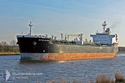
The vessel SC ESTEEM LII (IMO: 9251573, MMSI: 525119021) is a Oil Products Tanker that was built in 2003 ( 21 years old ). It's sailing under the flag of [ID] Indonesia.
In this page you can find informations about the vessels current position, last detected port calls, and current voyage information. If the vessels is not in coverage by AIS you will find the latest position.
The current position of SC ESTEEM LII is detected by our AIS receivers and we are not responsible for the reliability of the data. The last position was recorded while the vessel was in Coverage by the Ais receivers of our vessel tracking app.
The current draught of SC ESTEEM LII as reported by AIS is 7.7 meters
Weather
| Temperature | 30°C / 86°F |
|---|---|
| Wind Speed | 6 knots |
| Direction | 130° SE |
| Pressure | 1006.1 hPa |
| Humidity | 70.1 % |
| Cloud Coverage | 25 % |
Featured Company
Most Visited Ports (Last year)
| Port | Arrivals | |
|---|---|---|
| 9 | ||
| 7 | ||
| 2 | ||
| 2 | ||
| 2 | ||
| 2 |
Last Trips
Events
| Time | Event | Details | Position / Dest | Info |
|---|---|---|---|---|
| 2024-05-08 05:40 | Status Changed | Default At anchor |
1.32425 / 104.16667
[MY] PENGERANG
|
Speed: Course: 273° |
| 2024-05-08 05:34 | Status Changed | At anchor Default |
1.32425 / 104.16667
[MY] PENGERANG
|
Speed: Course: 273° |
| 2024-05-08 05:34 | OUT of Coverage |
1.32425 / 104.16667
Singapore Strait
[MY] PENGERANG
|
Speed: Course: 150.4° |
|
| 2024-05-08 05:16 | Status Changed | Default At anchor |
1.32426 / 104.16668
[MY] PENGERANG
|
Speed: 0.8 kn Course: 268° |
| 2024-05-08 05:16 | STOP Moving |
1.32426 / 104.16668
[MY] PENGERANG
|
Speed: 0.1 kn Course: 273° |
|
| 2024-05-08 05:01 | Status Changed | At anchor Default |
1.32541 / 104.16224
[MY] PENGERANG
|
Speed: 1.3 kn Course: 250° |
| 2024-05-08 04:52 | Status Changed | Default At anchor |
1.32557 / 104.15769
[MY] PENGERANG
|
Speed: 3.2 kn Course: 52° |
| 2024-05-08 04:51 | PORT ARRIVAL |
|
1.32557 / 104.15769
[MY] PENGERANG
|
Speed: 3.2 kn Course: 52° |
| 2024-05-08 04:45 | Status Changed | At anchor Default |
1.32392 / 104.15566
PENGERANG MY
|
Speed: 3.7 kn Course: 64° |
| 2024-05-08 04:33 | START Moving | 1.78 nm, West of PENGERANG |
1.31861 / 104.14303
PENGERANG MY
|
Speed: 3.3 kn Course: 71° |