
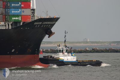
SAAM CLYDE
Tug
Current Trip
VAN HBR
| Time Travelled | 1 day |
|---|---|
| Remaining Time | --- |
| Distance Travelled | 286.85 nm |
| Remaining Distance | --- |
| AVG Speed | 7.6 Knots |
| MAX Speed | 10.6 Knots |
| AVG Wind | 5.9 knots |
| MAX Wind | 12.7 knots |
| MIN Temp | 0.5°C / 32.9°F |
| MAX Temp | 8.9°C / 48.02°F |
| Draught | 6 m |
| Position Received | 4 h, 42 m ago |
Current Position
| Longitude | --- |
|---|---|
| Latitude | --- |
| Status | Under way using engine |
| Speed | 8.2 Knots |
| Course | 131° |
| Area | The Coastal Waters of Southeast Alaska and British Columbia |
| Station | T-AIS |
| Position Received | 4 h, 42 m ago |
Info
Information
The current position of SAAM CLYDE is in The Coastal Waters of Southeast Alaska and British Columbia with coordinates 51.06553° / -127.68173° as reported on 2025-03-03 05:24 by AIS to our vessel tracker app. The vessel's current speed is 8.2 Knots
The vessel SAAM CLYDE (IMO: 9190391, MMSI: 316011473) is a Tug that was built in 2000 ( 25 years old ). It's sailing under the flag of [CA] Canada.
In this page you can find informations about the vessels current position, last detected port calls, and current voyage information. If the vessels is not in coverage by AIS you will find the latest position.
The current position of SAAM CLYDE is detected by our AIS receivers and we are not responsible for the reliability of the data. The last position was recorded while the vessel was in Coverage by the Ais receivers of our vessel tracking app.
The current draught of SAAM CLYDE as reported by AIS is 6 meters
Weather
| Temperature | 6.5°C / 43.7°F |
|---|---|
| Wind Speed | 4 knots |
| Direction | 241° WSW |
| Pressure | 1017 hPa |
| Humidity | 87.2 % |
| Cloud Coverage | 94 % |
Featured Company
Last Port Calls
| Port | Arrival | Departure | Time In Port |
|---|---|---|---|
| 2025-02-27 20:56 | 2025-03-01 13:36 | 1 d | |
| 2025-02-27 02:19 | 2025-02-27 18:04 | 15 h | |
| 2025-02-26 22:00 | 2025-02-26 22:34 | 33 m | |
| 2025-02-26 15:10 | 2025-02-26 18:58 | 3 h | |
| 2025-02-24 07:00 | 2025-02-26 14:36 | 2 d | |
| 2025-02-20 13:59 | 2025-02-24 05:40 | 3 d | |
| 2025-02-19 06:19 | 2025-02-20 08:31 | 1 d | |
| 2025-02-19 05:26 | 2025-02-19 05:40 | 14 m | |
| 2025-02-19 01:34 | 2025-02-19 04:01 | 2 h | |
| 2025-02-18 21:44 | 2025-02-19 01:26 | 3 h |
Most Visited Ports (Last year)
| Port | Arrivals | |
|---|---|---|
| 388 |
Last Trips
| Origin | Departure | Destination | Arrival | Distance | |
|---|---|---|---|---|---|
| 2025-02-27 18:04 | 2025-02-27 20:56 | 8.26 nm | |||
| 2025-02-26 22:34 | 2025-02-27 02:19 | 10.90 nm | |||
| 2025-02-26 18:58 | 2025-02-26 22:00 | 11.48 nm | |||
| 2025-02-26 14:36 | 2025-02-26 15:10 | 2.49 nm | |||
| 2025-02-24 05:40 | 2025-02-24 07:00 | 6.37 nm | |||
| 2025-02-20 08:31 | 2025-02-20 13:59 | 2.90 nm | |||
| 2025-02-19 05:40 | 2025-02-19 06:19 | 1.33 nm | |||
| 2025-02-19 04:01 | 2025-02-19 05:26 | 10.06 nm | |||
| 2025-02-19 01:26 | 2025-02-19 01:34 | 1.09 nm | |||
| 2025-02-18 21:11 | 2025-02-18 21:44 | 1.27 nm |
Events
| Time | Event | Details | Position / Dest | Info |
|---|---|---|---|---|
| 2025-03-03 05:29 | Status Changed | Default Under way using engine |
51.05860 / -127.66570
VAN HBR
|
Speed: 8.2 kn Course: 131° |
| 2025-03-03 05:24 | OUT of Coverage |
51.06553 / -127.68173
The Coastal Waters of Southeast Alaska and British Columbia
|
Speed: 8.2 kn Course: 131° |
|
| 2025-03-02 21:26 | Status Changed | Under way using engine Default |
52.06708 / -127.94707
VAN HBR
|
Speed: 7.6 kn Course: 115° |
| 2025-03-02 21:00 | Status Changed | Default Under way using engine |
52.07420 / -128.03958
VAN HBR
|
Speed: 8 kn Course: 86° |
| 2025-03-02 19:33 | Status Changed | Under way using engine Default |
52.20520 / -128.10738
VAN HBR
|
Speed: 6.1 kn Course: 153° |
| 2025-03-02 19:31 | Status Changed | Default Under way using engine |
52.20773 / -128.10939
VAN HBR
|
Speed: 6.1 kn Course: 153° |
| 2025-03-02 13:48 | Status Changed | Under way using engine Default |
52.68265 / -128.55370
VAN HBR
|
Speed: 6.4 kn Course: 152° |
| 2025-03-02 13:39 | IN Coverage |
52.68265 / -128.55370
The Coastal Waters of Southeast Alaska and British Columbia
|
Speed: 6.3 kn Course: 139° |
|
| 2025-03-02 02:00 | Status Changed | Default Under way using engine |
53.77725 / -129.92392
VAN HBR
|
Speed: 8.6 kn Course: 135° |
| 2025-03-02 01:58 | OUT of Coverage |
53.78043 / -129.92927
The Coastal Waters of Southeast Alaska and British Columbia
|
Speed: 8.6 kn Course: 135° |