
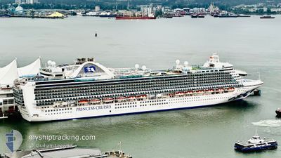
RUBY PRINCESS
Passengers Ship
Current Trip
USOGG
| Time Travelled | 2 days |
|---|---|
| Remaining Time | --- |
| Distance Travelled | 408.43 nm |
| Remaining Distance | --- |
| AVG Speed | 16.3 Knots |
| MAX Speed | 19.1 Knots |
| AVG Wind | 8.5 knots |
| MAX Wind | 18 knots |
| MIN Temp | 17.9°C / 64.22°F |
| MAX Temp | 28.6°C / 83.48°F |
| Draught | 8.8 m |
| Position Received | 11 h, 18 m ago |
Current Position
| Longitude | --- |
|---|---|
| Latitude | --- |
| Status | Under way using engine |
| Speed | 17.9 Knots |
| Course | 277.5° |
| Area | North Pacific Ocean |
| Station | T-AIS |
| Position Received | 11 h, 18 m ago |
Info
Information
The current position of RUBY PRINCESS is in North Pacific Ocean with coordinates 22.83595° / -109.97030° as reported on 2026-03-15 01:09 by AIS to our vessel tracker app. The vessel's current speed is 17.9 Knots
The vessel RUBY PRINCESS (IMO: 9378462, MMSI: 310567000) is a Passengers Ship that was built in 2008 ( 18 years old ). It's sailing under the flag of [BM] Bermuda.
In this page you can find informations about the vessels current position, last detected port calls, and current voyage information. If the vessels is not in coverage by AIS you will find the latest position.
The current position of RUBY PRINCESS is detected by our AIS receivers and we are not responsible for the reliability of the data. The last position was recorded while the vessel was in Coverage by the Ais receivers of our vessel tracking app.
The current draught of RUBY PRINCESS as reported by AIS is 8.8 meters
Weather
| Temperature | 19.6°C / 67.28°F |
|---|---|
| Wind Speed | 6 knots |
| Direction | 316° NW |
| Pressure | 1013.8 hPa |
| Humidity | 76 % |
| Cloud Coverage | 33 % |
Featured Company
Last Port Calls
| Port | Arrival | Departure | Time In Port |
|---|---|---|---|
| 2026-03-12 12:57 | 2026-03-13 01:01 | 12 h | |
| 2026-03-11 13:35 | 2026-03-11 22:11 | 8 h | |
| 2026-03-07 14:11 | 2026-03-08 00:35 | 10 h | |
| 2026-03-05 16:09 | 2026-03-06 01:40 | 9 h | |
| 2026-02-27 17:14 | 2026-02-28 09:15 | 16 h | |
| 2026-02-25 17:22 | 2026-02-26 03:22 | 10 h | |
| 2026-02-24 16:48 | 2026-02-25 09:16 | 16 h | |
| 2026-02-19 13:57 | 2026-02-20 00:19 | 10 h | |
| 2026-02-17 15:03 | 2026-02-18 01:31 | 10 h | |
| 2026-02-16 15:03 | 2026-02-17 06:58 | 15 h |
Last Trips
| Origin | Departure | Destination | Arrival | Distance | |
|---|---|---|---|---|---|
| 2026-03-11 15:11 | 2026-03-12 05:57 | 278.91 nm | |||
| 2026-03-07 16:35 | 2026-03-11 06:35 | 1437.71 nm | |||
| 2026-03-05 17:40 | 2026-03-07 06:11 | 557.49 nm | |||
| 2026-02-27 23:15 | 2026-03-05 08:09 | 2245.89 nm | |||
| 2026-02-25 17:22 | 2026-02-27 07:14 | 373.90 nm | |||
| 2026-02-24 23:16 | 2026-02-25 07:22 | 98.07 nm | |||
| 2026-02-19 16:19 | 2026-02-24 06:48 | 2223.45 nm | |||
| 2026-02-17 17:31 | 2026-02-19 05:57 | 557.05 nm | |||
| 2026-02-16 22:58 | 2026-02-17 07:03 | 87.06 nm | |||
| 2026-02-14 16:23 | 2026-02-16 07:03 | 525.26 nm |
Events
| Time | Event | Details | Position / Dest | Info |
|---|---|---|---|---|
| 2026-03-15 01:13 | Status Changed | Default Under way using engine |
22.83830 / -109.99036
USOGG
|
Speed: 17.9 kn Course: 277.5° |
| 2026-03-15 01:09 | OUT of Coverage |
22.83595 / -109.97030
North Pacific Ocean
|
Speed: 17.9 kn Course: 277.5° |
|
| 2026-03-15 00:52 | Change Sea Area | Mexican part of the North Pacific Ocean Mexican part of the Gulf of California |
22.84089 / -109.89797
North Pacific Ocean
|
Speed: 12.1 kn Course: 220.6° |
| 2026-03-15 00:52 | Status Changed | Under way using engine Default |
22.84089 / -109.89797
USOGG
|
Speed: 12.5 kn Course: 214° |
| 2026-03-15 00:38 | START Moving | --- |
22.88258 / -109.88655
USOGG
|
Speed: 5.8 kn Course: 164° |
| 2026-03-15 00:31 | Status Changed | Default Under way using engine |
22.88728 / -109.88926
USOGG
|
Speed: 0.7 kn Course: 279° |
| 2026-03-15 00:23 | Status Changed | Under way using engine At anchor |
22.88744 / -109.88849
USOGG
|
Speed: 0.3 kn Course: 208° |
| 2026-03-14 23:48 | Status Changed | At anchor Default |
22.88734 / -109.88816
USOGG
|
Speed: Course: -1° |
| 2026-03-14 23:31 | IN Coverage |
22.88734 / -109.88816
Gulf of California
|
Speed: 0.2 kn Course: 8.3° |
|
| 2026-03-14 21:00 | OUT of Coverage |
22.88708 / -109.88835
Gulf of California
|
Speed: 0.2 kn Course: 270.5° |