
PROMETHEUS ENERGY
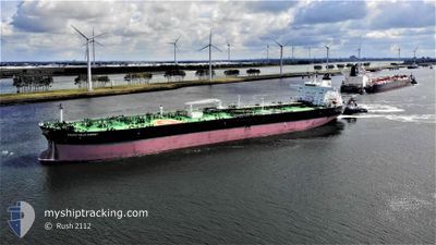
Tanker
Current Trip
| Time Travelled | 7 days |
|---|---|
| Remaining Time | --- |
| Distance Travelled | 1004.07 nm |
| Remaining Distance | --- |
| AVG Speed | 10.8 Knots |
| MAX Speed | 13.6 Knots |
| AVG Wind | 6.3 knots |
| MAX Wind | 19 knots |
| MIN Temp | 14°C / 57.2°F |
| MAX Temp | 17.7°C / 63.86°F |
| Draught | 8.4 m |
| Position Received | 18 h, 47 m ago |
Current Position
| Longitude | --- |
|---|---|
| Latitude | --- |
| Status | Under way using engine |
| Speed | 10.7 Knots |
| Course | 114.3° |
| Area | Mediterranean Sea - Eastern Basin |
| Station | T-AIS |
| Position Received | 18 h, 47 m ago |
Info
Information
The current position of PROMETHEUS ENERGY is in Mediterranean Sea - Eastern Basin with coordinates 36.09321° / 14.47301° as reported on 2025-12-14 17:05 by AIS to our vessel tracker app. The vessel's current speed is 10.7 Knots
The vessel PROMETHEUS ENERGY (IMO: 9801988, MMSI: 538008157) is a Tanker It's sailing under the flag of [MH] Marshall Is.
In this page you can find informations about the vessels current position, last detected port calls, and current voyage information. If the vessels is not in coverage by AIS you will find the latest position.
The current position of PROMETHEUS ENERGY is detected by our AIS receivers and we are not responsible for the reliability of the data. The last position was recorded while the vessel was in Coverage by the Ais receivers of our vessel tracking app.
The current draught of PROMETHEUS ENERGY as reported by AIS is 8.4 meters
Weather
| Temperature | 16.8°C / 62.24°F |
|---|---|
| Wind Speed | 12 knots |
| Direction | 124° SE |
| Pressure | 1025 hPa |
| Humidity | 70.8 % |
| Cloud Coverage | 88 % |
Featured Company
Last Port Calls
| Port | Arrival | Departure | Time In Port |
|---|---|---|---|
| 2025-12-06 15:11 | 2025-12-07 17:09 | 1 d | |
| 2025-11-19 21:31 | 2025-11-21 01:34 | 1 d | |
| 2025-11-12 23:20 | 2025-11-13 20:04 | 20 h | |
| 2025-11-03 03:50 | 2025-11-04 10:32 | 1 d | |
| 2025-10-25 13:37 | 2025-10-25 15:26 | 1 h | |
| 2025-10-05 23:07 | 2025-10-06 23:59 | 1 d |
Last Trips
| Origin | Departure | Destination | Arrival | Distance | |
|---|---|---|---|---|---|
| 2025-11-21 01:34 | 2025-12-06 15:11 | 2217.48 nm | |||
| 2025-11-13 20:04 | 2025-11-19 21:31 | 1442.93 nm | |||
| 2025-11-04 10:32 | 2025-11-12 23:20 | 1463.38 nm | |||
| 2025-10-25 15:26 | 2025-11-03 03:50 | 1224.84 nm | |||
| 2025-10-06 23:59 | 2025-10-25 13:37 | 2443.56 nm | |||
| 2025-09-01 00:18 | 2025-10-05 23:07 | 4154.02 nm |
Events
| Time | Event | Details | Position / Dest | Info |
|---|---|---|---|---|
| 2025-12-15 11:10 | START Moving | 12.65 nm, East of MARSAXLOKK |
35.87230 / 14.79938
MALTA
|
Speed: 3.7 kn Course: 198° |
| 2025-12-14 20:02 | STOP Moving | 12.81 nm, East of MARSAXLOKK |
35.87703 / 14.80115
MALTA
|
Speed: 0.1 kn Course: 183° |
| 2025-12-14 17:10 | Status Changed | Default Under way using engine |
36.08725 / 14.48921
MALTA
|
Speed: 10.7 kn Course: 114.3° |
| 2025-12-14 17:05 | Status Changed | Under way using engine Default |
36.09321 / 14.47301
MALTA
|
Speed: 10.7 kn Course: 114° |
| 2025-12-14 17:05 | OUT of Coverage |
36.09321 / 14.47301
Mediterranean Sea - Eastern Basin
MALTA
|
Speed: 10.7 kn Course: 114.3° |
|
| 2025-12-14 17:02 | Status Changed | Default Under way using engine |
36.09641 / 14.46422
MALTA
|
Speed: 10.7 kn Course: 114.9° |
| 2025-12-14 13:47 | Change Sea Area | Maltese part of the Mediterranean Sea - Eastern Basin Italian part of the Mediterranean Sea - Eastern Basin |
36.34649 / 13.80339
Mediterranean Sea - Eastern Basin
MALTA
|
Speed: 10.9 kn Course: 113.8° |
| 2025-12-14 13:47 | Status Changed | Under way using engine Default |
36.34649 / 13.80339
MALTA
|
Speed: 11 kn Course: 115° |
| 2025-12-14 13:27 | IN Coverage |
36.34649 / 13.80339
Mediterranean Sea - Eastern Basin
MALTA
|
Speed: 10.9 kn Course: 113.8° |
|
| 2025-12-14 09:20 | OUT of Coverage |
36.68966 / 12.89610
Mediterranean Sea - Eastern Basin
MALTA
|
Speed: 11.5 kn Course: 114.6° |