
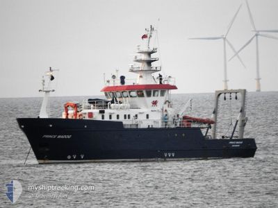
PRINCE MADOG
Other Type
Current Trip
| Time Travelled | 54 days |
|---|---|
| Remaining Time | --- |
| Distance Travelled | 311.21 nm |
| Remaining Distance | --- |
| AVG Speed | 10.1 Knots |
| MAX Speed | 15.9 Knots |
| AVG Wind | 10.3 knots |
| MAX Wind | 19.8 knots |
| MIN Temp | 6.5°C / 43.7°F |
| MAX Temp | 20.3°C / 68.54°F |
| Draught | 3.8 m |
| Position Received | 1 d ago |
Current Position
| Longitude | -6.95885° |
|---|---|
| Latitude | 55.92403° |
| Status | Under way using engine |
| Speed | 12.2 Knots |
| Course | 332.1° |
| Area | Inner Seas off the West Coast of Scotland |
| Station | T-AIS |
| Position Received | 1 d ago |
Info
Information
The current position of PRINCE MADOG is in Inner Seas off the West Coast of Scotland with coordinates 55.92403° / -6.95885° as reported on 2024-05-12 05:27 by AIS to our vessel tracker app. The vessel's current speed is 12.2 Knots
The vessel PRINCE MADOG (IMO: 922961100, MMSI: 235234000) is a Other Type It's sailing under the flag of [GB] United Kingdom.
In this page you can find informations about the vessels current position, last detected port calls, and current voyage information. If the vessels is not in coverage by AIS you will find the latest position.
The current position of PRINCE MADOG is detected by our AIS receivers and we are not responsible for the reliability of the data. The last position was recorded while the vessel was in Coverage by the Ais receivers of our vessel tracking app.
The current draught of PRINCE MADOG as reported by AIS is 3.8 meters
Weather
| Temperature | 11°C / 51.8°F |
|---|---|
| Wind Speed | 16 knots |
| Direction | 144° SE |
| Pressure | 1012.3 hPa |
| Humidity | 90.7 % |
| Cloud Coverage | 90 % |
Featured Company
Most Visited Ports (Last year)
| Port | Arrivals | |
|---|---|---|
| 4 | ||
| 1 | ||
| 1 | ||
| 1 |
Events
| Time | Event | Details | Position / Dest | Info |
|---|---|---|---|---|
| 2024-05-12 05:27 | OUT of Coverage |
55.92403 / -6.95885
Inner Seas off the West Coast of Scotland
GBLMA
|
Speed: 12.2 kn Course: 332.1° |
|
| 2024-05-11 18:46 | Change Sea Area | United Kingdom part of the Inner Seas off the West Coast of Scotland United Kingdom part of the Irish Sea and St. George's Channel |
54.46759 / -5.26043
Inner Seas off the West Coast of Scotland
GBLMA
|
Speed: 10.4 kn Course: 335.5° |
| 2024-05-11 17:51 | ETA Changed | 2024/05/13 14:00 2024/05/12 22:00 |
54.32281 / -5.13597
GBLMA
|
Speed: 10.5 kn Course: 337.8° |
| 2024-05-11 16:27 | ETA Changed | 2024/05/12 22:00 2024/03/30 10:00 |
54.08982 / -4.96796
GBLMA
|
Speed: 11.5 kn Course: 336° |
| 2024-05-11 16:27 | Destination Changed | GBLMA GBMEB |
54.08982 / -4.96796
GBLMA
|
Speed: 11.5 kn Course: 336° |
| 2024-05-11 16:27 | IN Coverage |
54.09461 / -4.97140
Irish Sea and St. George's Channel
GBLMA
|
Speed: 11.5 kn Course: 336.7° |
|
| 2024-05-11 13:29 | OUT of Coverage |
53.64605 / -4.45014
Irish Sea and St. George's Channel
|
Speed: 10.3 kn Course: 323.4° |
|
| 2024-05-11 13:28 | IN Coverage |
53.64605 / -4.45014
Irish Sea and St. George's Channel
|
Speed: 10.3 kn Course: 323.4° |
|
| 2024-05-11 10:17 | OUT of Coverage |
53.30093 / -4.03690
Irish Sea and St. George's Channel
|
Speed: 7.3 kn Course: 26.6° |
|
| 2024-05-11 09:29 | IN Coverage |
53.23718 / -4.13778
Irish Sea and St. George's Channel
|
Speed: 9.5 kn Course: 45.1° |