
PRAIRIE
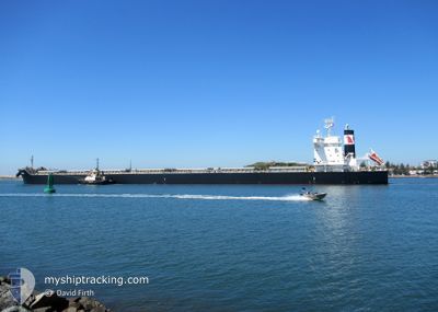
Cargo
Current Trip
| Time Travelled | 5 days |
|---|---|
| Remaining Time | --- |
| Distance Travelled | 1707.32 nm |
| Remaining Distance | --- |
| AVG Speed | 12.6 Knots |
| MAX Speed | 15.4 Knots |
| AVG Wind | 14.6 knots |
| MAX Wind | 29 knots |
| MIN Temp | 5.8°C / 42.44°F |
| MAX Temp | 16.4°C / 61.52°F |
| Draught | 7.9 m |
| Position Received | 1 d ago |
Current Position
| Longitude | --- |
|---|---|
| Latitude | --- |
| Status | Under way using engine |
| Speed | 11.8 Knots |
| Course | 247.7° |
| Area | North Atlantic Ocean |
| Station | T-AIS |
| Position Received | 1 d ago |
Info
Information
The current position of PRAIRIE is in North Atlantic Ocean with coordinates 44.67432° / -24.86534° as reported on 2025-03-02 15:28 by AIS to our vessel tracker app. The vessel's current speed is 11.8 Knots and is heading at the port of TERNEUZEN. The estimated time of arrival as calculated by MyShipTracking vessel tracking app is 2025-03-10 19:00 LT
The vessel PRAIRIE (IMO: 9860506, MMSI: 538008657) is a Cargo It's sailing under the flag of [MH] Marshall Is.
In this page you can find informations about the vessels current position, last detected port calls, and current voyage information. If the vessels is not in coverage by AIS you will find the latest position.
The current position of PRAIRIE is detected by our AIS receivers and we are not responsible for the reliability of the data. The last position was recorded while the vessel was in Coverage by the Ais receivers of our vessel tracking app.
The current draught of PRAIRIE as reported by AIS is 7.9 meters
Weather
| Temperature | 15.9°C / 60.62°F |
|---|---|
| Wind Speed | 15 knots |
| Direction | 223° SW |
| Pressure | 1023.9 hPa |
| Humidity | 91.5 % |
| Cloud Coverage | 100 % |
Featured Company
Last Port Calls
| Port | Arrival | Departure | Time In Port |
|---|---|---|---|
| 2025-02-23 07:23 | 2025-02-26 07:28 | 3 d | |
| 2025-02-18 20:01 | 2025-02-21 13:47 | 2 d | |
| 2025-02-02 13:13 | 2025-02-07 13:45 | 5 d |
Most Visited Ports (Last year)
| Port | Arrivals | |
|---|---|---|
| 3 | ||
| 2 | ||
| 2 | ||
| 2 | ||
| 2 | ||
| 1 |
Last Trips
| Origin | Departure | Destination | Arrival | Distance | |
|---|---|---|---|---|---|
| 2025-02-21 14:47 | 2025-02-23 08:23 | 68.54 nm | |||
| 2025-02-07 14:45 | 2025-02-18 21:01 | 1026.10 nm | |||
| 2024-12-06 11:31 | 2025-02-02 14:13 | 8398.65 nm |
Events
| Time | Event | Details | Position / Dest | Info |
|---|---|---|---|---|
| 2025-03-02 15:43 | Status Changed | Default Under way using engine |
44.65526 / -24.92757
FOR ORDER
|
Speed: 11.8 kn Course: 247.7° |
| 2025-03-02 15:28 | OUT of Coverage |
44.67432 / -24.86534
North Atlantic Ocean
FOR ORDER
|
Speed: 11.8 kn Course: 247.7° |
|
| 2025-03-02 14:49 | Status Changed | Under way using engine Default |
44.72425 / -24.70157
FOR ORDER
|
Speed: 11.7 kn Course: 248° |
| 2025-03-02 14:00 | Status Changed | Default Under way using engine |
44.78875 / -24.49298
FOR ORDER
|
Speed: 12 kn Course: 248.6° |
| 2025-03-02 13:34 | Status Changed | Under way using engine Default |
44.82109 / -24.37875
FOR ORDER
|
Speed: 11.8 kn Course: 249° |
| 2025-03-02 13:28 | Status Changed | Default Under way using engine |
44.82720 / -24.35646
FOR ORDER
|
Speed: 11.9 kn Course: 251° |
| 2025-03-02 13:12 | Status Changed | Under way using engine Default |
44.84607 / -24.28402
FOR ORDER
|
Speed: 11.9 kn Course: 249° |
| 2025-03-02 12:49 | Status Changed | Default Under way using engine |
44.87244 / -24.18481
FOR ORDER
|
Speed: 12.2 kn Course: 248.1° |
| 2025-03-02 12:43 | Status Changed | Under way using engine Default |
44.88009 / -24.15863
FOR ORDER
|
Speed: 12.2 kn Course: 246° |
| 2025-03-02 12:38 | Status Changed | Default Under way using engine |
44.88642 / -24.13741
FOR ORDER
|
Speed: 12.2 kn Course: 246.3° |