
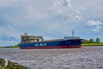
POSIDANA
General Cargo
Current Trip
| Time Travelled | 14 h, 2 mins |
|---|---|
| Remaining Time | --- |
| Distance Travelled | 82.98 nm |
| Remaining Distance | --- |
| AVG Speed | 9.6 Knots |
| MAX Speed | 11.9 Knots |
| AVG Wind | 5.5 knots |
| MAX Wind | 9.6 knots |
| MIN Temp | 6.8°C / 44.24°F |
| MAX Temp | 18.1°C / 64.58°F |
| Draught | 8.9 m |
| Position Received | 6 m ago |
Current Position
| Longitude | -75.23114° |
|---|---|
| Latitude | 39.85703° |
| Status | At anchor |
| Speed | 0.3 Knots |
| Course | 88° |
| Area | North Atlantic Ocean |
| Station | T-AIS |
| Position Received | 6 m ago |
Info
Information
The current position of POSIDANA is in North Atlantic Ocean with coordinates 39.85703° / -75.23114° as reported on 2024-05-13 15:41 by AIS to our vessel tracker app. The vessel's current speed is 0.3 Knots
The vessel POSIDANA (IMO: 9371086, MMSI: 257516000) is a General Cargo that was built in 2008 ( 16 years old ). It's sailing under the flag of [NO] Norway.
In this page you can find informations about the vessels current position, last detected port calls, and current voyage information. If the vessels is not in coverage by AIS you will find the latest position.
The current position of POSIDANA is detected by our AIS receivers and we are not responsible for the reliability of the data. The last position was recorded while the vessel was in Coverage by the Ais receivers of our vessel tracking app.
The current draught of POSIDANA as reported by AIS is 8.9 meters
Weather
| Temperature | 17°C / 62.6°F |
|---|---|
| Wind Speed | 7 knots |
| Direction | 230° SW |
| Pressure | 1018.8 hPa |
| Humidity | 65.1 % |
| Cloud Coverage | 39 % |
Featured Company
Last Port Calls
| Port | Arrival | Departure | Time In Port |
|---|---|---|---|
| 2024-05-12 11:28 | 2024-05-12 21:46 | 10 h | |
| 2024-04-27 17:41 | 2024-04-28 15:10 | 21 h | |
| 2024-04-21 00:50 | 2024-04-25 18:19 | 4 d | |
| 2024-04-15 12:19 | 2024-04-19 05:52 | 3 d | |
| 2024-04-10 04:46 | 2024-04-11 22:27 | 1 d | |
| 2024-04-05 07:13 | 2024-04-09 01:33 | 3 d | |
| 2024-03-13 18:09 | |||
| 2024-03-06 23:58 |
Last Trips
| Origin | Departure | Destination | Arrival | Distance | |
|---|---|---|---|---|---|
| 2024-04-28 15:10 | 2024-05-12 11:28 | 3962.55 nm | |||
| 2024-04-25 18:19 | 2024-04-27 17:41 | 467.28 nm | |||
| 2024-04-19 05:52 | 2024-04-21 00:50 | 469.79 nm | |||
| 2024-04-11 22:27 | 2024-04-15 12:19 | 1070.16 nm | |||
| 2024-04-09 01:33 | 2024-04-10 04:46 | 71.99 nm | |||
| 2024-03-06 23:58 | 2024-03-13 18:09 | 1315.69 nm |
Events
| Time | Event | Details | Position / Dest | Info |
|---|---|---|---|---|
| 2024-05-13 10:32 | Status Changed | At anchor Under way using engine |
39.85769 / -75.23105
USPHI
|
Speed: 0.2 kn Course: 79° |
| 2024-05-13 10:32 | ETA Changed | 2024/05/13 06:30 2024/05/13 11:00 |
39.85769 / -75.23105
USPHI
|
Speed: 0.2 kn Course: 79° |
| 2024-05-13 10:30 | STOP Moving | 0.88 nm, North East of PAULSBORO |
39.85759 / -75.23086
USPHI
|
Speed: 0.3 kn Course: 81° |
| 2024-05-13 09:23 | Status Changed | Under way using engine Default |
39.80597 / -75.41200
USPHI
|
Speed: 7.9 kn Course: 59° |
| 2024-05-13 09:22 | Status Changed | Default Under way using engine |
39.80543 / -75.41318
USPHI
|
Speed: 7.9 kn Course: 59.2° |
| 2024-05-13 09:22 | Status Changed | Under way using engine Default |
39.80522 / -75.41363
USPHI
|
Speed: 8.6 kn Course: 60° |
| 2024-05-13 09:15 | Status Changed | Default Under way using engine |
39.79580 / -75.43463
USPHI
|
Speed: 10.9 kn Course: 56.2° |
| 2024-05-13 09:03 | Status Changed | Under way using engine Default |
39.77209 / -75.46972
USPHI
|
Speed: 11.2 kn Course: 40° |
| 2024-05-13 08:46 | IN Coverage |
39.77209 / -75.46972
North Atlantic Ocean
USPHI
|
Speed: 11.2 kn Course: 34.5° |
|
| 2024-05-13 03:34 | OUT of Coverage |
39.28050 / -76.23029
North Atlantic Ocean
USPHI
|
Speed: 11.2 kn Course: 14.8° |