
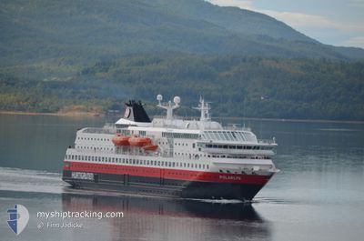
MS POLARLYS
Ro-Ro/Passenger Ship
Current Trip
| Time Travelled | 2 h, 41 mins |
|---|---|
| Remaining Time | 2 days |
| Distance Travelled | 40.60 nm |
| Remaining Distance | 808.03 nm |
| AVG Speed | 15.4 Knots |
| MAX Speed | 16.3 Knots |
| AVG Wind | 7.8 knots |
| MAX Wind | 13 knots |
| MIN Temp | -6.4°C / 20.48°F |
| MAX Temp | 1.5°C / 34.7°F |
| Draught | 5 m |
| Position Received | 2 m ago |
Current Position
| Longitude | --- |
|---|---|
| Latitude | --- |
| Status | Under way using engine |
| Speed | 14.6 Knots |
| Course | 23° |
| Area | Norwegian Sea |
| Station | T-AIS |
| Position Received | 2 m ago |
Info
Information
The current position of MS POLARLYS is in Norwegian Sea with coordinates 63.77777° / 9.55362° as reported on 2025-12-23 14:52 by AIS to our vessel tracker app. The vessel's current speed is 14.6 Knots and is heading at the port of KIRKENES. The estimated time of arrival as calculated by MyShipTracking vessel tracking app is 2025-12-25 18:45 LT
The vessel MS POLARLYS (IMO: 9107796, MMSI: 259322000) is a Ro-Ro/Passenger Ship that was built in 1996 ( 29 years old ). It's sailing under the flag of [NO] Norway.
In this page you can find informations about the vessels current position, last detected port calls, and current voyage information. If the vessels is not in coverage by AIS you will find the latest position.
The current position of MS POLARLYS is detected by our AIS receivers and we are not responsible for the reliability of the data. The last position was recorded while the vessel was in Coverage by the Ais receivers of our vessel tracking app.
The current draught of MS POLARLYS as reported by AIS is 5 meters
Weather
| Temperature | 1.3°C / 34.34°F |
|---|---|
| Wind Speed | 13 knots |
| Direction | 155° SSE |
| Pressure | 1033.1 hPa |
| Humidity | 71.8 % |
| Cloud Coverage | 51 % |
Featured Company
Last Port Calls
| Port | Arrival | Departure | Time In Port |
|---|---|---|---|
| 2025-12-23 10:05 | 2025-12-23 13:14 | 3 h | |
| 2025-12-23 02:39 | 2025-12-23 03:06 | 26 m | |
| 2025-12-22 22:38 | 2025-12-22 23:04 | 25 m | |
| 2025-12-22 09:43 | 2025-12-22 20:02 | 10 h | |
| 2025-12-22 05:08 | 2025-12-22 05:22 | 14 m | |
| 2025-12-22 02:42 | 2025-12-22 02:59 | 16 m | |
| 2025-12-21 14:31 | 2025-12-21 20:38 | 6 h | |
| 2025-12-21 08:13 | 2025-12-21 08:31 | 18 m | |
| 2025-12-21 05:51 | 2025-12-21 06:10 | 18 m | |
| 2025-12-21 00:29 | 2025-12-21 01:18 | 48 m |
Last Trips
| Origin | Departure | Destination | Arrival | Distance | |
|---|---|---|---|---|---|
| 2025-12-23 03:06 | 2025-12-23 10:05 | 92.52 nm | |||
| 2025-12-22 23:04 | 2025-12-23 02:39 | 48.72 nm | |||
| 2025-12-22 20:02 | 2025-12-22 22:38 | 34.64 nm | |||
| 2025-12-22 05:22 | 2025-12-22 09:43 | 54.44 nm | |||
| 2025-12-22 02:59 | 2025-12-22 05:08 | 26.88 nm | |||
| 2025-12-21 20:38 | 2025-12-22 02:42 | 87.02 nm | |||
| 2025-12-21 08:31 | 2025-12-21 14:31 | 83.00 nm | |||
| 2025-12-21 06:10 | 2025-12-21 08:13 | 27.47 nm | |||
| 2025-12-21 01:18 | 2025-12-21 05:51 | 52.90 nm | |||
| 2025-12-20 21:48 | 2025-12-21 00:29 | 34.66 nm |
Events
| Time | Event | Details | Position / Dest | Info |
|---|---|---|---|---|
| 2025-12-23 12:14 | PORT DEPARTURE |
|
63.44643 / 10.40034
NO KKN
|
Speed: 8.6 kn Course: 269° |
| 2025-12-23 12:13 | START Moving |
63.44543 / 10.40622
[NO] TRONDHEIM
|
Speed: 6.1 kn Course: 308° |
|
| 2025-12-23 09:09 | STOP Moving |
63.44352 / 10.40747
[NO] TRONDHEIM
|
Speed: 0.2 kn Course: 8° |
|
| 2025-12-23 09:05 | PORT ARRIVAL |
|
63.44532 / 10.40861
[NO] TRONDHEIM
|
Speed: 1.2 kn Course: 37° |
| 2025-12-23 08:53 | START Moving | 1.44 nm, North West of TRONDHEIM |
63.45080 / 10.34626
NO KKN
|
Speed: 3.3 kn Course: 114° |
| 2025-12-23 08:43 | STOP Moving | 1.56 nm, North West of TRONDHEIM |
63.45119 / 10.34122
NO KKN
|
Speed: 0.3 kn Course: 115° |
| 2025-12-23 02:06 | PORT DEPARTURE |
|
63.10007 / 7.74913
NO KKN
|
Speed: 10.6 kn Course: 156° |
| 2025-12-23 02:02 | START Moving |
63.11185 / 7.74093
[NO] KRISTIANSUND
|
Speed: 5.7 kn Course: 152° |
|
| 2025-12-23 01:48 | STOP Moving |
63.11472 / 7.73716
[NO] KRISTIANSUND
|
Speed: 0.2 kn Course: 340° |
|
| 2025-12-23 01:39 | PORT ARRIVAL |
|
63.10268 / 7.74869
[NO] KRISTIANSUND
|
Speed: 11.1 kn Course: 51.3° |