
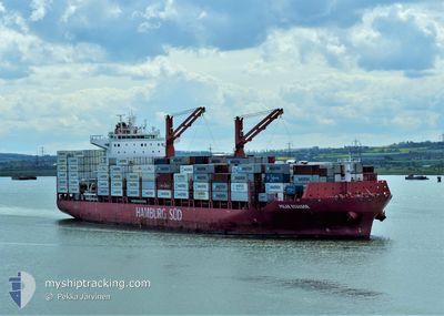
POLAR ECUADOR
Cargo A
Current Trip
| Time Travelled | 5 days |
|---|---|
| Remaining Time | --- |
| Distance Travelled | 2266.99 nm |
| Remaining Distance | --- |
| AVG Speed | 17.1 Knots |
| MAX Speed | 18.6 Knots |
| AVG Wind | 16.2 knots |
| MAX Wind | 22.8 knots |
| MIN Temp | 23.8°C / 74.84°F |
| MAX Temp | 27.8°C / 82.04°F |
| Draught | 12 m |
| Position Received | 2 d ago |
Current Position
| Longitude | --- |
|---|---|
| Latitude | --- |
| Status | Under way using engine |
| Speed | 17 Knots |
| Course | 76° |
| Area | Caribbean Sea |
| Station | T-AIS |
| Position Received | 2 d ago |
Info
Information
The current position of POLAR ECUADOR is in Caribbean Sea with coordinates 15.07438° / -61.30948° as reported on 2025-12-08 18:57 by AIS to our vessel tracker app. The vessel's current speed is 17 Knots and is heading at the port of BALBOA. The estimated time of arrival as calculated by MyShipTracking vessel tracking app is 2025-12-03 09:00 LT
The vessel POLAR ECUADOR (IMO: 9786774, MMSI: 563050500) is a Cargo A It's sailing under the flag of [SG] Singapore.
In this page you can find informations about the vessels current position, last detected port calls, and current voyage information. If the vessels is not in coverage by AIS you will find the latest position.
The current position of POLAR ECUADOR is detected by our AIS receivers and we are not responsible for the reliability of the data. The last position was recorded while the vessel was in Coverage by the Ais receivers of our vessel tracking app.
The current draught of POLAR ECUADOR as reported by AIS is 12 meters
Weather
| Temperature | 25.5°C / 77.9°F |
|---|---|
| Wind Speed | 20 knots |
| Direction | 79° E |
| Pressure | 1024.2 hPa |
| Humidity | 74.1 % |
| Cloud Coverage | 43 % |
Featured Company
Last Port Calls
| Port | Arrival | Departure | Time In Port |
|---|---|---|---|
| 2025-12-04 18:31 | 2025-12-05 18:31 | 1 d | |
| 2025-12-03 10:49 | 2025-12-04 02:31 | 15 h | |
| 2025-11-29 02:57 | 2025-11-29 17:46 | 14 h | |
| 2025-11-25 19:34 | 2025-11-27 03:55 | 1 d | |
| 2025-11-23 23:01 | 2025-11-24 15:54 | 16 h | |
| 2025-11-20 19:51 | 2025-11-21 20:19 | 1 d | |
| 2025-11-15 09:21 | 2025-11-15 23:36 | 14 h | |
| 2025-11-04 01:13 | 2025-11-04 15:02 | 13 h | |
| 2025-10-27 15:29 | 2025-10-28 10:09 | 18 h | |
| 2025-10-25 23:52 | 2025-10-26 22:53 | 23 h |
Most Visited Ports (Last year)
| Port | Arrivals | |
|---|---|---|
| 17 | ||
| 16 | ||
| 11 | ||
| 11 | ||
| 9 | ||
| 8 |
Last Trips
| Origin | Departure | Destination | Arrival | Distance | |
|---|---|---|---|---|---|
| 2025-12-04 02:31 | 2025-12-04 18:31 | 48.18 nm | |||
| 2025-11-29 17:46 | 2025-12-03 10:49 | 854.03 nm | |||
| 2025-11-27 03:55 | 2025-11-29 02:57 | 782.66 nm | |||
| 2025-11-24 15:54 | 2025-11-25 19:34 | 365.74 nm | |||
| 2025-11-21 20:19 | 2025-11-23 23:01 | 428.71 nm | |||
| 2025-11-15 23:36 | 2025-11-20 19:51 | 1972.96 nm | |||
| 2025-11-04 15:02 | 2025-11-15 09:21 | 3749.62 nm | |||
| 2025-10-28 10:09 | 2025-11-04 01:13 | 1902.93 nm | |||
| 2025-10-26 22:53 | 2025-10-27 15:29 | 79.62 nm | |||
| 2025-10-24 03:56 | 2025-10-25 23:52 | 85.96 nm |
Events
| Time | Event | Details | Position / Dest | Info |
|---|---|---|---|---|
| 2025-12-08 19:00 | Status Changed | Default Under way using engine |
15.07833 / -61.29500
PABLB
|
Speed: 17 kn Course: 76° |
| 2025-12-08 18:57 | Status Changed | Under way using engine Default |
15.07438 / -61.30948
PABLB
|
Speed: 17 kn Course: 76° |
| 2025-12-08 18:57 | OUT of Coverage |
15.07438 / -61.30948
Caribbean Sea
|
Speed: 17 kn Course: 76° |
|
| 2025-12-08 18:51 | Status Changed | Default Under way using engine |
15.06833 / -61.33833
PABLB
|
Speed: 17 kn Course: 76° |
| 2025-12-08 18:50 | Status Changed | Under way using engine Default |
15.06605 / -61.34485
PABLB
|
Speed: 17.3 kn Course: 76° |
| 2025-12-08 18:16 | Status Changed | Default Under way using engine |
15.02750 / -61.50985
PABLB
|
Speed: 17 kn Course: 76° |
| 2025-12-08 18:13 | Status Changed | Under way using engine Default |
15.02503 / -61.52033
PABLB
|
Speed: 17.1 kn Course: 77° |
| 2025-12-08 17:54 | IN Coverage |
15.02503 / -61.52033
Caribbean Sea
|
Speed: 17 kn Course: 76° |
|
| 2025-12-08 17:12 | Status Changed | Default Under way using engine |
14.95667 / -61.81167
PABLB
|
Speed: 16 kn Course: 77° |
| 2025-12-08 17:09 | OUT of Coverage |
14.95356 / -61.82485
Caribbean Sea
|
Speed: 16 kn Course: 77° |