
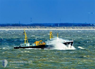
LOODSBOOT 7 PILOT
Pilot Ship
Current Trip
OOSTENDE
| Time Travelled | 2 days |
|---|---|
| Remaining Time | --- |
| Distance Travelled | 220.98 nm |
| Remaining Distance | --- |
| AVG Speed | 10.6 Knots |
| MAX Speed | 16.4 Knots |
| AVG Wind | 9.5 knots |
| MAX Wind | 12.8 knots |
| MIN Temp | 12.9°C / 55.22°F |
| MAX Temp | 21.7°C / 71.06°F |
| Draught | 3.6 m |
| Position Received | 2 m ago |
Current Position
| Longitude | 3.59763° |
|---|---|
| Latitude | 51.44134° |
| Status | Moored |
| Speed | |
| Course | 293° |
| Area | North Sea |
| Station | T-AIS |
| Position Received | 2 m ago |
Info
Information
The current position of LOODSBOOT 7 PILOT is in North Sea with coordinates 51.44134° / 3.59763° as reported on 2024-05-13 19:57 by AIS to our vessel tracker app. The vessel's current speed is 0 Knots
The vessel LOODSBOOT 7 PILOT (IMO: 8424927, MMSI: 205110000) is a Pilot Ship that was built in 1978 ( 46 years old ). It's sailing under the flag of [BE] Belgium.
In this page you can find informations about the vessels current position, last detected port calls, and current voyage information. If the vessels is not in coverage by AIS you will find the latest position.
The current position of LOODSBOOT 7 PILOT is detected by our AIS receivers and we are not responsible for the reliability of the data. The last position was recorded while the vessel was in Coverage by the Ais receivers of our vessel tracking app.
The current draught of LOODSBOOT 7 PILOT as reported by AIS is 3.6 meters
Weather
| Temperature | 18°C / 64.4°F |
|---|---|
| Wind Speed | 8 knots |
| Direction | 156° SSE |
| Pressure | 1006.9 hPa |
| Humidity | 80.8 % |
| Cloud Coverage | 92 % |
Featured Company
Last Port Calls
| Port | Arrival | Departure | Time In Port |
|---|---|---|---|
| 2024-05-10 16:33 | 2024-05-11 12:00 | 19 h | |
| 2024-05-01 15:58 | 2024-05-10 06:03 | 8 d | |
| 2024-04-25 12:47 | 2024-04-26 05:59 | 17 h | |
| 2024-04-23 17:47 | 2024-04-25 11:11 | 1 d | |
| 2024-04-23 11:26 | 2024-04-23 15:59 | 4 h | |
| 2024-04-18 12:07 | 2024-04-19 06:04 | 17 h | |
| 2024-04-17 17:59 | 2024-04-18 10:15 | 16 h | |
| 2024-04-17 13:12 | 2024-04-17 16:16 | 3 h | |
| 2024-04-17 11:27 | 2024-04-17 11:35 | 8 m | |
| 2024-04-17 08:36 | 2024-04-17 09:03 | 26 m |
Most Visited Ports (Last year)
| Port | Arrivals | |
|---|---|---|
| 109 | ||
| 1 |
Last Trips
| Origin | Departure | Destination | Arrival | Distance | |
|---|---|---|---|---|---|
| 2024-05-10 06:03 | 2024-05-10 16:33 | 50.09 nm | |||
| 2024-04-26 05:59 | 2024-05-01 15:58 | 223.59 nm | |||
| 2024-04-25 11:11 | 2024-04-25 12:47 | 18.92 nm | |||
| 2024-04-23 15:59 | 2024-04-23 17:47 | 20.13 nm | |||
| 2024-04-19 06:04 | 2024-04-23 11:26 | 148.89 nm | |||
| 2024-04-18 10:15 | 2024-04-18 12:07 | 18.36 nm | |||
| 2024-04-17 16:16 | 2024-04-17 17:59 | 19.76 nm | |||
| 2024-04-17 11:35 | 2024-04-17 13:12 | 18.92 nm | |||
| 2024-04-17 09:03 | 2024-04-17 11:27 | 25.21 nm | |||
| 2024-04-12 14:54 | 2024-04-17 08:36 | 208.30 nm |
Events
| Time | Event | Details | Position / Dest | Info |
|---|---|---|---|---|
| 2024-05-13 07:25 | STOP Moving | 0.45 nm, South East of VLISSINGEN STATION |
51.44134 / 3.59767
OOSTENDE
|
Speed: 0.1 kn Course: 289° |
| 2024-05-13 06:26 | Change Sea Area | Dutch part of the North Sea Belgian part of the North Sea |
51.39955 / 3.34037
North Sea
|
Speed: 12.6 kn Course: 78.2° |
| 2024-05-13 03:05 | Change Sea Area | Belgian part of the North Sea Dutch part of the North Sea |
51.40090 / 3.32549
North Sea
|
Speed: 10.1 kn Course: 252.5° |
| 2024-05-13 01:58 | START Moving | 0.49 nm, South East of VLISSINGEN STATION |
51.44201 / 3.60039
OOSTENDE
|
Speed: 5.5 kn Course: 140.8° |
| 2024-05-12 15:25 | STOP Moving | 0.45 nm, South East of VLISSINGEN STATION |
51.44131 / 3.59769
OOSTENDE
|
Speed: Course: 294° |
| 2024-05-12 14:29 | Change Sea Area | Dutch part of the North Sea Belgian part of the North Sea |
51.40198 / 3.35247
North Sea
|
Speed: 15.2 kn Course: 82.6° |
| 2024-05-12 11:20 | Change Sea Area | Belgian part of the North Sea Dutch part of the North Sea |
51.39986 / 3.32816
North Sea
|
Speed: 13.4 kn Course: 264.9° |
| 2024-05-12 10:26 | START Moving | 0.51 nm, South East of VLISSINGEN STATION |
51.44172 / 3.60058
OOSTENDE
|
Speed: 6 kn Course: 149.2° |
| 2024-05-12 07:50 | STOP Moving | 0.45 nm, South East of VLISSINGEN STATION |
51.44137 / 3.59769
OOSTENDE
|
Speed: Course: 294° |
| 2024-05-12 06:34 | Change Sea Area | Dutch part of the North Sea Belgian part of the North Sea |
51.40083 / 3.34874
North Sea
|
Speed: 11.2 kn Course: 82.3° |