
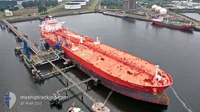
PHILOTIMOS
Tanker
Current Trip
| Time Travelled | 8 days |
|---|---|
| Remaining Time | --- |
| Distance Travelled | 2300.83 nm |
| Remaining Distance | --- |
| AVG Speed | 11.6 Knots |
| MAX Speed | 13.7 Knots |
| AVG Wind | 16.7 knots |
| MAX Wind | 26.8 knots |
| MIN Temp | 12.1°C / 53.78°F |
| MAX Temp | 20.2°C / 68.36°F |
| Draught | 9 m |
| Position Received | 7 d ago |
Current Position
| Longitude | -5.25479° |
|---|---|
| Latitude | 49.51127° |
| Status | Under way using engine |
| Speed | 12.5 Knots |
| Course | 246.4° |
| Area | English Channel |
| Station | T-AIS |
| Position Received | 7 d ago |
Info
Information
The current position of PHILOTIMOS is in English Channel with coordinates 49.51127° / -5.25479° as reported on 2024-05-30 00:02 by AIS to our vessel tracker app. The vessel's current speed is 12.5 Knots and is heading at the port of HOUSTON. The estimated time of arrival as calculated by MyShipTracking vessel tracking app is 2024-06-14 07:00 LT
The vessel PHILOTIMOS (IMO: 9793997, MMSI: 248851000) is a Tanker It's sailing under the flag of [MT] Malta.
In this page you can find informations about the vessels current position, last detected port calls, and current voyage information. If the vessels is not in coverage by AIS you will find the latest position.
The current position of PHILOTIMOS is detected by our AIS receivers and we are not responsible for the reliability of the data. The last position was recorded while the vessel was in Coverage by the Ais receivers of our vessel tracking app.
The current draught of PHILOTIMOS as reported by AIS is 9 meters
Weather
| Temperature | 20.5°C / 68.9°F |
|---|---|
| Wind Speed | 16 knots |
| Direction | 189° S |
| Pressure | 1012.9 hPa |
| Humidity | 73.2 % |
| Cloud Coverage | 9 % |
Featured Company
Last Port Calls
| Port | Arrival | Departure | Time In Port |
|---|---|---|---|
| 2024-05-27 04:59 | 2024-05-28 11:30 | 1 d | |
| 2024-04-26 23:04 | 2024-04-28 18:21 | 1 d | |
| 2024-04-06 11:47 | 2024-04-07 23:07 | 1 d |
Most Visited Ports (Last year)
| Port | Arrivals | |
|---|---|---|
| 2 | ||
| 2 | ||
| 1 | ||
| 1 | ||
| 1 | ||
| 1 |
Events
| Time | Event | Details | Position / Dest | Info |
|---|---|---|---|---|
| 2024-05-30 00:08 | Status Changed | Default Under way using engine |
49.50364 / -5.28177
USHOU
|
Speed: 12.5 kn Course: 246.4° |
| 2024-05-30 00:02 | Status Changed | Under way using engine Default |
49.51127 / -5.25479
USHOU
|
Speed: 12.5 kn Course: 246° |
| 2024-05-30 00:02 | OUT of Coverage |
49.51127 / -5.25479
English Channel
USHOU
|
Speed: 12.5 kn Course: 246.4° |
|
| 2024-05-29 23:36 | Status Changed | Default Under way using engine |
49.54236 / -5.13056
USHOU
|
Speed: 12 kn Course: 253.2° |
| 2024-05-29 23:21 | Status Changed | Under way using engine Default |
49.55553 / -5.06053
USHOU
|
Speed: 12 kn Course: 254° |
| 2024-05-29 23:20 | Status Changed | Default Under way using engine |
49.55671 / -5.05406
USHOU
|
Speed: 11.9 kn Course: 254.6° |
| 2024-05-29 23:03 | Status Changed | Under way using engine Default |
49.57139 / -4.97316
USHOU
|
Speed: 11.8 kn Course: 254° |
| 2024-05-29 22:48 | IN Coverage |
49.56984 / -4.98188
English Channel
USHOU
|
Speed: 11.8 kn Course: 254.6° |
|
| 2024-05-29 21:50 | Status Changed | Default Under way using engine |
49.63691 / -4.63692
USHOU
|
Speed: 11.4 kn Course: 254.2° |
| 2024-05-29 21:45 | OUT of Coverage |
49.64150 / -4.61265
English Channel
USHOU
|
Speed: 11.4 kn Course: 254.2° |