
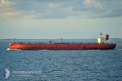
PEACE VICTORIA
Tanker
Current Trip
| Time Travelled | 3 days |
|---|---|
| Remaining Time | --- |
| Distance Travelled | 641.57 nm |
| Remaining Distance | --- |
| AVG Speed | 8.7 Knots |
| MAX Speed | 13 Knots |
| AVG Wind | 5.3 knots |
| MAX Wind | 17.8 knots |
| MIN Temp | 27.1°C / 80.78°F |
| MAX Temp | 32.3°C / 90.14°F |
| Draught | 8.2 m |
| Position Received | 5 h, 6 m ago |
Current Position
| Longitude | 56.68756° |
|---|---|
| Latitude | 24.74582° |
| Status | Under way using engine |
| Speed | 10.7 Knots |
| Course | 202.5° |
| Area | Gulf of Oman |
| Station | T-AIS |
| Position Received | 5 h, 6 m ago |
Info
Information
The current position of PEACE VICTORIA is in Gulf of Oman with coordinates 24.74582° / 56.68756° as reported on 2024-05-07 13:16 by AIS to our vessel tracker app. The vessel's current speed is 10.7 Knots
The vessel PEACE VICTORIA (IMO: 9771028, MMSI: 636019175) is a Tanker It's sailing under the flag of [LR] Liberia.
In this page you can find informations about the vessels current position, last detected port calls, and current voyage information. If the vessels is not in coverage by AIS you will find the latest position.
The current position of PEACE VICTORIA is detected by our AIS receivers and we are not responsible for the reliability of the data. The last position was recorded while the vessel was in Coverage by the Ais receivers of our vessel tracking app.
The current draught of PEACE VICTORIA as reported by AIS is 8.2 meters
Weather
| Temperature | 30.6°C / 87.08°F |
|---|---|
| Wind Speed | 1 knots |
| Direction | 300° WNW |
| Pressure | 1008 hPa |
| Humidity | 63 % |
| Cloud Coverage | 7 % |
Featured Company
Last Port Calls
| Port | Arrival | Departure | Time In Port |
|---|---|---|---|
| 2024-05-01 13:15 | 2024-05-04 15:01 | 3 d | |
| 2024-04-26 10:44 | 2024-04-29 06:36 | 2 d | |
| 2024-04-15 14:36 | 2024-04-18 10:47 | 2 d | |
| 2024-04-08 10:25 | 2024-04-10 23:09 | 2 d | |
| 2024-03-31 02:25 | 2024-04-01 22:49 | 1 d | |
| 2024-03-27 18:26 | 2024-03-29 06:40 | 1 d | |
| 2024-03-19 20:32 | 2024-03-20 21:40 | 1 d | |
| 2024-03-17 04:15 | 2024-03-19 01:24 | 1 d |
Most Visited Ports (Last year)
| Port | Arrivals | |
|---|---|---|
| 3 | ||
| 3 | ||
| 3 | ||
| 2 | ||
| 2 | ||
| 2 |
Last Trips
| Origin | Departure | Destination | Arrival | Distance | |
|---|---|---|---|---|---|
| 2024-04-29 10:36 | 2024-05-01 18:15 | 586.27 nm | |||
| 2024-04-18 15:47 | 2024-04-26 14:44 | 662.62 nm | |||
| 2024-04-11 03:09 | 2024-04-15 19:36 | 594.35 nm | |||
| 2024-04-02 01:49 | 2024-04-08 14:25 | 586.85 nm | |||
| 2024-03-29 09:40 | 2024-03-31 05:25 | 15.77 nm | |||
| 2024-03-21 01:40 | 2024-03-27 21:26 | 400.16 nm | |||
| 2024-03-19 05:24 | 2024-03-20 00:32 | 225.46 nm | |||
| 2024-02-28 21:33 | 2024-03-17 08:15 | 3684.62 nm |
Events
| Time | Event | Details | Position / Dest | Info |
|---|---|---|---|---|
| 2024-05-07 14:43 | STOP Moving | 6.45 nm, North of SOHAR |
24.61096 / 56.65686
OM SOH
|
Speed: 0.3 kn Course: 104° |
| 2024-05-07 13:24 | Status Changed | Default Under way using engine |
24.72321 / 56.67918
OM SOH
|
Speed: 10.7 kn Course: 202.5° |
| 2024-05-07 13:16 | OUT of Coverage |
24.74583 / 56.68756
Gulf of Oman
OM SOH
|
Speed: 10.7 kn Course: 202.5° |
|
| 2024-05-07 12:31 | ETA Changed | 2024/05/07 14:00 2024/05/07 03:00 |
24.86151 / 56.76348
OM SOH
|
Speed: 11 kn Course: 210.5° |
| 2024-05-07 12:24 | Destination Changed | OM SOH AE FJR |
24.87936 / 56.77408
OM SOH
|
Speed: 10.9 kn Course: 206.5° |
| 2024-05-07 11:19 | Change Sea Area | Omani part of the Gulf of Oman United Arab Emirates part of the Gulf of Oman |
25.05519 / 56.86733
Gulf of Oman
|
Speed: 10.8 kn Course: 204.6° |
| 2024-05-07 01:00 | Status Changed | Under way using engine Default |
25.11656 / 56.71887
AE FJR
|
Speed: 5.5 kn Course: 320° |
| 2024-05-07 00:56 | Status Changed | Default Under way using engine |
25.11303 / 56.72195
AE FJR
|
Speed: 6.8 kn Course: 317.5° |
| 2024-05-07 00:13 | Change Sea Area | United Arab Emirates part of the Gulf of Oman Omani part of the Gulf of Oman |
25.05172 / 56.78701
Gulf of Oman
AE FJR
|
Speed: 8.7 kn Course: 294.9° |
| 2024-05-06 21:31 | Draught Changed | 8.2 8.6 |
24.69626 / 57.15906
AE FJR
|
Speed: 12.2 kn Course: 312.8° |