
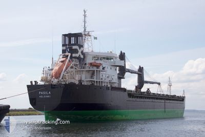
PASILA
General Cargo
Current Trip
| Trip Time | 5 days |
|---|---|
| Trip Distance | 859.16 nm |
| AVG Speed | 11.1 Knots |
| MAX Speed | 12.6 Knots |
| Draught | 8 m |
| AVG Wind | 15.3 knots |
| MAX Wind | 27 knots |
| MIN Temp | -0.6°C / 30.92°F |
| MAX Temp | 6.2°C / 43.16°F |
| Position Received | 5 d ago |
Current Position
| Longitude | --- |
|---|---|
| Latitude | --- |
| Status | Under way using engine |
| Speed | 12.3 Knots |
| Course | 18° |
| Area | Gulf of Bothnia |
| Station | T-AIS |
| Position Received | 5 d ago |
Info
Information
The current position of PASILA is in Gulf of Bothnia with coordinates 61.51538° / 19.50341° as reported on 2025-02-24 14:33 by AIS to our vessel tracker app. The vessel's current speed is 12.3 Knots and is currently inside the port of RONNSKAR.
The vessel PASILA (IMO: 9113018, MMSI: 230336000) is a General Cargo that was built in 1995 ( 30 years old ). It's sailing under the flag of [FI] Finland.
In this page you can find informations about the vessels current position, last detected port calls, and current voyage information. If the vessels is not in coverage by AIS you will find the latest position.
The current position of PASILA is detected by our AIS receivers and we are not responsible for the reliability of the data. The last position was recorded while the vessel was in Coverage by the Ais receivers of our vessel tracking app.
The current draught of PASILA as reported by AIS is 8 meters
Weather
| Temperature | 0.8°C / 33.44°F |
|---|---|
| Wind Speed | 9 knots |
| Direction | 235° SW |
| Pressure | 998.4 hPa |
| Humidity | 95.7 % |
| Cloud Coverage | 100 % |
Featured Company
Last Port Calls
| Port | Arrival | Departure | Time In Port |
|---|---|---|---|
| 2025-02-27 20:17 | |||
| 2025-02-22 04:02 | 2025-02-22 04:07 | 5 m | |
| 2025-02-20 13:51 | 2025-02-20 15:04 | 1 h | |
| 2025-02-17 09:35 | 2025-02-19 12:40 | 2 d | |
| 2025-01-30 14:48 | 2025-02-05 08:33 | 5 d | |
| 2025-01-19 12:24 | 2025-01-29 01:08 | 9 d |
Last Trips
| Origin | Departure | Destination | Arrival | Distance | |
|---|---|---|---|---|---|
| 2025-02-22 04:07 | 2025-02-27 20:17 | 859.16 nm | |||
| 2025-02-20 15:04 | 2025-02-22 04:02 | 58.72 nm | |||
| 2025-02-19 12:40 | 2025-02-20 13:51 | 202.26 nm | |||
| 2025-02-05 08:33 | 2025-02-17 09:35 | 2843.17 nm | |||
| 2025-01-29 01:08 | 2025-01-30 14:48 | 415.42 nm | |||
| 2024-12-31 10:17 | 2025-01-19 12:24 | 3207.94 nm |
Events
| Time | Event | Details | Position / Dest | Info |
|---|---|---|---|---|
| 2025-02-27 19:26 | STOP Moving |
64.67001 / 21.28403
[SE] RONNSKAR
|
Speed: 0.2 kn Course: 45° |
|
| 2025-02-27 19:17 | PORT ARRIVAL |
|
64.66935 / 21.28907
[SE] RONNSKAR
|
Speed: 2.5 kn Course: 289° |
| 2025-02-27 18:18 | START Moving | 4.89 nm, East of RONNSKAR |
64.66326 / 21.44371
SEROR
|
Speed: 3.5 kn Course: 215° |
| 2025-02-25 09:50 | STOP Moving | 5 nm, East of RONNSKAR |
64.67007 / 21.45045
SEROR
|
Speed: 0.1 kn Course: 192° |
| 2025-02-24 14:45 | Status Changed | Default Under way using engine |
61.55658 / 19.52360
SEROR
|
Speed: 12.3 kn Course: 18° |
| 2025-02-24 14:33 | OUT of Coverage |
61.51538 / 19.50341
Gulf of Bothnia
SEROR
|
Speed: 12.3 kn Course: 18° |
|
| 2025-02-24 14:26 | Status Changed | Under way using engine Default |
61.49300 / 19.49184
SEROR
|
Speed: 12.1 kn Course: 13° |
| 2025-02-24 14:02 | Status Changed | Default Under way using engine |
61.41254 / 19.45394
SEROR
|
Speed: 11.9 kn Course: 13° |
| 2025-02-24 13:42 | Status Changed | Under way using engine Default |
61.34985 / 19.42442
SEROR
|
Speed: 11.9 kn Course: 7° |
| 2025-02-24 13:41 | Status Changed | Default Under way using engine |
61.34714 / 19.42358
SEROR
|
Speed: 11.9 kn Course: 16° |