
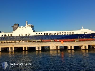
PAQIZE
Ro-Ro Cargo
Current Trip
| Time Travelled | 20 h, 23 mins |
|---|---|
| Remaining Time | --- |
| Distance Travelled | 0.32 nm |
| Remaining Distance | --- |
| AVG Speed | --- |
| MAX Speed | --- |
| AVG Wind | 8 knots |
| MAX Wind | 8 knots |
| MIN Temp | 11°C / 51.8°F |
| MAX Temp | 11°C / 51.8°F |
| Draught | 6.5 m |
| Position Received | 6 m ago |
Current Position
| Longitude | --- |
|---|---|
| Latitude | --- |
| Status | Moored |
| Speed | |
| Course | 330° |
| Area | Sea of Marmara |
| Station | T-AIS |
| Position Received | 6 m ago |
Info
Information
The current position of PAQIZE is in Sea of Marmara with coordinates 40.69351° / 29.42831° as reported on 2025-12-23 11:45 by AIS to our vessel tracker app. The vessel's current speed is 0 Knots
The vessel PAQIZE (IMO: 9457206, MMSI: 256263000) is a Ro-Ro Cargo that was built in 2010 ( 15 years old ). It's sailing under the flag of [MT] Malta.
In this page you can find informations about the vessels current position, last detected port calls, and current voyage information. If the vessels is not in coverage by AIS you will find the latest position.
The current position of PAQIZE is detected by our AIS receivers and we are not responsible for the reliability of the data. The last position was recorded while the vessel was in Coverage by the Ais receivers of our vessel tracking app.
The current draught of PAQIZE as reported by AIS is 6.5 meters
Weather
| Temperature | 10.6°C / 51.08°F |
|---|---|
| Wind Speed | 7 knots |
| Direction | 7° N |
| Pressure | 1017.4 hPa |
| Humidity | 89.1 % |
| Cloud Coverage | 99 % |
Featured Company
Last Port Calls
| Port | Arrival | Departure | Time In Port |
|---|---|---|---|
| 2025-12-21 21:32 | 2025-12-22 15:28 | 17 h | |
| 2025-12-17 06:22 | 2025-12-17 14:46 | 8 h | |
| 2025-12-13 01:21 | 2025-12-13 12:35 | 11 h | |
| 2025-12-09 09:00 | 2025-12-09 18:16 | 9 h | |
| 2025-12-05 22:07 | 2025-12-06 06:24 | 8 h | |
| 2025-12-04 12:36 | 2025-12-05 17:15 | 1 d | |
| 2025-11-30 09:31 | 2025-11-30 18:05 | 8 h | |
| 2025-11-26 03:35 | 2025-11-27 01:20 | 21 h | |
| 2025-11-22 03:05 | 2025-11-22 11:33 | 8 h | |
| 2025-11-17 23:30 | 2025-11-18 12:10 | 12 h |
Last Trips
| Origin | Departure | Destination | Arrival | Distance | |
|---|---|---|---|---|---|
| 2025-12-17 15:46 | 2025-12-22 00:32 | 1461.69 nm | |||
| 2025-12-13 15:35 | 2025-12-17 07:22 | 1460.39 nm | |||
| 2025-12-09 19:16 | 2025-12-13 04:21 | 1455.91 nm | |||
| 2025-12-06 09:24 | 2025-12-09 10:00 | 1393.98 nm | |||
| 2025-12-05 20:15 | 2025-12-06 01:07 | 72.88 nm | |||
| 2025-11-30 19:05 | 2025-12-04 15:36 | 1463.22 nm | |||
| 2025-11-27 04:20 | 2025-11-30 10:31 | 1460.78 nm | |||
| 2025-11-22 12:33 | 2025-11-26 06:35 | 1498.62 nm | |||
| 2025-11-18 15:10 | 2025-11-22 04:05 | 1502.89 nm | |||
| 2025-11-14 17:16 | 2025-11-18 02:30 | 1449.04 nm |
Events
| Time | Event | Details | Position / Dest | Info |
|---|---|---|---|---|
| 2025-12-22 21:34 | Status Changed | Moored Default |
40.69348 / 29.42829
TRYAL
|
Speed: Course: 329° |
| 2025-12-22 21:28 | Status Changed | Default Moored |
40.69346 / 29.42829
TRYAL
|
Speed: Course: 329° |
| 2025-12-22 20:45 | Status Changed | Moored Default |
40.69348 / 29.42828
TRYAL
|
Speed: Course: 329° |
| 2025-12-22 20:05 | Status Changed | Default Moored |
40.69350 / 29.42828
TRYAL
|
Speed: Course: 329° |
| 2025-12-22 15:35 | Status Changed | Moored Under way using engine |
40.69346 / 29.42831
TRYAL
|
Speed: 4.5 kn Course: 107° |
| 2025-12-22 15:35 | STOP Moving | 0.24 nm, West of TOPCULAR |
40.69346 / 29.42831
TRYAL
|
Speed: Course: 329° |
| 2025-12-22 15:28 | Status Changed | Under way using engine Moored |
40.69729 / 29.42329
TRYAL
|
Speed: Course: 329° |
| 2025-12-22 15:28 | START Moving | 0.54 nm, North West of TOPCULAR |
40.69729 / 29.42329
TRYAL
|
Speed: 4.5 kn Course: 107° |
| 2025-12-22 15:28 | PORT DEPARTURE |
|
40.69729 / 29.42329
TRYAL
|
Speed: Course: 329° |
| 2025-12-22 11:02 | Status Changed | Moored Default |
40.69348 / 29.42833
[TR] TOPCULAR
|
Speed: Course: 329° |