
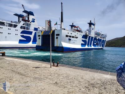
PAOLO VERONESE
Ro-Ro/Passenger Ship
Current Trip
| Time Travelled | 4 h, 49 mins |
|---|---|
| Remaining Time | --- |
| Distance Travelled | 47.15 nm |
| Remaining Distance | --- |
| AVG Speed | 10.6 Knots |
| MAX Speed | 11.9 Knots |
| AVG Wind | 16.4 knots |
| MAX Wind | 20.3 knots |
| MIN Temp | 13.2°C / 55.76°F |
| MAX Temp | 17°C / 62.6°F |
| Draught | 3.9 m |
| Position Received | 1 h, 25 m ago |
Current Position
| Longitude | --- |
|---|---|
| Latitude | --- |
| Status | Under way using engine |
| Speed | 11.3 Knots |
| Course | 181.7° |
| Area | Mediterranean Sea - Eastern Basin |
| Station | T-AIS |
| Position Received | 1 h, 25 m ago |
Info
Information
The current position of PAOLO VERONESE is in Mediterranean Sea - Eastern Basin with coordinates 37.45638° / 12.29452° as reported on 2026-01-06 01:31 by AIS to our vessel tracker app. The vessel's current speed is 11.3 Knots
The vessel PAOLO VERONESE (IMO: 8407450, MMSI: 247003700) is a Ro-Ro/Passenger Ship that was built in 1986 ( 40 years old ). It's sailing under the flag of [IT] Italy.
In this page you can find informations about the vessels current position, last detected port calls, and current voyage information. If the vessels is not in coverage by AIS you will find the latest position.
The current position of PAOLO VERONESE is detected by our AIS receivers and we are not responsible for the reliability of the data. The last position was recorded while the vessel was in Coverage by the Ais receivers of our vessel tracking app.
The current draught of PAOLO VERONESE as reported by AIS is 3.9 meters
Weather
| Temperature | 17°C / 62.6°F |
|---|---|
| Wind Speed | 17 knots |
| Direction | 200° SSW |
| Pressure | 1003 hPa |
| Humidity | 77 % |
| Cloud Coverage | 21 % |
Featured Company
Last Port Calls
| Port | Arrival | Departure | Time In Port |
|---|---|---|---|
| 2026-01-05 14:49 | 2026-01-05 23:07 | 8 h | |
| 2026-01-05 06:21 | 2026-01-05 10:05 | 3 h | |
| 2026-01-03 14:52 | 2026-01-04 23:09 | 1 d | |
| 2026-01-03 06:24 | 2026-01-03 10:08 | 3 h | |
| 2025-12-31 14:52 | 2026-01-02 23:09 | 2 d | |
| 2025-12-31 06:20 | 2025-12-31 10:04 | 3 h | |
| 2025-12-30 14:52 | 2025-12-30 23:07 | 8 h | |
| 2025-12-30 06:16 | 2025-12-30 10:04 | 3 h | |
| 2025-12-29 14:57 | 2025-12-29 23:06 | 8 h | |
| 2025-12-29 06:20 | 2025-12-29 10:16 | 3 h |
Most Visited Ports (Last year)
| Port | Arrivals | |
|---|---|---|
| 211 | ||
| 205 | ||
| 4 | ||
| 3 |
Last Trips
| Origin | Departure | Destination | Arrival | Distance | |
|---|---|---|---|---|---|
| 2026-01-05 10:05 | 2026-01-05 14:49 | 74.53 nm | |||
| 2026-01-04 23:09 | 2026-01-05 06:21 | 76.41 nm | |||
| 2026-01-03 10:08 | 2026-01-03 14:52 | 75.47 nm | |||
| 2026-01-02 23:09 | 2026-01-03 06:24 | 76.90 nm | |||
| 2025-12-31 10:04 | 2025-12-31 14:52 | 74.97 nm | |||
| 2025-12-30 23:07 | 2025-12-31 06:20 | 77.04 nm | |||
| 2025-12-30 10:04 | 2025-12-30 14:52 | 75.50 nm | |||
| 2025-12-29 23:06 | 2025-12-30 06:16 | 76.19 nm | |||
| 2025-12-29 10:16 | 2025-12-29 14:57 | 76.01 nm | |||
| 2025-12-28 23:09 | 2025-12-29 06:20 | 75.89 nm |
Events
| Time | Event | Details | Position / Dest | Info |
|---|---|---|---|---|
| 2026-01-06 02:01 | Status Changed | Default Under way using engine |
37.36027 / 12.28142
ITPNL
|
Speed: 11.3 kn Course: 181.7° |
| 2026-01-06 01:31 | OUT of Coverage |
37.45638 / 12.29452
Mediterranean Sea - Eastern Basin
ITPNL
|
Speed: 11.3 kn Course: 181.7° |
|
| 2026-01-05 23:58 | Change Sea Area | Italian part of the Mediterranean Sea - Eastern Basin Italian part of the Mediterranean Sea - Western Basin |
37.73453 / 12.30017
Mediterranean Sea - Eastern Basin
ITPNL
|
Speed: 10.8 kn Course: 200.1° |
| 2026-01-05 23:25 | Change Sea Area | Italian part of the Mediterranean Sea - Western Basin Italian part of the Tyrrhenian Sea |
37.82592 / 12.34501
Mediterranean Sea - Western Basin
ITPNL
|
Speed: 10.5 kn Course: 203.1° |
| 2026-01-05 22:07 | PORT DEPARTURE |
|
38.00237 / 12.49549
ITPNL
|
Speed: 10.6 kn Course: 237° |
| 2026-01-05 22:01 | START Moving |
38.01179 / 12.50801
[IT] TRAPANI
|
Speed: 6.5 kn Course: 307° |
|
| 2026-01-05 21:52 | Status Changed | Under way using engine Moored |
38.01042 / 12.50980
[IT] TRAPANI
|
Speed: Course: 322° |
| 2026-01-05 21:52 | Destination Changed | ITPNL ITTPS |
38.01040 / 12.50983
[IT] TRAPANI
|
Speed: Course: 322° |
| 2026-01-05 21:52 | ETA Changed | 2026/01/06 05:30 2026/01/05 14:30 |
38.01040 / 12.50983
[IT] TRAPANI
|
Speed: Course: 322° |
| 2026-01-05 16:29 | Status Changed | Moored Default |
38.01041 / 12.50985
[IT] TRAPANI
|
Speed: Course: 322° |