
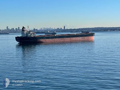
PANDA
Bulk Carrier
Current Trip
| Time Travelled | 11 days |
|---|---|
| Remaining Time | --- |
| Distance Travelled | 1513.16 nm |
| Remaining Distance | --- |
| AVG Speed | 9.5 Knots |
| MAX Speed | 13.1 Knots |
| AVG Wind | 11.8 knots |
| MAX Wind | 20 knots |
| MIN Temp | 24.7°C / 76.46°F |
| MAX Temp | 29.1°C / 84.38°F |
| Draught | 17.8 m |
| Position Received | 2 m ago |
Current Position
| Longitude | --- |
|---|---|
| Latitude | --- |
| Status | Under way using engine |
| Speed | 12.1 Knots |
| Course | 298.5° |
| Area | Malacca Strait |
| Station | T-AIS |
| Position Received | 2 m ago |
Info
Information
The current position of PANDA is in Malacca Strait with coordinates 1.92241° / 102.33083° as reported on 2026-01-08 07:28 by AIS to our vessel tracker app. The vessel's current speed is 12.1 Knots and is heading at the port of MUNDRA. The estimated time of arrival as calculated by MyShipTracking vessel tracking app is 2026-01-19 03:30 LT
The vessel PANDA (IMO: 9296212, MMSI: 538009966) is a Bulk Carrier that was built in 2004 ( 22 years old ). It's sailing under the flag of [MH] Marshall Is.
In this page you can find informations about the vessels current position, last detected port calls, and current voyage information. If the vessels is not in coverage by AIS you will find the latest position.
The current position of PANDA is detected by our AIS receivers and we are not responsible for the reliability of the data. The last position was recorded while the vessel was in Coverage by the Ais receivers of our vessel tracking app.
The current draught of PANDA as reported by AIS is 17.8 meters
Weather
| Temperature | 28.3°C / 82.94°F |
|---|---|
| Wind Speed | 10 knots |
| Direction | 42° NE |
| Pressure | 1010.1 hPa |
| Humidity | 72.6 % |
| Cloud Coverage | 100 % |
Featured Company
Last Port Calls
| Port | Arrival | Departure | Time In Port |
|---|---|---|---|
| 2025-12-27 08:04 | 2025-12-28 15:24 | 1 d | |
| 2025-12-12 10:01 | 2025-12-15 10:01 | 2 d | |
| 2025-11-07 08:56 | 2025-11-07 18:26 | 9 h | |
| 2025-11-02 16:21 | 2025-11-02 17:50 | 1 h |
Most Visited Ports (Last year)
| Port | Arrivals | |
|---|---|---|
| 3 | ||
| 2 | ||
| 2 | ||
| 1 | ||
| 1 | ||
| 1 |
Last Trips
| Origin | Departure | Destination | Arrival | Distance | |
|---|---|---|---|---|---|
| 2025-12-15 10:01 | 2025-12-27 08:04 | 2763.03 nm | |||
| 2025-11-02 17:50 | 2025-12-12 10:01 | 8998.14 nm | |||
| 2025-11-02 17:50 | 2025-11-07 08:56 | 825.92 nm | |||
| 2025-09-27 14:50 | 2025-11-02 16:21 | 4252.89 nm |
Events
| Time | Event | Details | Position / Dest | Info |
|---|---|---|---|---|
| 2026-01-08 07:11 | Status Changed | Under way using engine Default |
1.89698 / 102.38157
IN MUN
|
Speed: 12 kn Course: 297° |
| 2026-01-08 06:40 | Status Changed | Default Under way using engine |
1.85140 / 102.47032
IN MUN
|
Speed: 11.3 kn Course: 296.1° |
| 2026-01-08 06:33 | Change Sea Area | Malaysian part of the Malacca Strait Malaysian part of the Singapore Strait |
1.83998 / 102.49218
Malacca Strait
IN MUN
|
Speed: 11.3 kn Course: 296.1° |
| 2026-01-08 06:32 | Status Changed | Under way using engine Default |
1.83878 / 102.49457
IN MUN
|
Speed: 11.2 kn Course: 296° |
| 2026-01-08 06:27 | IN Coverage |
1.83998 / 102.49218
Malacca Strait
IN MUN
|
Speed: 11.3 kn Course: 296.1° |
|
| 2026-01-08 00:08 | Status Changed | Default Under way using engine |
1.21428 / 103.53925
IN MUN
|
Speed: 12.7 kn Course: 280.4° |
| 2026-01-08 00:02 | Status Changed | Under way using engine Default |
1.20911 / 103.56274
IN MUN
|
Speed: 12.7 kn Course: 280° |
| 2026-01-08 00:02 | OUT of Coverage |
1.20911 / 103.56274
Singapore Strait
IN MUN
|
Speed: 12.7 kn Course: 280.4° |
|
| 2026-01-08 00:01 | Status Changed | Default Under way using engine |
1.20863 / 103.56570
IN MUN
|
Speed: 12.8 kn Course: 280.8° |
| 2026-01-07 23:53 | Change Sea Area | Malaysian part of the Singapore Strait Indonesian part of the Singapore Strait |
1.20315 / 103.59394
Singapore Strait
IN MUN
|
Speed: 13 kn Course: 280.5° |