
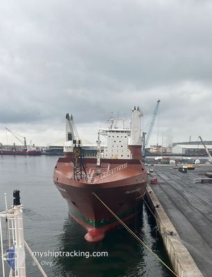
PALEISGRACHT
General Cargo
Current Trip
UKTEE
| Time Travelled | 2 days |
|---|---|
| Remaining Time | --- |
| Distance Travelled | 712.89 nm |
| Remaining Distance | --- |
| AVG Speed | 13.6 Knots |
| MAX Speed | 16.3 Knots |
| AVG Wind | 13.2 knots |
| MAX Wind | 19 knots |
| MIN Temp | 3.2°C / 37.76°F |
| MAX Temp | 9°C / 48.2°F |
| Draught | 8 m |
| Position Received | 47 m ago |
Current Position
| Longitude | --- |
|---|---|
| Latitude | --- |
| Status | Under way using engine |
| Speed | 14.7 Knots |
| Course | 333° |
| Area | North Sea |
| Station | T-AIS |
| Position Received | 47 m ago |
Info
Information
The current position of PALEISGRACHT is in North Sea with coordinates 53.46333° / 1.04426° as reported on 2025-03-14 02:12 by AIS to our vessel tracker app. The vessel's current speed is 14.7 Knots
The vessel PALEISGRACHT (IMO: 9448346, MMSI: 244122000) is a General Cargo that was built in 2011 ( 14 years old ). It's sailing under the flag of [NL] Netherlands.
In this page you can find informations about the vessels current position, last detected port calls, and current voyage information. If the vessels is not in coverage by AIS you will find the latest position.
The current position of PALEISGRACHT is detected by our AIS receivers and we are not responsible for the reliability of the data. The last position was recorded while the vessel was in Coverage by the Ais receivers of our vessel tracking app.
The current draught of PALEISGRACHT as reported by AIS is 8 meters
Weather
| Temperature | 5.1°C / 41.18°F |
|---|---|
| Wind Speed | 2 knots |
| Direction | 109° ESE |
| Pressure | 1006.5 hPa |
| Humidity | 71.3 % |
| Cloud Coverage | 100 % |
Featured Company
Last Port Calls
| Port | Arrival | Departure | Time In Port |
|---|---|---|---|
| 2025-02-28 06:21 | 2025-03-11 23:46 | 11 d | |
| 2025-02-21 18:48 | 2025-02-22 08:37 | 13 h | |
| 2025-02-03 07:46 | 2025-02-05 08:10 | 2 d | |
| 2025-01-10 11:33 | 2025-01-13 20:50 | 3 d |
Most Visited Ports (Last year)
| Port | Arrivals | |
|---|---|---|
| 5 | ||
| 4 | ||
| 4 | ||
| 3 | ||
| 2 | ||
| 2 |
Last Trips
| Origin | Departure | Destination | Arrival | Distance | |
|---|---|---|---|---|---|
| 2025-02-22 08:37 | 2025-02-28 06:21 | 1406.63 nm | |||
| 2025-02-05 08:10 | 2025-02-21 18:48 | 4796.54 nm | |||
| 2025-01-13 20:50 | 2025-02-03 07:46 | 6467.47 nm | |||
| 2024-12-20 11:07 | 2025-01-10 11:33 | 5464.71 nm |
Events
| Time | Event | Details | Position / Dest | Info |
|---|---|---|---|---|
| 2025-03-14 02:15 | Status Changed | Default Under way using engine |
53.47466 / 1.03474
UKTEE
|
Speed: 14.7 kn Course: 333° |
| 2025-03-14 01:12 | Status Changed | Under way using engine Default |
53.25200 / 1.28102
UKTEE
|
Speed: 15.8 kn Course: 317° |
| 2025-03-14 01:10 | Status Changed | Default Under way using engine |
53.24418 / 1.29292
UKTEE
|
Speed: 16 kn Course: 317.2° |
| 2025-03-13 23:06 | Status Changed | Under way using engine Default |
52.91413 / 1.96787
UKTEE
|
Speed: 14.5 kn Course: 308° |
| 2025-03-13 23:06 | Status Changed | Default Under way using engine |
52.91264 / 1.97104
UKTEE
|
Speed: 14.3 kn Course: 307.1° |
| 2025-03-13 22:59 | Status Changed | Under way using engine Default |
52.89637 / 2.00592
UKTEE
|
Speed: 14.2 kn Course: 308° |
| 2025-03-13 22:42 | IN Coverage |
52.89737 / 2.00374
North Sea
UKTEE
|
Speed: 14.3 kn Course: 307.1° |
|
| 2025-03-13 17:35 | Status Changed | Default Under way using engine |
51.84931 / 2.46639
UKTEE
|
Speed: 13.5 kn Course: 318.8° |
| 2025-03-13 17:33 | OUT of Coverage |
51.84346 / 2.47168
North Sea
UKTEE
|
Speed: 13.5 kn Course: 318.8° |
|
| 2025-03-13 17:33 | Change Sea Area | United Kingdom part of the North Sea Belgian part of the North Sea |
51.84346 / 2.47168
North Sea
UKTEE
|
Speed: 13.5 kn Course: 318.8° |