
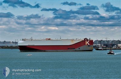
ORION HIGHWAY
Cargo
Current Trip
| Time Travelled | 11 h, 21 mins |
|---|---|
| Remaining Time | 2 days |
| Distance Travelled | 171.19 nm |
| Remaining Distance | 507.91 nm |
| AVG Speed | 15.4 Knots |
| MAX Speed | 19.9 Knots |
| AVG Wind | 13.9 knots |
| MAX Wind | 20 knots |
| MIN Temp | 0.9°C / 33.62°F |
| MAX Temp | 6.2°C / 43.16°F |
| Draught | 8.7 m |
| Position Received | 2 m ago |
Current Position
| Longitude | --- |
|---|---|
| Latitude | --- |
| Status | Under way using engine |
| Speed | 13 Knots |
| Course | 135° |
| Area | North Atlantic Ocean |
| Station | T-AIS |
| Position Received | 2 m ago |
Info
Information
The current position of ORION HIGHWAY is in North Atlantic Ocean with coordinates 36.70954° / -75.63219° as reported on 2025-12-05 10:29 by AIS to our vessel tracker app. The vessel's current speed is 13 Knots and is heading at the port of BRUNSWICK. The estimated time of arrival as calculated by MyShipTracking vessel tracking app is 2025-12-07 15:11 LT
The vessel ORION HIGHWAY (IMO: 9728071, MMSI: 374678000) is a Cargo It's sailing under the flag of [PA] Panama.
In this page you can find informations about the vessels current position, last detected port calls, and current voyage information. If the vessels is not in coverage by AIS you will find the latest position.
The current position of ORION HIGHWAY is detected by our AIS receivers and we are not responsible for the reliability of the data. The last position was recorded while the vessel was in Coverage by the Ais receivers of our vessel tracking app.
The current draught of ORION HIGHWAY as reported by AIS is 8.7 meters
Weather
| Temperature | 5.7°C / 42.26°F |
|---|---|
| Wind Speed | 16 knots |
| Direction | 50° NE |
| Pressure | 1022.9 hPa |
| Humidity | 91 % |
| Cloud Coverage | 100 % |
Featured Company
Last Port Calls
| Port | Arrival | Departure | Time In Port |
|---|---|---|---|
| 2025-12-03 19:16 | 2025-12-04 18:11 | 22 h | |
| 2025-12-02 18:54 | 2025-12-03 18:55 | 1 d | |
| 2025-12-02 02:16 | 2025-12-02 18:20 | 16 h | |
| 2025-11-19 01:07 | 2025-11-21 06:11 | 2 d | |
| 2025-11-15 05:14 | 2025-11-17 15:54 | 2 d | |
| 2025-11-13 04:09 | 2025-11-13 21:28 | 17 h | |
| 2025-11-02 08:05 | 2025-11-03 00:26 | 16 h | |
| 2025-10-30 19:25 | 2025-11-01 15:21 | 1 d | |
| 2025-10-27 19:41 | 2025-10-28 17:31 | 21 h | |
| 2025-10-26 20:16 | 2025-10-27 19:23 | 23 h |
Most Visited Ports (Last year)
| Port | Arrivals | |
|---|---|---|
| 10 | ||
| 9 | ||
| 7 | ||
| 6 | ||
| 6 | ||
| 6 |
Last Trips
| Origin | Departure | Destination | Arrival | Distance | |
|---|---|---|---|---|---|
| 2025-12-03 18:55 | 2025-12-03 19:16 | 0.96 nm | |||
| 2025-12-02 18:20 | 2025-12-02 18:54 | 4.44 nm | |||
| 2025-11-21 06:11 | 2025-12-02 02:16 | 3905.34 nm | |||
| 2025-11-17 15:54 | 2025-11-19 01:07 | 391.33 nm | |||
| 2025-11-13 21:28 | 2025-11-15 05:14 | 482.22 nm | |||
| 2025-11-03 00:26 | 2025-11-13 04:09 | 4044.45 nm | |||
| 2025-11-01 15:21 | 2025-11-02 08:05 | 175.98 nm | |||
| 2025-10-28 17:31 | 2025-10-30 19:25 | 697.05 nm | |||
| 2025-10-27 19:23 | 2025-10-27 19:41 | 0.80 nm | |||
| 2025-10-26 19:45 | 2025-10-26 20:16 | 4.36 nm |
Events
| Time | Event | Details | Position / Dest | Info |
|---|---|---|---|---|
| 2025-12-05 10:20 | Status Changed | Under way using engine Default |
36.73472 / -75.66327
US SSI
|
Speed: 11.9 kn Course: 136° |
| 2025-12-05 10:19 | Status Changed | Default Under way using engine |
36.73669 / -75.66562
US SSI
|
Speed: 11.9 kn Course: 135.4° |
| 2025-12-05 09:12 | Status Changed | Under way using engine Default |
36.83839 / -75.82681
US SSI
|
Speed: 8.1 kn Course: 122° |
| 2025-12-05 09:11 | Status Changed | Default Under way using engine |
36.83956 / -75.82913
US SSI
|
Speed: 8.4 kn Course: 122.2° |
| 2025-12-05 08:54 | Status Changed | Under way using engine Moored |
36.86134 / -75.87113
US SSI
|
Speed: 8.9 kn Course: 130.6° |
| 2025-12-05 06:20 | Status Changed | Moored Default |
37.39166 / -76.07768
US SSI
|
Speed: 18.7 kn Course: 167° |
| 2025-12-05 06:19 | Status Changed | Default Moored |
37.39760 / -76.07938
US SSI
|
Speed: 18 kn Course: 167° |
| 2025-12-05 06:18 | Status Changed | Moored Default |
37.40349 / -76.08108
US SSI
|
Speed: 18.8 kn Course: 166° |
| 2025-12-05 06:15 | IN Coverage |
37.40349 / -76.08108
North Atlantic Ocean
US SSI
|
Speed: 18 kn Course: 167° |
|
| 2025-12-05 05:12 | OUT of Coverage |
37.68838 / -76.17014
North Atlantic Ocean
US SSI
|
Speed: 17.5 kn Course: 142° |